Tranquility – In the Australian Bush


I’m camped by a favourite waterhole of ours along the Bogan River as I head towards Milparinka which is situated in the Corner Country in the far northwest of New South Wales…

Hey. three weeks in the outback, where a deep blue sky gently blends to the red earth on a faraway horizon, and the night sky is laden with stars – how good is that, hey…!

Photo: Baz – The Landy, on the Bogan River

Wildflowers Flowers – Of the Australian Outback…

Outback Australia

The Sturt Desert Pea, almost alien looking…!

Photo: Janet-Planet, Outback Australia

Janet-Planet

Nature’s Art – In the Australian Outback

Outback Australia

Photo: Janet-Planet, Outback Australia


Janet-Planet

Quenching a thirst – in the Australian Outback…

Photo’s: Baz – The Landy, in the Australian Bush…

Barry O'Malley
Baz – The Landy

Milparinka – Outback Australia…

There is something very special about the Corner Country that has kept Janet and me coming back for as long as we can remember.


Perhaps it is the wide-open plains where the sunburnt land meets a deep blue sky on a far-away horizon, perhaps it is the golden sunsets as the sun slides below the western skyline, or maybe it is just the people and characters you meet out there…

In late May I will be acting caretaker at the Milparinka historical precinct and museum.

Milparinka is a tiny community located in far north-western New South Wales, about 40-kilometres south of Tibooburra and 300-kilometres north of Broken Hill. It is the oldest proclaimed township in the Corner Country, and is situated on the banks of the Evelyn Creek, named by Charles Sturt during his 1845 Inland Expedition.

Hey, be sure to drop into the museum and say g’day, if you’re out that way…!

Oh, don’t worry, if you can’t make it I’ll be sure to be capturing some of our spectacular outback in photo’s…

Photos: Baz – The Landy, Corner Country, Outback Australia…

Barry O'Malley
Baz – The Landy

Colours of the Australian Outback…


Termite Mound

Photo: Baz – The Landy, Plenty Highway, Central Australia…

Barry O'Malley
Baz – The Landy

Renovator’s Delight – In the Australian Outback…

Oodnadatta Track

Photo: Baz – The Landy, the Peake Overland Telegraph Station, Oodnadatta Track, Outback Australia…

Barry O'Malley
Baz – The Landy

Nightfall, in the Australian Outback…

Camp Fire

Photo: Baz – The Landy, Canning Stock Route, Outback Australia

Barry O'Malley
Baz – The Landy

Croajingolong – Australia’s Rugged South-Coast…

Croajingolong NP

Croajingolong National Park looks much the same today as when Captain Cook first sighted it in 1770…

“..With the first daylight this morn the land was seen, it made in sloping hill covered in part with trees and bushes, but interspersed with large tracts of sand… I have named it Point Hicks because Lieutenant (Zachariah) Hicks was the first to discover this land..” April 19th 1770.

Photo: Baz – The Landy, Point Hicks, Southern Australia…

Remoteness and isolation – deep in the Australian Outback…

outback australia

Photo: Baz – The Landy, Outback Australia


Barry O'Malley
Baz – The Landy

A vibrant desert landscape – Australia’s Outback

gibson desert

Photo: Baz – The Landy, Gibson Desert, Outback Australia

Barry O'Malley
Baz – The Landy

The track seldom travelled – Outback Australia…

Outback Australia

Photo: Baz – The Landy, Outback Australia…

Barry O'Malley
Baz – The Landy

The Glasshouse Mountains…spectacularly beautiful!

Photo’s: Baz – The Landy, Glasshouse Mountains, Australia

Barry O'Malley
Baz – The Landy

Last light…

Photo’s: Baz – The Landy, Moreton Island, East Coast Australia…

Barry O'Malley
Baz – The Landy

The Pink Lakes…

Murray Sunset NP

Photo: Baz – The Landy, Murray Sunset National Park, Australia…

Barry O'Malley
Baz – The Landy


Reflections – By the Billabong…

Diamantina National Park

Photo: Baz – The Landy, Gumhole Water Hole, Outback Australia

Barry O'Malley
Baz – The Landy

Dreaming away…

Wilsons Promontory

For the dreamer’s amongst us, there is nothing better than watching the sun slowly slide below the western horizon.

Photo: Baz – The Landy, Shallow Inlet, Wilson’s Promontory.

G’day – from the Australian Bush

Australian Birds

A (beautiful) Eastern Yellow Robin.

Photo: Baz, Wilson’s Promontory, Southern Australia…

The Bass Coast – Ruggedly beautiful in Southern Australia


Photo’s: Baz – The Landy, Phillip Island, Southern Australia

A True Blue Aussie – As Australian as it gets…

Outback Australia

Nothing speaks Australia more than these wonderful animals…

I never tire of watching, observing, and photographing them…

Photograph: Baz – The Landy, Outback Australia

A Place of Haunting Beauty – In Outback Australia…

Mungo National Park

In the far west of New South Wales, some one thousand kilometres from Sydney, lies Lake Mungo and the Willandra Lakes World Heritage Area…


Now before you go strapping the kayak to the top of your vehicle or hitching the “tinnie” to the back of your four-wheel drive it is worth knowing that Lake Mungo has been dry for some 15,000 years.


But don’t be put off by that fact, this is a fabulous place to spend a few days exploring what is a very special place to three Aboriginal tribal groups, the Paakantji / Barkindji, Ngyiampaa and Mutthi people.

These people have walked this land for close to 50,000 years.

Yes, 50,000 years…!

To put some context to that, they only started building the pyramids about 5,000 years ago, and Christian’s celebrated the arrival of Jesus Christ just over 2,000 years ago.

And in more contemporary history of Australia, Captain Cook landed at Botany Bay less than 250 years ago.

Life would have been substantially different when the waters were teaming with fish and the land abundant with food sources. And remarkably, evidence of this era has been enshrined in the “Mungo Lunette” and uncovered by the moving sand dunes in this windswept land.

A Lunette is a crescent-shaped sand dune similar in outline to the first quarter of the Moon. The Mungo Lunette is also known as the “Walls of China”.

I visited the region recently with the hope of photographing the “Super Red Blue Moon” that rose in the skies on 31 January, the prospect of capturing a photograph of a remarkable event over the Walls of China proving irresistible to me.

The Walls of China is where the remains of “Mungo Lady” an aboriginal women of some 18 years of age was discovered in the late 1960s. Her discovery and subsequent removal from her “spiritual home” by archaeologists’ was not without controversy, especially for the aboriginal people from this region.

Mungo Woman was eventually returned home to rest in country by her people and similarly, Mungo Man, whose remains were removed from his resting place has also made the journey home to country.

Scientists’ estimated that Mungo Man walked this land over 40,000 years ago.

It was against this cultural backdrop that I stood alone at the Mungo Lunette, a number of camera’s at hand to capture this remarkable lunar event.

But it wasn’t too be as cloud cover “eclipsed” my view of the moon as it rose over this ancient land.

Looking to the west, the sky was ablaze as a fiery sun cast its final rays into a darkening night sky…

I closed my eyes and let my mind drift and wondered if the spirits of those who had walked this land were sitting around the glow of this eternal fire, breathing life to this place of Haunting Beauty…

Photo’s: Baz – The Landy, Mungo National Park, Outback Australia

Dog on the Tucker Box…

Well I’ve left the “big smoke” behind and pointed myself westward towards Mungo National Park to watch the lunar eclipse in a couple of days.

But hey, with time on my side what better way to wile away that time than being camped beside the mighty Murrumbidgee River at Gundagai reading poems and short stories by one of Australia’s greatest story tellers, Henry Lawson.

And of course, apart from the river the town is famous for the “Dog on the Tucker Box”…

Photos: Baz – The Landy, Gundagai…

Lunar Trifecta – Possibly a once in a lifetime opportunity…

Moreton Bay

I’m sure many are aware of a rare lunar phenomenon that is set to occur next week.

It is being billed as a “once-in-a-lifetime” lunar trifecta and Australian’s have one of the best vantage points around the globe to view what is being described as a “super red blue moon” as three lunar conditions converge.

Apparently, a super moon occurs when the moon reaches its closest point to earth and appears much larger than normal (some 30% they say). The red part happens during a lunar eclipse, and the blue moon is when there are two full moons in a month.

Some experts suggest that it is unlikely to see all three events converge again this century, although I have seen conflicting reports on this with suggestions there will be another one in 2028 – but given it last occurred in 1866 I’ll try and observe this one and leave it to the experts to argue over the timing of the next one.

I was pondering where to view it from away from the glare of city lights and decided on heading to the World Heritage listed Mungo National Park, south east of Broken Hill.

It has been at least two decades since I last visited the area so I am looking forward to it, although with daytime temperatures getting up to around the 45C mark I doubt I will linger there for too long afterwards. But it is a spectacular area, so I’ll play that one by ear and see how the weather is…

The phenomena is due to start on 31 January around 10:30pm (AEDT) and end just after 2:00AM (AEDT) on 1 February…

Photo: Baz – The Landy, Moreton Bay, Queensland

Exploring Australia (One moment at a time)

Australia is a remarkable country, with a remarkable history…

An island continent inhabited by our first nation people for ten’s of thousands of years, and more recently, through European settlement. At times, it can be an unforgiving place where water can be scarce.

Australian aboriginal people moved from water-hole to water-hole to survive in the harsh desert country relying on “dream-time stories” to guide them…

Stories told in song, carvings and engravings, and rock art.

For our early European explorers’ finding water was critical as they surveyed our vast sunburnt country. At times, it was a critical life and death situation and there are many tributes to these explorers’ dotted across Australia.

Two explorers, John and Alexander Forrest, both surveyors, travelled into the vast Western Australian desert region in 1874. One can only imagine what was in their thoughts as they stood atop Mt Allott looking back across the vast plains to Mt Worsnop in the distance…

Perhaps it was the need to find a water supply before thirst from the relentless heat of the desert claimed them.

Standing on Mt Allott I reflected on how you can only live in the moment you are in; the past is irrelevant and the future may never arrive – you can only survive one moment at a time…!

That’s a great way to live your life, one moment at a time. Hey, what do you reckon?

Photos: Baz, Outback Australia (somewhere…!)

Outback Australia (Xplore – Out & About)

Happy New Year to all…

Yes, it seems I’m a couple of weeks late, but hey, I’m working on leisure time these days…

Janet and I are gearing up for plenty of adventure travel into the Australian Bush and Outback this year and we’ve dusted the cameras’ off to photograph our magnificent country.

Photo’s: Baz – The Landy, Outback Australia.

Beach Shacks and Lazy Summer Days…

Beach shacks and lazy summer days along the fabulous Australian Coastline, you got to love it, hey…!

Photo’s: Baz, Kangaroo Island, Southern Australia.

Outback Australia – Sunset, a warm fire, a view, and a swag…


Photos: Baz – The Landy, Outback Australia

Powerful Owl – A chance encounter…

Australian Owl

The Australian Bush is full of unique experiences, especially when it comes to our wildlife, and sometimes you might just find something interesting in your own backyard…

Recently, I was fortunate to observe a magnificent looking ‘Powerful Owl’ whilst walking the Warimoo and Sphinx Tracks at Bobbin Head, in Ku-ring-gai Chase National Park.

Janet and I think of this area as our ‘backyard’ and over many years we have walked and kayaked through this area, which is little more than 20-kilometres north of the Sydney CBD. And yet, this was a first time spotting for us of the powerful owl, which is Australia’s largest, in this location.

Although, it is a familiar bird for us as we have visitations from one into the local park opposite our home. In fact, I heard our resident owl calling just a few nights ago…

Following my sighting of the bird last week I made contact with Beth Mott, Project Officer for the Powerful Owl Project with Birdlife Australia who was excited to review the area and to glean if there is a pair that might be raising a young chick.

So today, Janet, myself and Beth set off along the track to see if we could find any further signs of inhabitation.

Janet and I were on a steep learning curve when it came to bird observation, but Beth, who holds a Degree in Conservation Biology, and who has undertaken a PhD study on ‘Animal Community Dynamics’, enthusiastically showed us many of the ‘telltale’ signs to look for.

Um, that includes bird vomit and droppings, you know, poo!

Beth’s enthusiasm was infectious and on our walk she went on to explain…

“We aim to locate Powerful Owl breeding pairs within urban Greater Sydney, which also includes Newcastle in the north to Kiama in the south and west to the Blue Mountains.

We also aim to identify the location of nesting trees and record breeding behaviour and success.

This information will help determine the critical roosting and breeding requirements of urban Powerful Owls. We are collecting data on diet and foraging habitat to gain a greater understanding of their urban ecology, as well as look at threats (causes of injury and mortality) within the urban landscape.”

We were surprised to learn that there is estimated to be only around 400 Powerful Owls in the Greater Sydney Region and around 5,000 in Australia, and that puts them only one notch above being an “endangered species”.

Powerful Owls have a slow; double-note ‘whoo-hoo’ call that is soft, but very strong and resonant, and which can be heard more than 1-kilometre away. And the most common time to hear them is when they “wake” to a new day, at least for them, around dusk…

So if you hear that sound, take the time to look around your ‘backyard’ you might just find a special visitor, and if you do observe one, be sure to let the good people at Birdlife Australia know…

Photos: Baz – The Landy, Ku-ring-gai Chase National Park, Bobbin Head.

Australian Deserts – Jump up Country…

Tibooburra NSW

I love our desert country, so harsh, yet so fragile…

Photo: Baz – The Landy, “Jump up Country” North-West New South Wales, Australia


An Oasis in the Desert – Boodjamulla National Park

lawn hill NP

Situated in the Gulf Savannah country of northern Australia, with its deep gorges and craggy rocky outcrops, is the rugged and spectacularly beautiful Boodjamulla National Park…


This is an ancient, sunburnt land, and archaeological evidence suggests the area has been continuously occupied for at least 30,000-years, possibly longer than anywhere else in Australia.


The attraction is the permanent water source of Lawn Hill Creek. During arid times, when other sites where abandoned, this area was like an oasis in the desert for aboriginal people, Australia’s first people, who gathered here to camp, fish, and hunt.

Janet, TomO, and I have explored this region previously, but it has drawn us back like a magnet on many occasions, and being in North Queensland I could not resist the lure of another visit, to walk through the country and swim in Lawn Hill Creek.

In the Dreamtime stories of the Waanyi people, “Boodjamulla” is a spiritual person, the creator of all animals.

In the words of the Waanyi people…

“He made all the animals in the Lawn Hill area, and all the billabongs such as the green swamp, and all the bush tucker. Boodjamulla’s dreamtime travels started in Waanyi country at Cabbage Tree Spring, up above Riversleigh, giving water to O’Shanassy Creek, Lawn Hill Creek, the Gregory River, Louie Creek and Lilydale Springs.

Waanyi believe that Boodjamulla created these rivers as healing waters – known in Waanyi language as Bougli Water”…

Perhaps for the Waanyi people, the “Bougli Waters” has a different interpretation, but I certainly found the cool spring fed water of Lawn Hill Creek soothing after a day of walking in the gorges and climbing the Constance Range.

As a base for this trip I stayed just outside of the national park at Adels Grove, a private campground that we first visited in the early 1990s. Not much has changed over the years, and that is a good thing.

Adels Grove was declared a ’Miner’s Homestead Perpetual Lease’ in 1920, being within the Burketown Mineral Field at that time.

According to the history provided by the current owners, Adels Grove lease was purchased by Albert De Lestang, a French botanist, who experimented with the growing of tropical trees and fruits and had in excess of 1,000 trees and sold the fruit to supplement his income.

Lawn Hill

Tragically, in the early 1950s the ‘Grove’ and buildings were accidently burnt down. By this time Albert was in his seventies and after loosing everything, including all of his written records, he succumbed to depression and died age 75 at Charters Towers in 1959.

‘The Grove’ has certainly provided shade and comfort from the heat of the winter sun during my stay, with temperatures reaching up to 36 degrees throughout the day and around 15 degrees at night…

Apart from the rugged and rocky outcrops surrounding the gorge, the country has a prolific amount of wildlife. This includes the Johnstone’s crocodile or Freshie as it is usually known, turtles, the olive python, a large variety of birds, and a favourite of ours, the Gilbert Dragon, or Ta-Ta lizard due to the peculiar little wave it gives with its front legs before scampering away.

I managed to photograph some of the wildlife on my walks and at other times, simply sat back and enjoyed the calls of the birds flittering through the trees, and of the birds of prey soaring overhead.

And yes, I did swim with the Freshwater Crocs. Unlike their Saltwater cousins, the Freshie’s are generally timid and will leave you alone, if you stay out of their way…!

Boodjamulla National Park, truly an Oasis in the Desert in Australia’s Gulf Savannah.

Photos: Baz – The Landy, in the Gulf Savannah, Northern Australia…Hinchinbrook Island


Room with a view – Camping out…(In the Australian Bush)

gulf country


Baz – The Landy, Leichhardt Lagoon, Gulf Country, Australia… Hinchinbrook Island

Australian Wildlife – Encounters in the bush

Photo’s: Baz – The Landy, Gulf Country, Northern Australia Hinchinbrook Island

A Classic Country Pub (With cold beer)

You’ve got to love a classic Australian Pub, and this one situated in Malanda on the Atherton Tablelands, inland from Cairns, is one of the best…

And hey, take my word for it…!

I worked in Malanda in the late 1970s and lived in this very pub.

Today, I had my first meal in the Malanda Hotel in almost 40-years and I am pleased it is still owned by the same people, the English family, and it is as grand as I always remember it. And how good is that silky-oak timber.

Um, yeah, a touch of reminiscing going on here…!

But hey, the past is what makes up the mosaic of whom we are today, right…!

Cheers, Baz – The Landy, in Far North Queensland…


Mysterious Hinchinbrook Island – A Jewel in the Coral Sea

Hinchinbrook Island

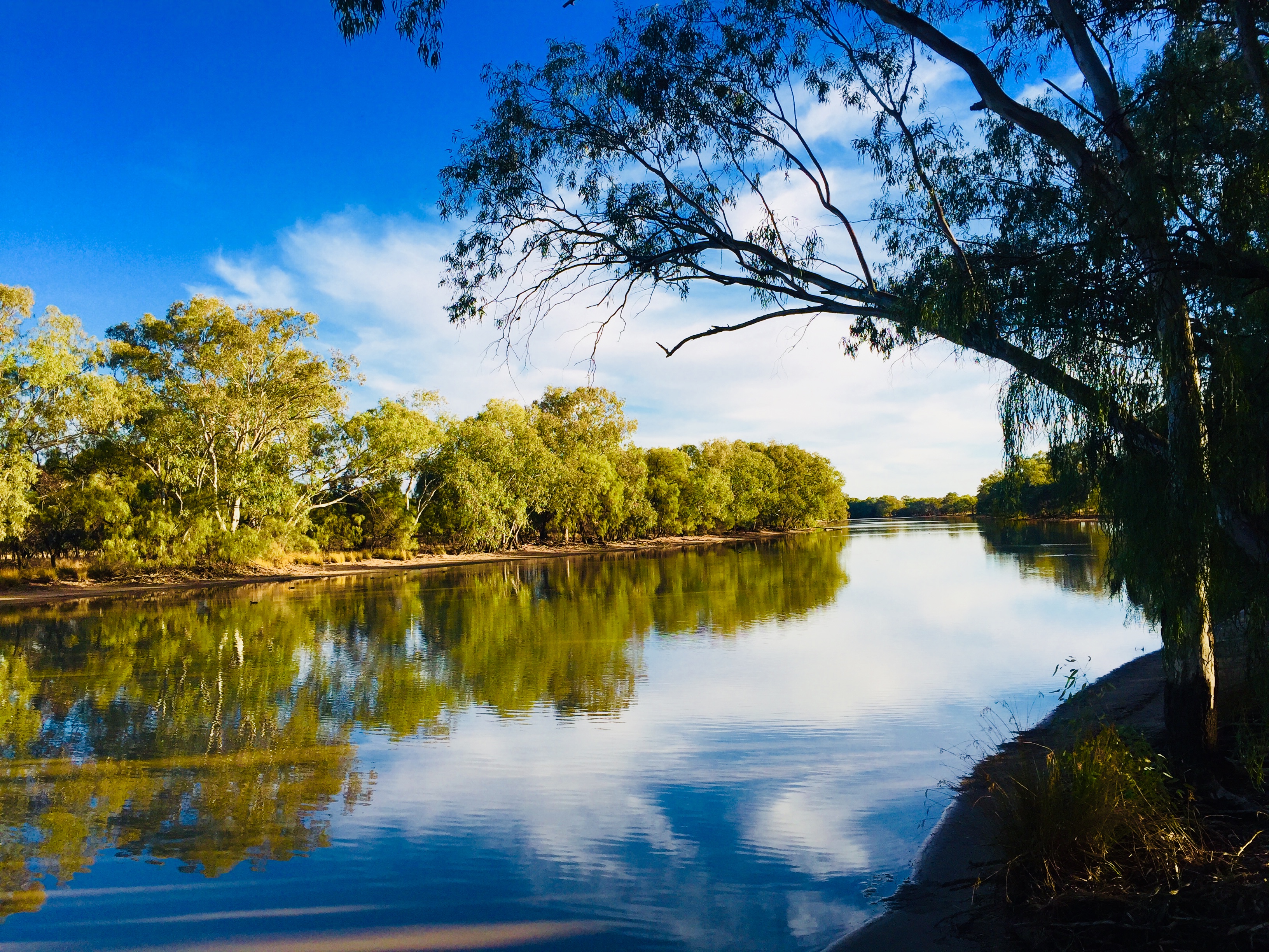
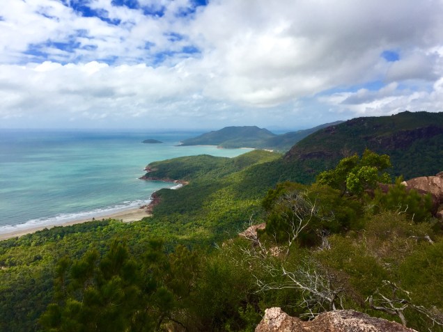
 Nestled in the Coral Sea just off the coast of Cardwell in Far North Queensland is the wonderfully mysterious Hinchinbrook Island…

Wonderfully mysterious is perhaps an odd way to describe Hinchinbrook, but as a kid growing up in the region I always remember thinking of it in this way as we stopped at the local ‘pie cart’ on the foreshore. A delightful feature of Cardwell that I am pleased to say is still the case today.

Pie-Man

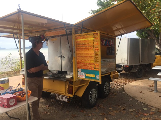
Across the water, the island’s tall peaks stand proudly, densely covered in tropical rainforest and often shrouded in cloud, giving it a mysterious look. A somewhat enticing look that always excited me as a place made of a ‘boy’s own adventure’ and I daydreamed of what I would find as I devoured my pie.  And if I was lucky, another.

They say it is never too late and as I stood on the Cardwell Esplanade this week, eating a pie from the pie-man, I looked out across the Hinchinbrook Passage to that mysterious island with the eyes of a young boy. Excited no less than I was all those years ago I contemplated the walk along the Thorsborne Trail on the eastern seaboard of the island that I was about to embark on.

Would I find my boy’s own adventure?

Whilst I am a frequent hiker in the bush and mountains it has been a while since I last strapped on my hiking pack and my fitness levels were showing it, especially after just spending a month in Scotland and England enjoying cream teas and the odd one, or too many, pints of bitter, despite it being warm. Both the beer and the weather!

It is fair to say the waist strap was slightly more extended than usual, but a few days hiking would go some way to sorting that out…

Hinchinbrook Island

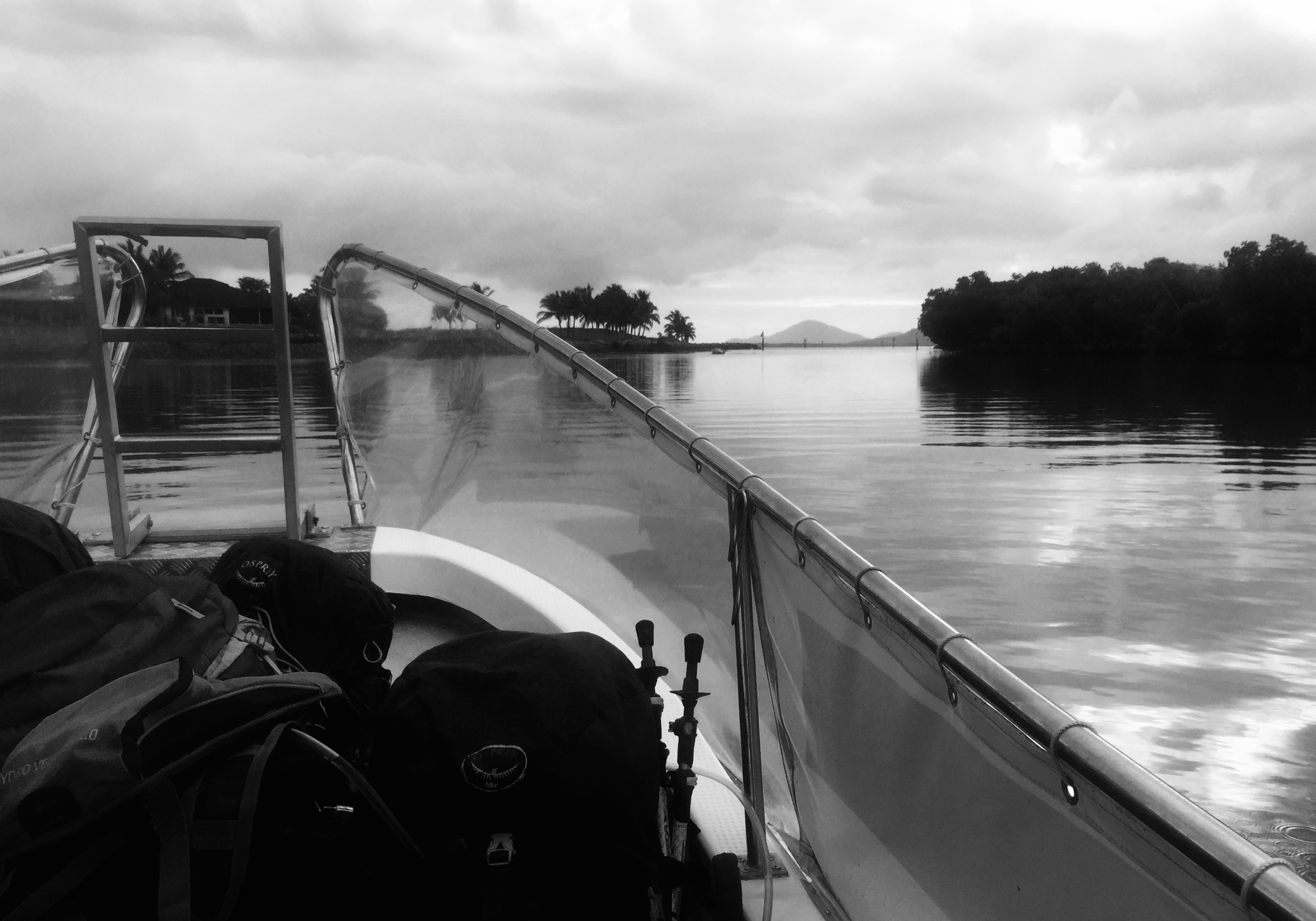
Eagerly, I boarded a small boat that would ferry myself and some other hikers to the island. And under overcast skies we headed towards our drop-off point at Ramsay Bay, situated on the northern part of the island, but not quite at the tip.

We were hopeful of seeing a dugong, sea calf as they are frequently described as we made our way across the shallow passage. Over the past couple of years they have been returning to the area in growing numbers as their natural habitat and food source recovers following the devastating destruction Cyclone Yasi caused in 2011.

Unfortunately, we would not be so lucky to make a sighting on this day.

It is a pleasant boat ride and the skipper, Dean, was keen to point out many of the different landmarks and islands in the area, but before long I was strapping on my pack and walking south on this fantastic adventure.

A comfortable hiking time is four-days and three nights, with camps set at distances sufficient to challenge, but with plenty of time to enjoy the scenery.

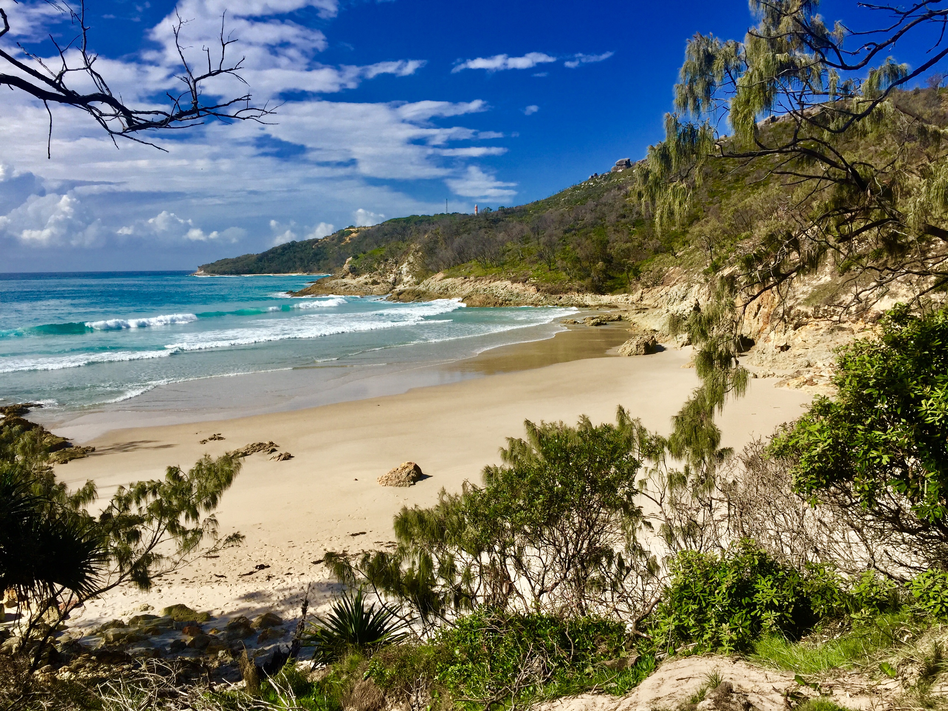
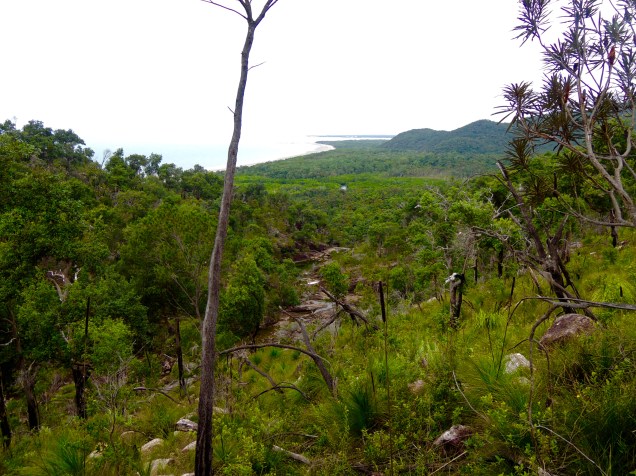
My first day was spent hiking from Ramsay Bay, through Nina Bay and an overnight camp at Little Ramsay Bay, which is nestled in the rainforest just behind the beach next to a small lagoon. Before passing Nina Bay I climbed to the top of Nina Peak, a must-do for any visitor to the island. Sitting at the top you get a great sense of the magnitude of the island and a better glimpse of those mountaintops shrouded in cloud and mist.

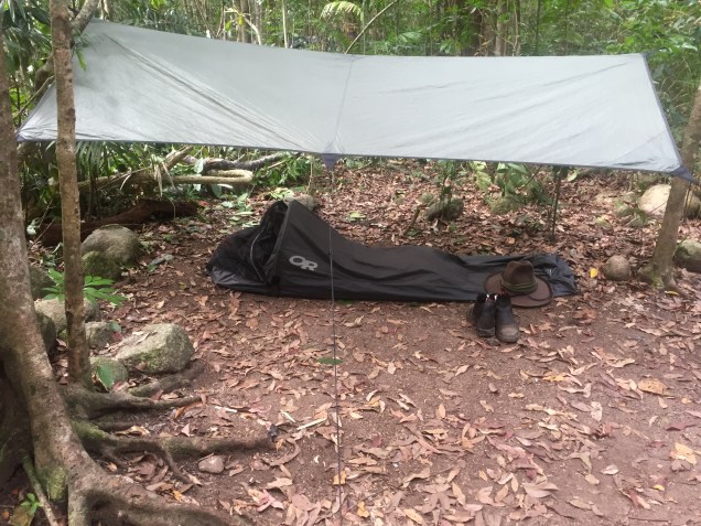
For this hike I decided to travel light and used a simple bivvy bag and lightweight tarp to shelter from the elements, especially the sandflies that inhabit the island. Whilst a small insect it shows no discrimination in its choice of victim.

The ‘Hinchinbrook Hilton’ as I called my sleeping arrangements served me well and did the job perfectly.

Thorsborne Trail

I also kept meals simple, as I usually do on these types of hikes, dining on a ration of French onion soup and beef jerky, supplemented with dried apricots and mango, and a favourite hiking delicacy of mine, smoked hickory almonds.

There was little risk of me starving and besides I had built up a decent layer of body fat after a few months of inactivity, much like a bear about to go into hibernation!

Water was generally accessible throughout the hike and whilst carrying water-purifying tablets I didn’t feel the need to use them all the time, but assessed it depending where I was getting the water. And hey, it is nice to get some fresh, unadulterated drinking water from streams whose origins are in the mountains.

And of course, speaking of water it is sensible to keep in mind that this is crocodile country and they are known to inhabit the island, something I was extremely conscious of as I heard the water lapping onto the beach not far from the ‘Hinchinbrook Hilton’ on my second night at Zoe Bay.

Departure from my first night’s camp on day two was delayed slightly as the National Parks Rangers’ had closed the track between Little Ramsay Bay and Zoe Bay the previous day due a ‘cool burn’ they were conducting of undergrowth nearby to the walking track. I was aware of this in the week leading up to the hike and after they did a quick reconnaissance of the area they reopened the track mid-morning as planned.

The burn had little impact on the walk from Little Ramsay Bay to Zoe Bay.

Leaving Little Ramsay I had to do some rock hopping around the southern end of the beach leading to another beach around the headland before heading into the bush. The track takes you through a number of vegetation types, including dry open forest, rainforest and mangrove swamps and many creek crossings. At times of heavy rain the swamplands and creek crossings would become more challenging.

Continuing south towards Zoe Bay my path took me through a number of palm swamps in tall rainforest between North Zoe Creek and Fan Palm Creek, an area I was able to view earlier on one of the many headlands that I had ascended.

Thorsborne Trail

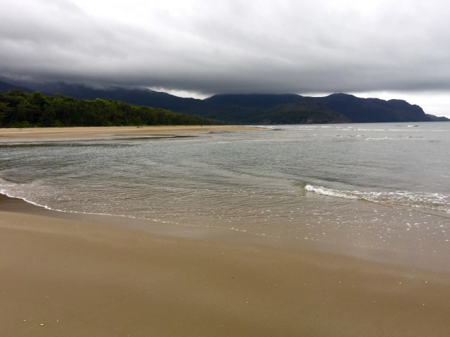
Eventually I found myself on the sands at Zoe Beach and I made way towards the camp situated near the mouth of South Zoe Creek. And let me say, the creek looked inviting, but there were plenty of ‘croc’ warning signs to indicate swimming here would be a mugs game. Mind you, it was only a short walk up the creek to Zoe Falls, where I enjoyed a refreshing couple of hours swimming in the pristine waters…

I shared the night here with a number of other hiker’s enjoying a meal and the camaraderie that is forged from a common interest. And a feature of these campsites is the metal boxes provided for food storage. The island has a large population of native rats and they are known to chew through your backpack to get to your food supply!

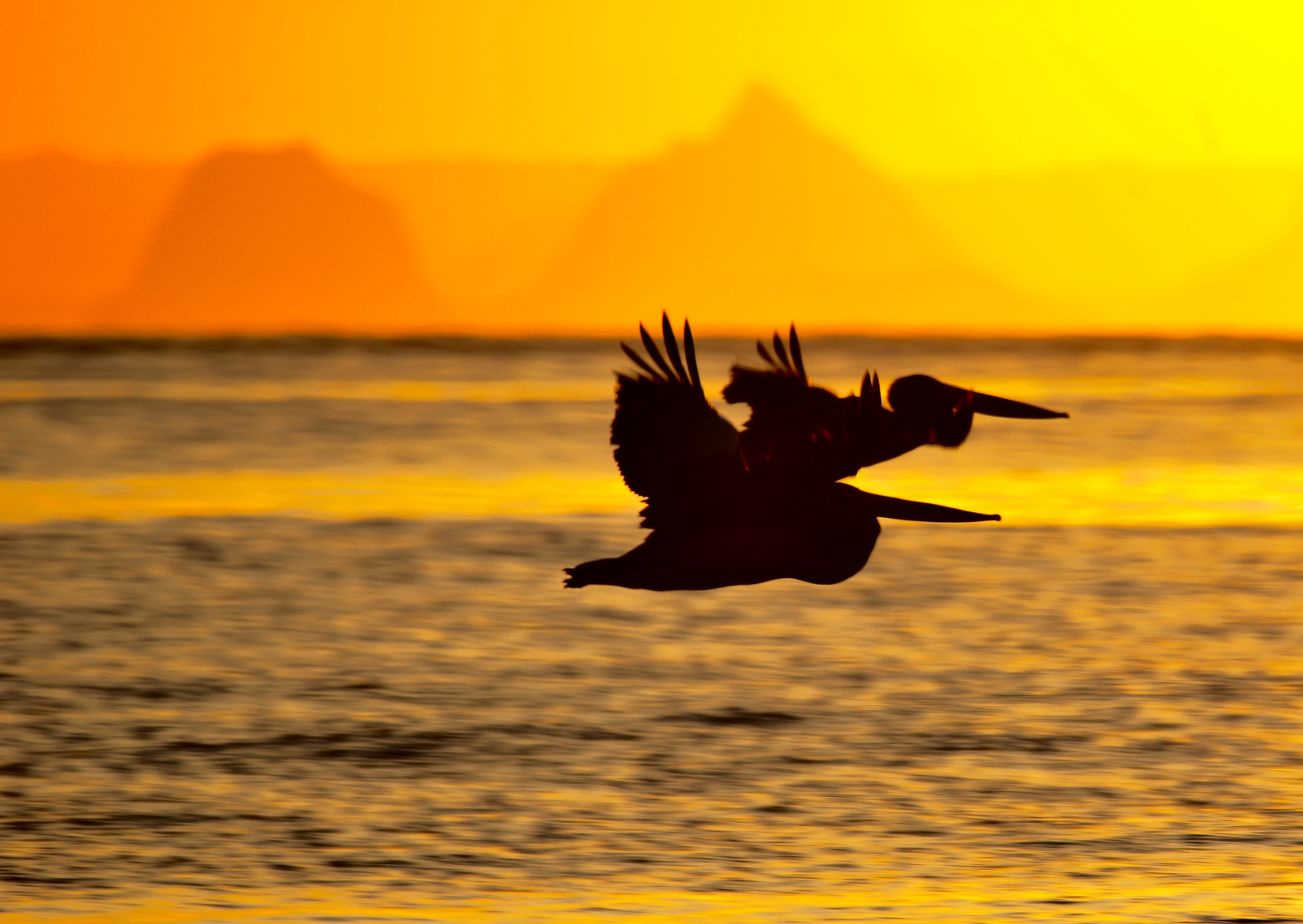
The smoke haze from the burn-off provided a spectacular sunset that evening and an equally spectacular sunrise the next morning. And whilst the ‘Hinchinbrook Hilton’ was serving me well, its size provides an incentive to get up and stretch the body early enough to witness sunrise, the start of another day in paradise…!

My third day of hiking started with a heart-pumping climb up behind Zoe Falls and on to some granite slabs above the falls where you get spectacular views of Zoe Bay. And a note to self, next time fill the water containers at the top of the falls rather than at the bottom!

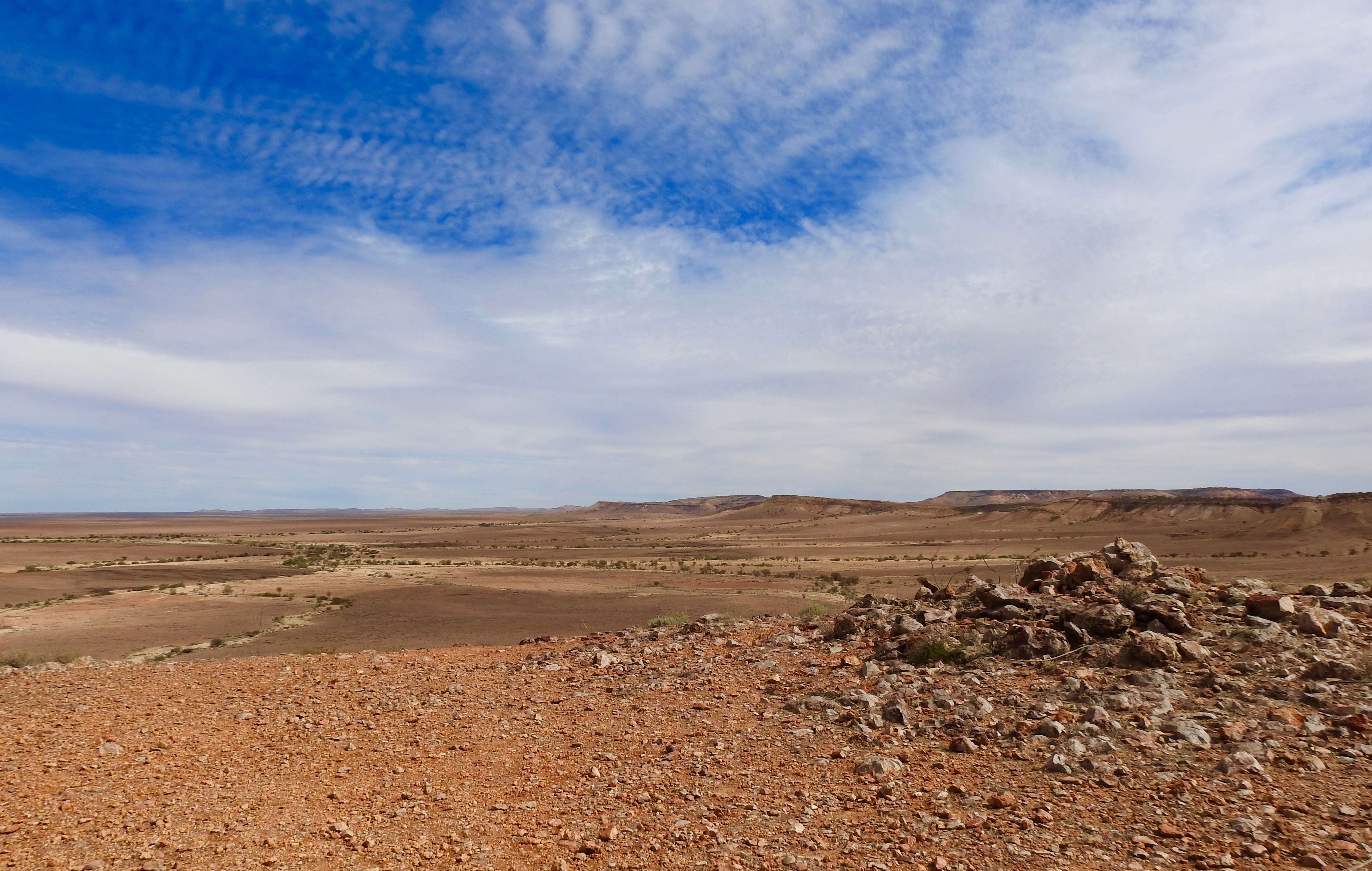
After crossing numerous creeks on the ascent towards the trail’s highest point, which is 260 metres, I was rewarded with great views of the Palm Island Group of islands to the south. I have always marvelled at this island group sparkling in the Coral Sea.

Traversing a variety of terrain I eventually descended to Diamantina Creek where I sat back amongst the trees and listened to the calls of the many species of birds present on the island.

Crossing this creek needs to be done with care as the rocks and boulders can be slippery when wet, and if the water is high and running you would be wise to wait until it subsides. But with the water low I was across and only a short walk to my last camp on the island at Mulligan Falls.

I wasted little time in setting up the ‘Hinchinbrook Hilton’ in this rainforest setting before making a beeline for the refreshing waters of the falls. This is a beautiful spot to relax and with an early arrival at camp I made the most of it.

There is a restricted area above the falls where you are not permitted to enter due to the slippery nature of the boulders and rock pavements and deaths and serious injuries have occurred here. So it is wise to heed the advice.

But as I relaxed against a rock perfectly molded to the shape of my back I dozed in the warmth as my body tingled from the crystal clear water that washed away the sweat and grime of the day’s hike.  The only thing missing was a ‘Margarita’ to refresh the soul…!

And a word of warning, if there is one thing you don’t want to forget when visiting Hinchinbrook Island is some form of insect repellant, especially when camping in the midst of the rainforest. This was no more apparent than at Mulligan Falls.

The dawn was welcoming and whilst my sleep was restful when it came, at other times it was punctuated by the sounds of a ‘million mozzies’ serenading me and all wanting a piece of my flesh.

Such is life in the food chain, I guess…

The pick-up point for my boat ride back to Cardwell was at George Point and was timed to coincide with low tide to assist with the crossing of Mulligan Creek.

Situated on the southern tip of the island George Point overlooks the port of Lucinda and the extremely long jetty that transports sugar grown locally to cargo vessels.

Much of the morning’s walk was along the beach at Mulligan Bay and it was with just a touch of trepidation that I crossed Mulligan Creek where it opened to the sea. And not before I walked upstream for a 100 metres, or so, to see if there were any telltale crocodile slide marks on the banks…

Hinchinbrook Island

Fortunately for me the only ‘crocs’ present where the ones I was wearing on my feet. Not long after I crossed the creek I found myself humming the tune ‘Never Smile at a Crocodile’ which made me laugh at myself. Amusement can be very simple, all that is needed is a good sense of imagination, hey!

Before long I was sitting on the sand at George Point reflecting on my ‘boy’s own adventure’ through the eyes of an adult…

…And rest assured it was with no less enthusiasm and excitement than a young boy looking over to the ‘Mysterious Island’…

Hinchinbrook Island

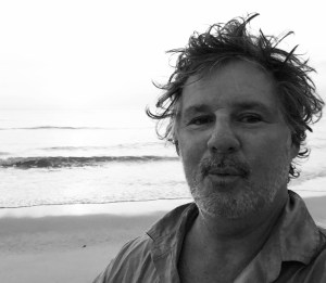
Baz – The Landy, Hinchinbrook Island, Far North Queensland.

Old, old story from long time ago…(Dreamtime)

Australia’s Traditional Owners have many wonderful Creation and Dreamtime stories that form the basis of customary laws and traditions.

On our travels throughout Australia, Janet-Planet and I seek out these stories as they provide a fascinating insight to the local area, often the prominent land topography, and importantly, aboriginal culture.

Ahead of this week’s hike on Hinchinbrook Island I came across one such story as related by a Traditional Owner from the Girramay people. The Girramay come from the lands surrounding Cardwell, in Queensland and this story is common to a number of groups in the region.

A great story to kick-off my hike with!

“An old, old story from long time ago…

Girugarr, we call that bloke the first surveyor, he named all the country, he come from across the sea, we don’t know where he came from. He look like man on top and he got long tail like an eel.

Girugarr comes from across the sea and he stop there on Palm Island, his first foot print is there at Mundy Bay.

The earth was hot and when he put his foot down there was a little bit of splash on the mud, it’s on a rock over there.

He speaks to the old people there, growls at them, “what are you doing?”

Girugarr comes up the channel.

When he comes through the sea up to Hinchinbrook Island there are no waves in that sea. He finds all the old people cutting a candle nut tree down and he asks them what are they doing.

They’re telling him in Guwal, the traditional language, “we are cutting this tree down to find witchetty grub”.

In Guwal the tree is called gabura.

The sea was calm.

That gabura tree it stand up tall and when it falls down into the water it creates waves for the first time…”

Thanks to Marcia, a Traditional Owner, for sharing a part of this wonderful dreamtime story from long time ago.

If there are waves on the passage as I cross to Hinchinbrook Island I will be able to reflect on the dreamtime story of the Girramay people – how good is that, hey.

Photos: Baz – The Landy, Cardwell, Far North Queensland…!


Achievement and Happiness…

Clairview, Queensland


“Achievement leads nowhere; makes no difference at all…

Just be happy now, release your struggle, let go of your mind, throw away your concerns and relax into the world.

No need to resist life, open your eyes and see that you are far more than you think,

You are already free…!”

I’ve been reflecting on this statement as I head to North Queensland, especially given there has been some endless driving following the white line on the bitumen road, affording plenty of “thinking time”.

And yes, for sure, I will get off the bitumen eventually and back out into the bush, the outback and some “red dusty roads”.

Mind you, it is quite pleasant travelling the coastal route and I’ve managed to spend time sitting back with a book gazing out across the water as I make my way towards Hinchinbrook Island for a few days of hiking, followed by a trip to Cape Melville, halfway up to the tip of Cape York.

Back to that statement though…

As many will recall, I recently “graduated from work” having decided there was more to life than joining the traffic jam on my way to work, only to do the same thing some (too many) hours later to get home.

Did it truly make me happy?

Perhaps the security of a weekly pay-cheque provides an illusion of happiness, but now that I have let that go and started to focus on “living in the moment” I’ve discovered far greater riches than a financial outcome can ever provide.

Yep, I have concluded that there is far more to life than work…

And hey, let me tell you Janet-Planet and I will be putting the “more to life than work” theory to the test as much as we possibly can.

Perhaps some will disagree with the proposition achievement leads nowhere; makes no difference at all, but as we all take our last breathe in this lifetime, we’ll all be equal, what we’ve achieved will mean little at that point – but being happy to that last moment will be priceless.

Well, at least that is my take on it, but whatever your view, just be happy now – strewth, that is my motto these days…!

Photo: Baz – The Landy, on the beach at Clairview, Queensland.

Ps: Yes, the last you heard from me I was in England, but I am back travelling the country I love. And don’t be alarmed if you don’t hear from me from time-to-time, the beauty of where I am travelling to be is no communications!

Seaside – On the English Channel


Slapton Beach, a pleasant beach on the English Channel, which was one of the launching sites on D-Day in World War Two, and the site of a large American presence during the conflict…

Photos: Baz – The Landy, Slapton Beach, England…

The Wisdom of Merlin…

“Spend time not pondering what you see, but why you see it…”

Did Merlin actually exist and impart this great wisdom on a young King Arthur – crikey, who knows, but not a bad quote to reflect on, hey…!

Photos: Baz – The Landy & Janet-Planet, at Merlin’s Cave, Tintatgel, Cornwall (we’re believers!)

Enjoying a golden sunset…

Sunset

Photo: Baz – The Landy, Moreton Island, Australia

Craggy Peaks and Golden Sunsets…

Glasshouse Mountains

During a trip to southern Queensland over the past two weeks I have been able to view the magnificent Glasshouse Mountains from a couple of different perspectives…

From the top of Mt Ngungun (pronounced “Noo Noo”) and from the beach on Moreton Island as the sun slipped below the western horizon, casting a wonderful golden glow over Moreton Bay and providing a beautiful silhouette to Mt Tibrogargan and Mt Beerwah…

Inhabited by Australia’s first people for thousands of years the craggy peaks that stand tall over the region are so significant that they are listed as a “landscape of national significance”…

And hey, what a wonderful backdrop for two pelicans as they glided off into the sunset.

Strewth, you wouldn’t be dead for quids, hey…!

Photos: Baz – The Landy, South-East Queensland, Australia…


The Glasshouse Mountains…

Climbing to the top of Mt Ngungun on a crisp winter’s morning rewarded me with a magnificent view of Mt Tibrogargan and Mt Beerwah.

In the language of the Gubbi Gubbi people, Ngungun means “faces” and  is pronounced “Noo Noo”…
Photo: Baz – The Landy, Australia…

Making Tracks – On an Island Hideaway


Have you ever been to a destination that has been sitting right under your nose, so to speak…

And wondered why you left it so long to visit?

This week I had great pleasure from that feeling when I finally visited Moreton Island, nestled just off the Queensland coast and a 90 minute ferry ride from the Port of Brisbane.

Long sandy beaches, an endless blue sky, and beautiful clear waters to swim in – what a great way for us Aussies’ to welcome winter…!

I made my camp, a simple ‘swag’ under my hiking tarp, in the dunes behind the beach at Comboyuro Point on the northern end of the island.

And all within view of the Glasshouse Mountains, that were wonderfully silhouetted against a setting sun…

But hey, I’ll let the photographs tell the story of this Island Jewel, they do it far more justice than words…

Photos: Baz – The Landy, Moreton Island, Australia

Miss Redhead – My burning desire…

Red heads

The Australian Outback, an ancient land where the red-parched soil is touched by an endless blue sky and where confetti flutters on the breeze.


Hang-on, since when was confetti part of our outback landscape…?

On a recent foray into the outback we thought we were travelling behind a bus full of Japanese newly-weds…

You know, the ones you see down at the Historic Rocks precinct in Sydney on a Saturday morning.

Lots of smiling faces, nodding as only the Japanese can in their most polite way, married in large groups on the steps of Mrs Macquarie’s Chair overlooking the magnificent Sydney Harbour, and more confetti than you could poke-a-stick at.

Strewth, and just to be clear, lest I be accused of casting a racial slur…

I love the Japanese people.

What would lunchtime be without sashimi – Nikon camera’s weren’t the only thing they shared with the world.  And hey, I’m not suggesting there were busloads of them in the outback throwing confetti everywhere either.

I was speaking metaphorically…(okay?)

But crikey – somebody must have been.

There was so much of it you could be forgiven for thinking that it must have come from a mass wedding.

Now I get it, it isn’t the most popular dinner party topic, but thanks to the hilarious 2006 movie “Kenny” we have at least got a little more comfortable discussing the issue around the camp fire these days.

And let’s not beat around the bush here, we are talking about “Poo Tickets”

Crikey, I thought everyone has watched that movie?

Toilet paper, you dill…!

Oh, stop cringing and shuffling in your seat…

And spare us the protest, Kenny dispelled many of those urban myths about…

Mine doesn’t smell and I always clean the bowel…

As a kid I used to visit my grandmother’s home in a small country town and she had an outhouse down the backyard. Anyone from the bush will know what an outhouse is and without doubt they’ve been the butt of many jokes for time eternity.

In Nan’s outhouse there was always a small box of matches sitting behind the door and she insisted one be lit each and every time you arose from the throne!

I thought this was normal and I don’t recall anyone ever complaining about the need to do it, it was just part of the routine…

Although, Uncle Bluey did complain about it once, but that was when my cousin accidently set alight to his prized Playboy Mag he had tucked down the back of the seat that us kids never knew about.

And mum’s still the word on that one..!

So why a box of matches?

Well nothing beats a freshly lit match to kill all other lingering smells …

Come-on,  you’re not still cringing, surely?

Needless to say, caution should always be exercised when playing with matches and there was the time Bluey sent the outhouse door over the back fence after a brekkie of Heinz baked beans…(thank God for flushing toilet’s these days, hey)

I’m not sure what was funniest, Bluey sitting there in his navy singlet with his Y-Fronts around his ankles, or the dunny door in the neighbour’s mango tree.

He had that “eyes rolled-up, embarrassed” look that dogs get when your eyes meet as they do their business.

Dog owners will know what I mean…

But, here is the thing, we’ve always carried a little box of redheads when we are Out and About.

In one bold strike you fill the air with the smell of a freshly burning match after a squat, removing the need to protest yours doesn’t smell, and importantly, you can use it to burn your poo tickets…

So, for those of you that head bush please take “Miss Redhead” with you.  

She may not ignite your passion, but in the least, she will put a flame to your “poo tickets” and spare our wonderful country the indignity of the unwanted and unsightly “confetti” that has increasingly become part of the landscape…

Baz – The Landy

Ps: Seriously, this is a major problem these days!

Your Mind’s Eye – A wonderful gift…

Bathed in the glow of a setting sun, this tailor’s shop took me on a journey to another time…

Who went through the front door, what did they buy, what banter did those inside share, was there laughter to be heard over the sound of a sewing machine?

Your mind’s eye is a wonderful gift that enables you to indulge your own thoughts, to pause and reflect…

Sitting around the fire later that evening, embers glowing a soft orange and providing warmth against the chill, I wondered, what thread did the tailor weave in this once thriving bush community…?

I’ll leave you to reflect…

Photo: Baz – The Landy, Yerranderie, Australia…

Yerranderie – Whispers from the past…

Standing amongst the wooden and corrugated iron buildings in the old silver mining town of Yerranderie, my mind’s eye could hear the whispers, the laughter of people long gone drifting on the breeze…

Yerranderie is a small bush town not too far from the centre of the bustling metropolis of Australia’s capital city, Sydney – at least as the crow flies.

In reality it is about a six-hour drive, depending on the route you take.

Recently, I travelled via Oberon, the Kowmung River and along the historic Colong Stock Route. A dusty, but scenic route, and I was sure to wile away some time sitting next to the Kowmung River with a mug of steaming black tea as black cockatoos passed overhead…

With a few days up my sleeve I decided to spend a couple of them exploring, photographing, and hiking around the wonderful bush surrounds the town is situated in.

My visit was mid-week and I literally had the place to myself, apart from the caretaker who lives on-site. And the only sound one could hear was the constant chiming of the bellbirds’ call, ringing as they flittered through the trees.

The town is nestled beneath Bartlett’s Head, an impressive rock that stands proud and from its vantage point provides a wonderful panoramic view of the surrounding bush and the Kanangra Boyd Wilderness Area.

The hike to the top is well worth the effort and takes little more than an hour.

And at day’s end there is a rich golden glow as the setting sun reflects off its cliff walls before it glides below the mountain peaks, beyond the horizon, heralding in nightfall as wombats awaken from their daytime burrows…

From Bartlett’s Head you can view the Burragorang Valley and backwaters of Warragamba Dam, which provides Sydney with its water supply.

Prior to the construction of the dam in the late 1950s the Burragorang Valley was home to a small farming community and it provided a more direct access route to Yerranderie from the township of Camden to Sydney’s south-west.

Yerranderie has a history closely linked to the people of Burragorang Valley…

On Easter Sunday a service is held in the local Catholic Church to commemorate the pioneering people of the valley and their association with the town.

An opportunity for old friends to “catch-up”…

Whilst it is a reasonable trek to get to this little gem in the Australian Bush, if you have an adventurous spirit, enjoy a freshness in the air that only the mountains can provide, and a day or two to spare, I encourage you to pack some camping gear and your favourite bottle of red wine to share with friends around the warmth of a glowing campfire – better still pack another bottle and stay one more night!

Photos: Baz – The Landy, Yerranderie, Australia…


XPLORE – Out and About (On Facebook)

Australian Outback

Hey, did you notice we have created a new Facebook Page?

XPLORE – Out and About – it is in the sidebar of our blog…

If you are “Facebook Inclined” please like or follow us to stay up to date with our adventures…and if you like what you see why not share it with your friends!

The more the merrier we reckon…

Cheers, Baz – The Landy and Janet-Planet…

Moreton Island – A different kind of sand dune…

Toyota 79 Series Dual Cab


Our touring vehicle “The Landy” is booked in for a major service tomorrow having done 100,000 kilometres of touring this great country of ours over the past three-and-a-half years.

Much of it in the sand and desert country that is a feature of our Australian landscape…

At the end of the week I will be heading off to experience another type of sand country – Moreton Island, just off the coast of Brisbane.

Despite having lived in Brisbane for a number of years, Janet and I have never visited, so Janet has suggested I head off and do a “recce” of it so we can spend some time there together in the future.

Perhaps she is planning some “girlie shopping” ahead of our trip to Devon, in the South of England, during June and July and needs some space!

Moreton Island, which is reached by ferry, has around 400-kilomtetres of sand tracks to be “Xplored”, pristine waters and wrecks that you can snorkel around, and a historic Light-house built in the mid 1800’s…and they say the fishing is great – well I’ll put that to the test at some stage, but knowing my track record the fridge in “The Landy” will be stocked with a few steaks, just in case!

And I will be leaving the TVAN, our touring camper-trailer, at home in favour of swagging it – simple and easy.

The camera gear is packed, so hopefully the weather will be kind on Moreton so I can get “Out and About” and experience a different kind of sand country…

Photos:  Baz – The Landy