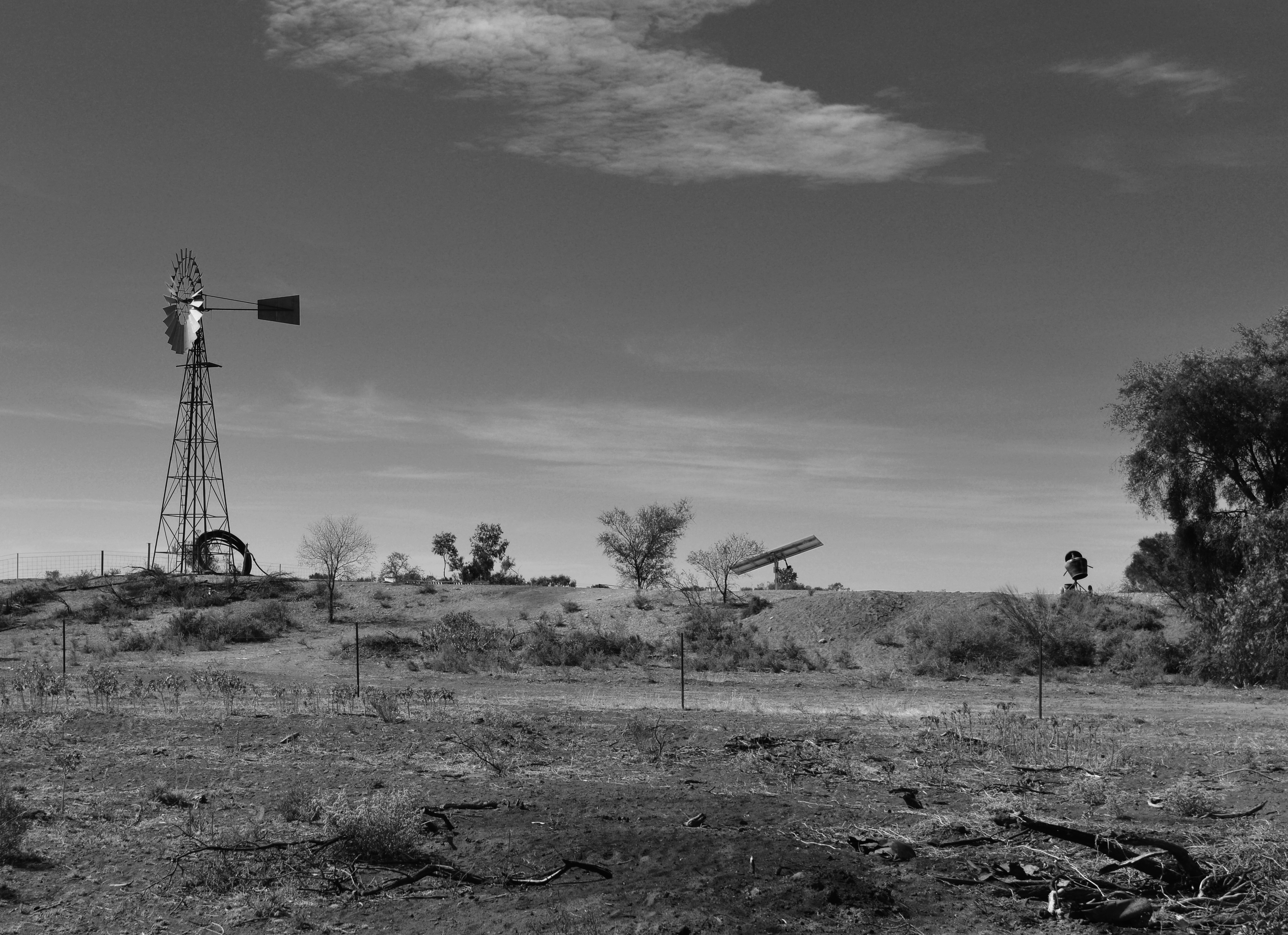
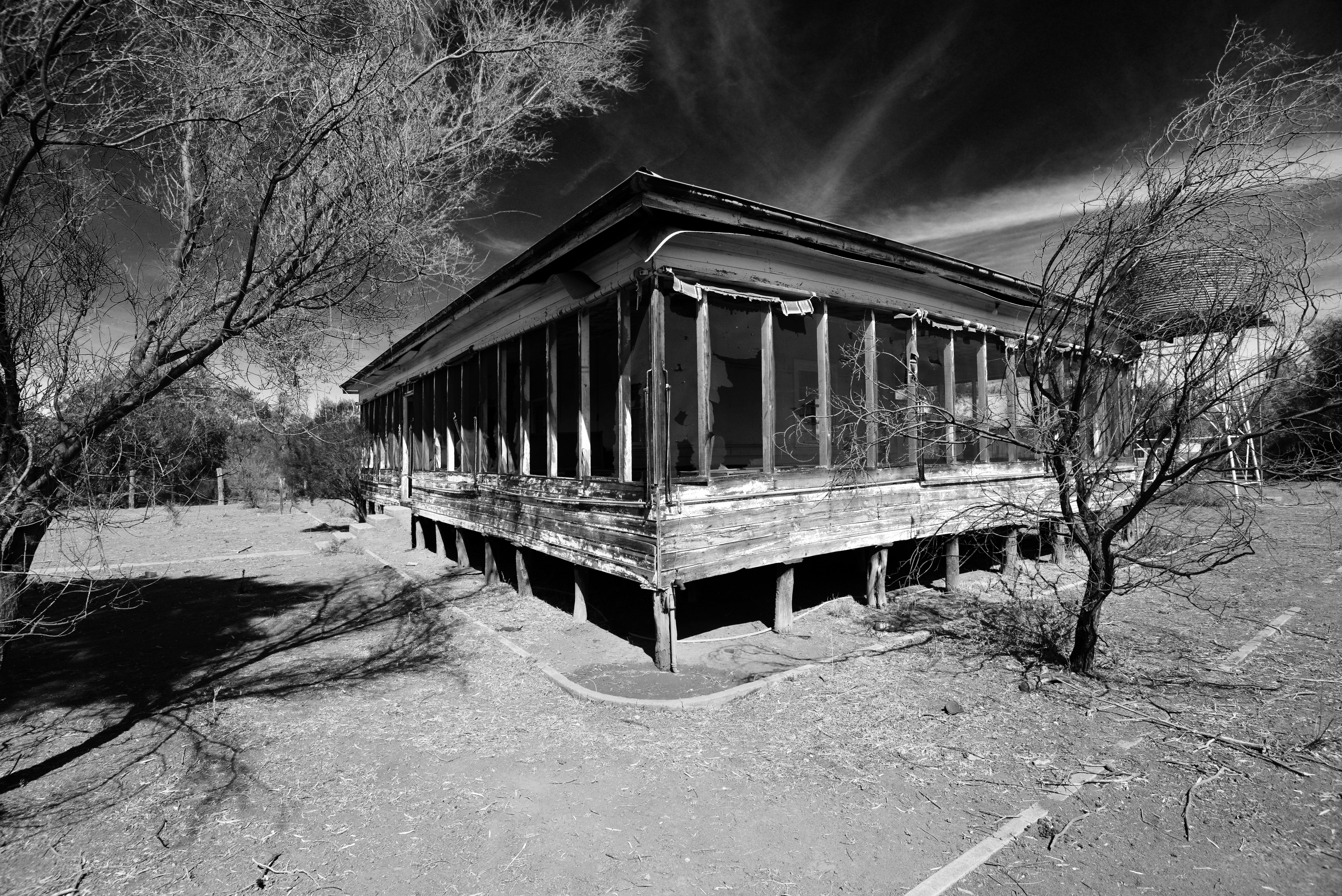
Standing amongst the wooden and corrugated iron buildings in the old silver mining town of Yerranderie, my mind’s eye could hear the whispers, the laughter of people long gone drifting on the breeze…
Yerranderie is a small bush town not too far from the centre of the bustling metropolis of Australia’s capital city, Sydney – at least as the crow flies.
In reality it is about a six-hour drive, depending on the route you take.
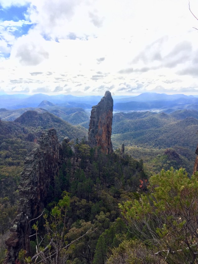
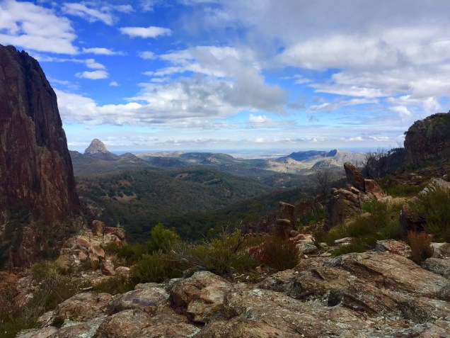
The town is nestled beneath Bartlett’s Head, an impressive rock that stands proud and from its vantage point provides a wonderful panoramic view of the surrounding bush and the Kanangra Boyd Wilderness Area.
The hike to the top is well worth the effort and takes little more than an hour.
And at day’s end there is a rich golden glow as the setting sun reflects off its cliff walls before it glides below the mountain peaks, beyond the horizon, heralding in nightfall as wombats awaken from their daytime burrows…
From Bartlett’s Head you can view the Burragorang Valley and backwaters of Warragamba Dam, which provides Sydney with its water supply.
Prior to the construction of the dam in the late 1950s the Burragorang Valley was home to a small farming community and it provided a more direct access route to Yerranderie from the township of Camden to Sydney’s south-west.
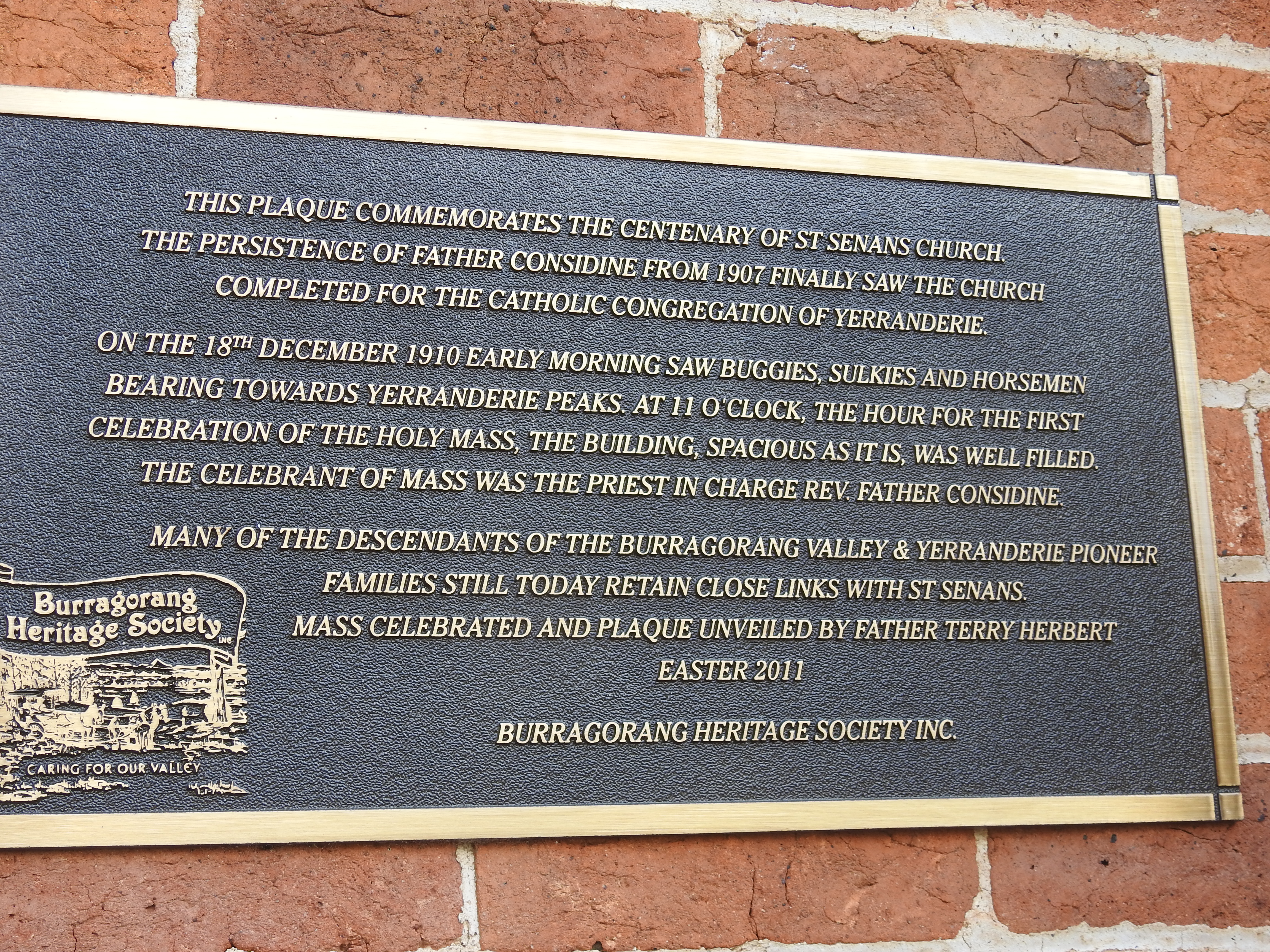
Yerranderie has a history closely linked to the people of Burragorang Valley…
On Easter Sunday a service is held in the local Catholic Church to commemorate the pioneering people of the valley and their association with the town.
An opportunity for old friends to “catch-up”…
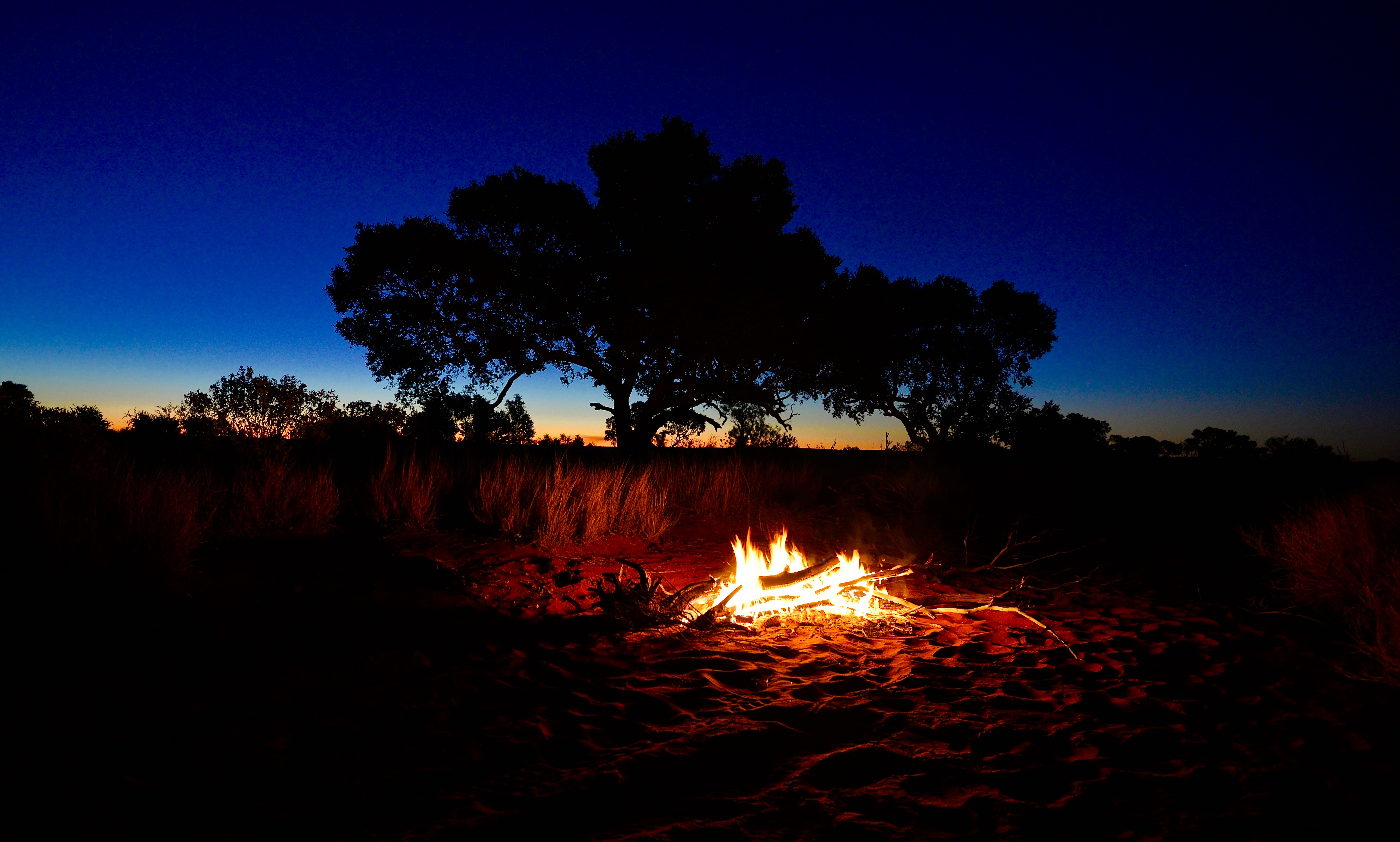
Whilst it is a reasonable trek to get to this little gem in the Australian Bush, if you have an adventurous spirit, enjoy a freshness in the air that only the mountains can provide, and a day or two to spare, I encourage you to pack some camping gear and your favourite bottle of red wine to share with friends around the warmth of a glowing campfire – better still pack another bottle and stay one more night!
Photos: Janet & Baz
About us…
We love the colours of the Australian Outback, the red earth touching a blue sky on a faraway horizon; and the fabulous coastline of our sunburnt country, where a golden sandy beach is washed over by a warm turquoise blue sea…
A few years ago we graduated from work and re-entered the classroom of life where an education is guaranteed and all that is needed is an open mind.
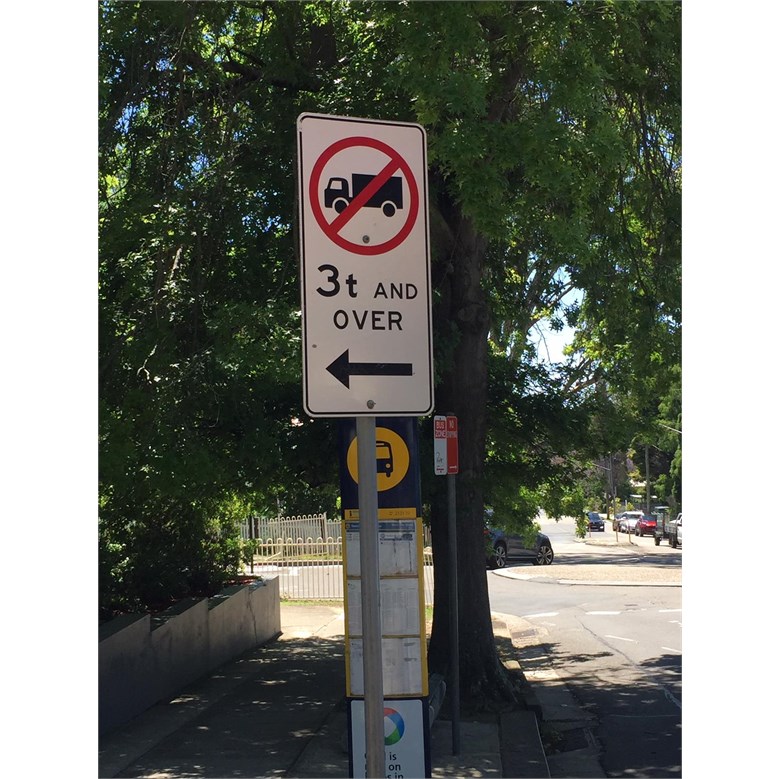
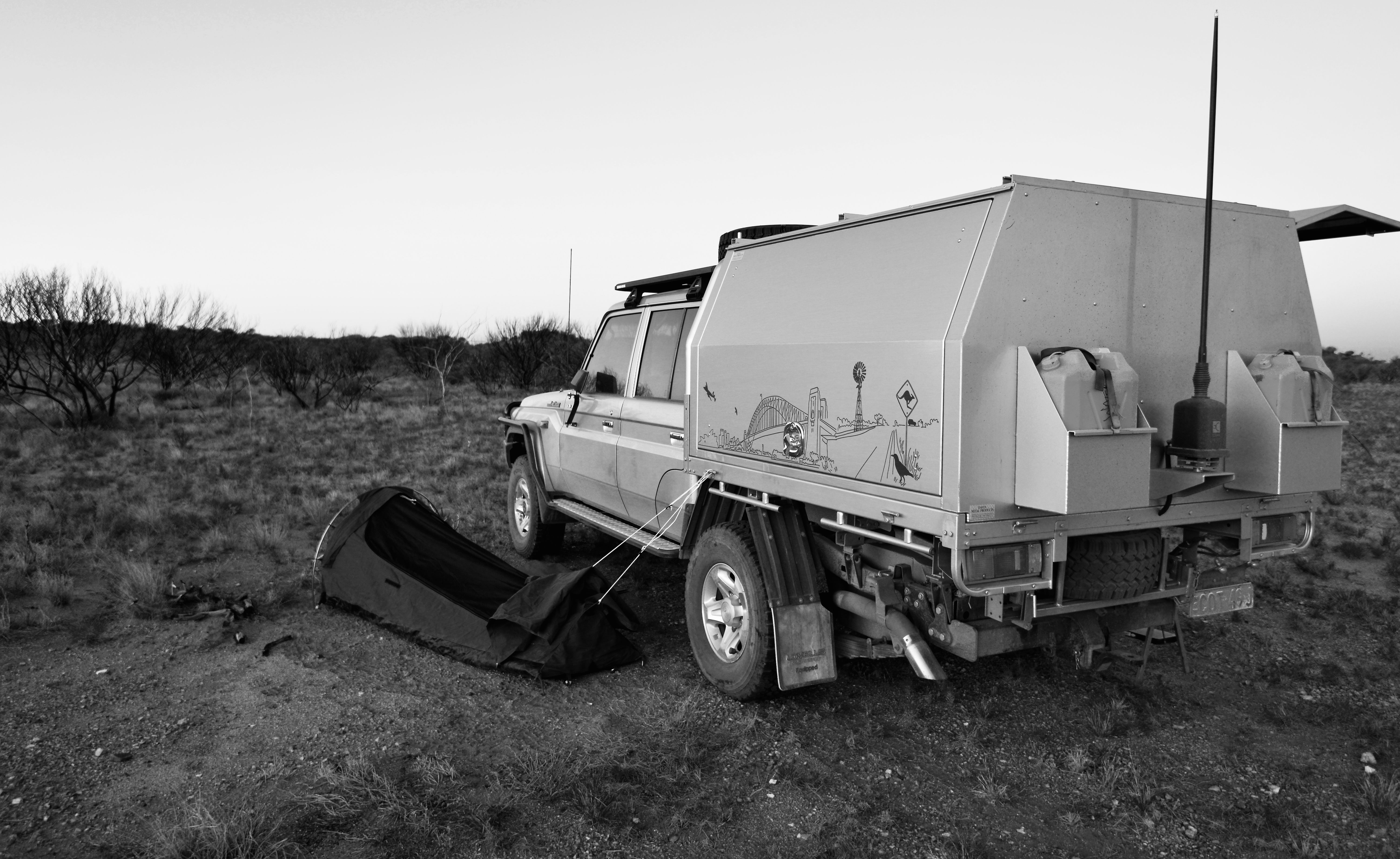
Increasingly, it appears these weight-restricting signs are appearing on our roads, especially in metropolitan areas where they are usually put in place by local government authorities.
In NSW the Roads and Maritime Services (RMS) look after major roads and local government authorities lesser local roads within its area.
Many will be familiar with these signs restricting vehicles over 3,000kg (usually marked 3-ton) from travelling along a particular road or street. Usually the sign has a “truck” picture on it; similar to the one in the photograph possibly leading drivers to form an opinion it does not refer to standard SUV style vehicles.
And I must note that frequently these signs are not obvious, hidden behind foliage on a tree, which perhaps is another problem altogether when it comes to road signs…!
But what is the implication of these weight-restricted roads for today’s modern four-wheel drive vehicles?
A quick look at many of the popular four-wheel drive vehicles on the market today, including the Nissan Patrol and the popular Toyota 78 and 79 Series show that they all have a standard GVM in excess of 3,000kg. Put a couple of adults and some luggage in any of these vehicles along with a full tank of fuel and they will most likely be weighing in excess of 3,000kg.
And it is worth noting many weight-restricted roads have a “GVM Limit” of 3 ton, so the popular range of four-wheel drive vehicles I’ve noted are impacted, regardless of what they weigh in at on the road.
We have a Toyota 79 Series with a GVM of 3,780kg (standard is 3,300kg) and it usually weighs in at around 3,500kg in its touring configuration.
But, 3-ton means 3-ton even if it doesn’t look like a truck and more like a passenger vehicle.
Possibly many may be of the view that the sign does not refer to their vehicle and be travelling on them unaware of the implications it might have, especially in the case of an accident.
Perhaps others simply ignore the directive.
If you have comprehensive insurance on your vehicle, and who doesn’t these days, you will find that one of the first things it will say in the PDS is that you are “covered anywhere you are legally entitled to be”.
And it pays to reflect on that statement – anywhere you are legally entitled to be…
The implication for those with vehicles weighing over 3-ton or with a GVM in excess of 3-ton is that travelling on a weight restricted road might void your ability to make an insurance claim if it relates to an accident on that weight restricted road.
I am insured with the popular four-wheel drive specialist underwriter, Club 4×4, and I have confirmed with them that my interpretation is correct – if you are not legally entitled to travel on a road due to it being weight restricted you will be in breach of the terms and conditions of the policy.
Now maybe that interpretation is the default position from the insurer in the first instance, but the implication is clear, a claim might be denied…
And given underwriting standards and interpretations of terms and conditions are fairly standard across the automotive insurance companies you will find they’ll all mostly likely arrive at the same conclusion.
Now there might be a couple of caveats on that view depending on the specific circumstances, but it is usually with great certainty that whenever “grey area meets legal implications” it will cost you money to prosecute your case.
Local government authorities when restricting roads and streets to weight are required to provide an alternative for vehicles in excess of the weight restriction. I live in an area of Sydney that has numerous 3-ton weight-restricted roads and there are alternatives.
But it is a minefield of sorts, especially if travelling in areas you are less familiar with. And a review of a number of GPS mapping systems highlights that none appear to give the user an option to avoid weight-restricted roads, at least not in the systems usually associated with SUV type vehicles.
As with most things in life, it is never a problem, until it becomes a problem.
It is unlikely you will be booked by the local government authority enforcement officers or police for travelling along a weight-restricted road in your four-wheel drive vehicle if the tare weight is under 3-ton. After all, it would need to be weighed to determine if it is under or over. But if you are involved in an accident where there is an injury, or worse, the vehicle may be put over the scales and you may find you will face a charge of negligence if over 3-ton, depending on the circumstances, which is not a traffic violation but a criminal charge.
The question needs to be asked is why are there an increasing number of weight-restricted roads being introduced, maybe it is time for the four-wheel drive lobby groups to become active in this regard.
Perhaps many are blissfully unaware of the implications of weight-restricted roads, especially with regard to insurance and personal liability – but 3-ton, is 3-ton, regardless of the vehicle you are driving, it doesn’t apply to just trucks, so keep an eye out for those weight-restricted roads….
About us…
We have always loved the colours of the Australian Outback, the ochre red earth touching a deep blue sky on a faraway horizon; and the fabulous coastline of our sunburnt country, where a golden sandy beach is washed over by a turquoise blue sea; and the characters you meet in a quiet country pub, where it is nothing flash, but you are enriched by the encounter…
A couple of years ago we decided that after many years of paid and unpaid work that it was time for us to “graduate from work” and re-enter “the classroom of life” where an education is guaranteed and all that is needed is an open mind.
Yes, it seems I’m a couple of weeks late, but hey, I’m working on leisure time these days…
Janet and I are gearing up for plenty of adventure travel into the Australian Bush and Outback this year and we’ve dusted the cameras’ off to photograph our magnificent country.
Have you ever been to a destination that has been sitting right under your nose, so to speak…
And wondered why you left it so long to visit?
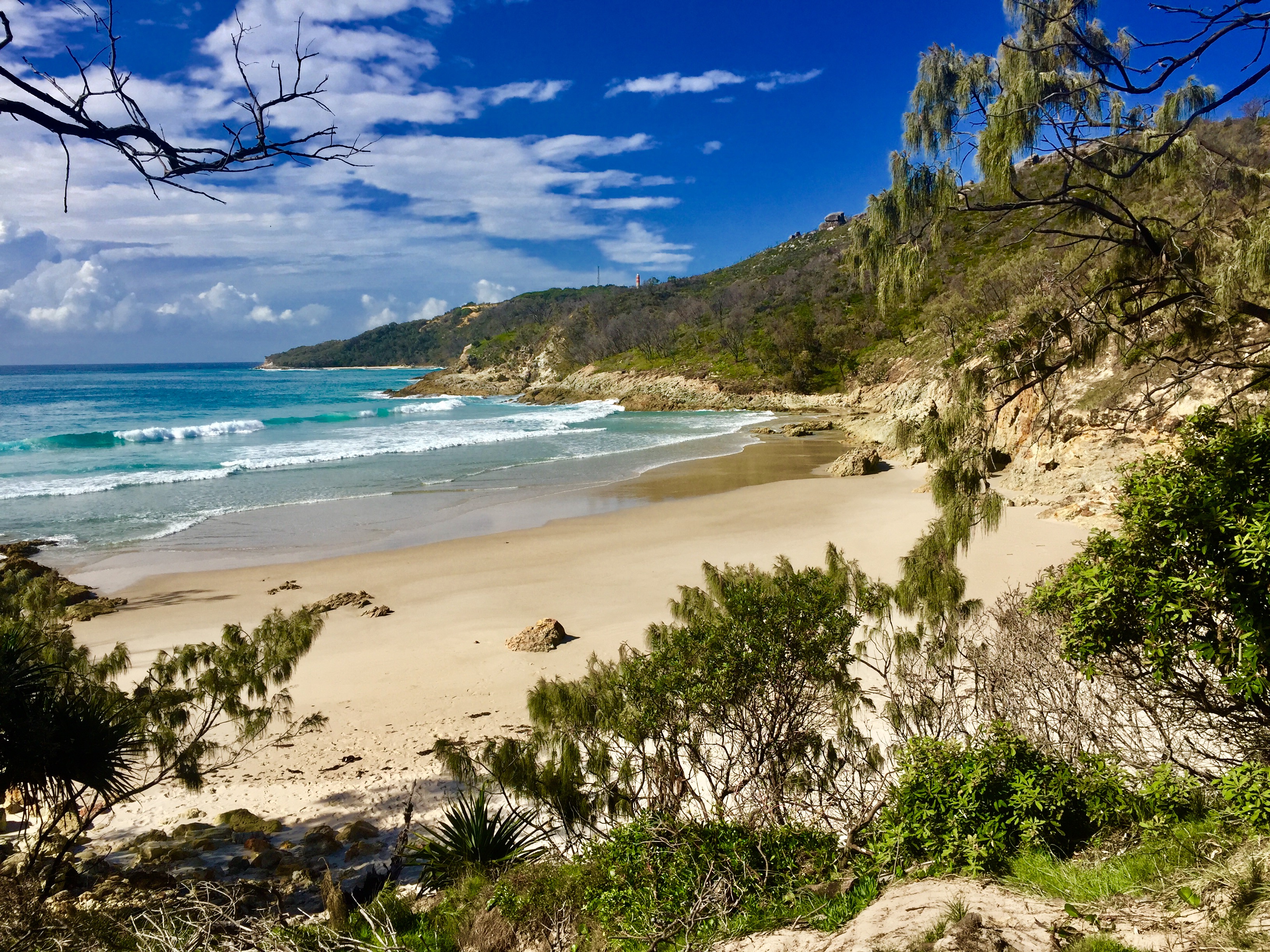
This week I had great pleasure from that feeling when I finally visited Moreton Island, nestled just off the Queensland coast and a 90 minute ferry ride from the Port of Brisbane.
Long sandy beaches, an endless blue sky, and beautiful clear waters to swim in – what a great way for us Aussies’ to welcome winter…!
I made my camp, a simple ‘swag’ under my hiking tarp, in the dunes behind the beach at Comboyuro Point on the northern end of the island.
And all within view of the Glasshouse Mountains, that were wonderfully silhouetted against a setting sun…
But hey, I’ll let the photographs tell the story of this Island Jewel, they do it far more justice than words…
Photos: Baz – The Landy, Moreton Island, Australia
Standing amongst the wooden and corrugated iron buildings in the old silver mining town of Yerranderie, my mind’s eye could hear the whispers, the laughter of people long gone drifting on the breeze…
Yerranderie is a small bush town not too far from the centre of the bustling metropolis of Australia’s capital city, Sydney – at least as the crow flies.
In reality it is about a six-hour drive, depending on the route you take.
Recently, I travelled via Oberon, the Kowmung River and along the historic Colong Stock Route. A dusty, but scenic route, and I was sure to wile away some time sitting next to the Kowmung River with a mug of steaming black tea as black cockatoos passed overhead…
With a few days up my sleeve I decided to spend a couple of them exploring, photographing, and hiking around the wonderful bush surrounds the town is situated in.
My visit was mid-week and I literally had the place to myself, apart from the caretaker who lives on-site. And the only sound one could hear was the constant chiming of the bellbirds’ call, ringing as they flittered through the trees.
The town is nestled beneath Bartlett’s Head, an impressive rock that stands proud and from its vantage point provides a wonderful panoramic view of the surrounding bush and the Kanangra Boyd Wilderness Area.
The hike to the top is well worth the effort and takes little more than an hour.
And at day’s end there is a rich golden glow as the setting sun reflects off its cliff walls before it glides below the mountain peaks, beyond the horizon, heralding in nightfall as wombats awaken from their daytime burrows…
From Bartlett’s Head you can view the Burragorang Valley and backwaters of Warragamba Dam, which provides Sydney with its water supply.
Prior to the construction of the dam in the late 1950s the Burragorang Valley was home to a small farming community and it provided a more direct access route to Yerranderie from the township of Camden to Sydney’s south-west.
Yerranderie has a history closely linked to the people of Burragorang Valley…
On Easter Sunday a service is held in the local Catholic Church to commemorate the pioneering people of the valley and their association with the town.
An opportunity for old friends to “catch-up”…
Whilst it is a reasonable trek to get to this little gem in the Australian Bush, if you have an adventurous spirit, enjoy a freshness in the air that only the mountains can provide, and a day or two to spare, I encourage you to pack some camping gear and your favourite bottle of red wine to share with friends around the warmth of a glowing campfire – better still pack another bottle and stay one more night!
Our touring vehicle “The Landy” is booked in for a major service tomorrow having done 100,000 kilometres of touring this great country of ours over the past three-and-a-half years.
Much of it in the sand and desert country that is a feature of our Australian landscape…
At the end of the week I will be heading off to experience another type of sand country – Moreton Island, just off the coast of Brisbane.
Despite having lived in Brisbane for a number of years, Janet and I have never visited, so Janet has suggested I head off and do a “recce” of it so we can spend some time there together in the future.
Perhaps she is planning some “girlie shopping” ahead of our trip to Devon, in the South of England, during June and July and needs some space!
Moreton Island, which is reached by ferry, has around 400-kilomtetres of sand tracks to be “Xplored”, pristine waters and wrecks that you can snorkel around, and a historic Light-house built in the mid 1800’s…and they say the fishing is great – well I’ll put that to the test at some stage, but knowing my track record the fridge in “The Landy” will be stocked with a few steaks, just in case!
And I will be leaving the TVAN, our touring camper-trailer, at home in favour of swagging it – simple and easy.
Luxury…
The camera gear is packed, so hopefully the weather will be kind on Moreton so I can get “Out and About” and experience a different kind of sand country…
Deep in the middle of one of Australia’s remote desert lands at a place where perhaps only a handful of Australian’s of European descent have stood, if that many and not a soul in sight
A favourite catch-cry in the corporate world, of which I am firmly entrenched, suggests any goal needs a plan and a “road map” detailing how you are going to arrive at your objective.
But what about “road maps” when we are Out and About – Having Fun?
I grew up wandering the bush with a compass in hand and a bunch of paper maps and in my flying days I had similar.
Even with the advancement of GPS technology I still haven’t been able to give-up my paper maps and compass.
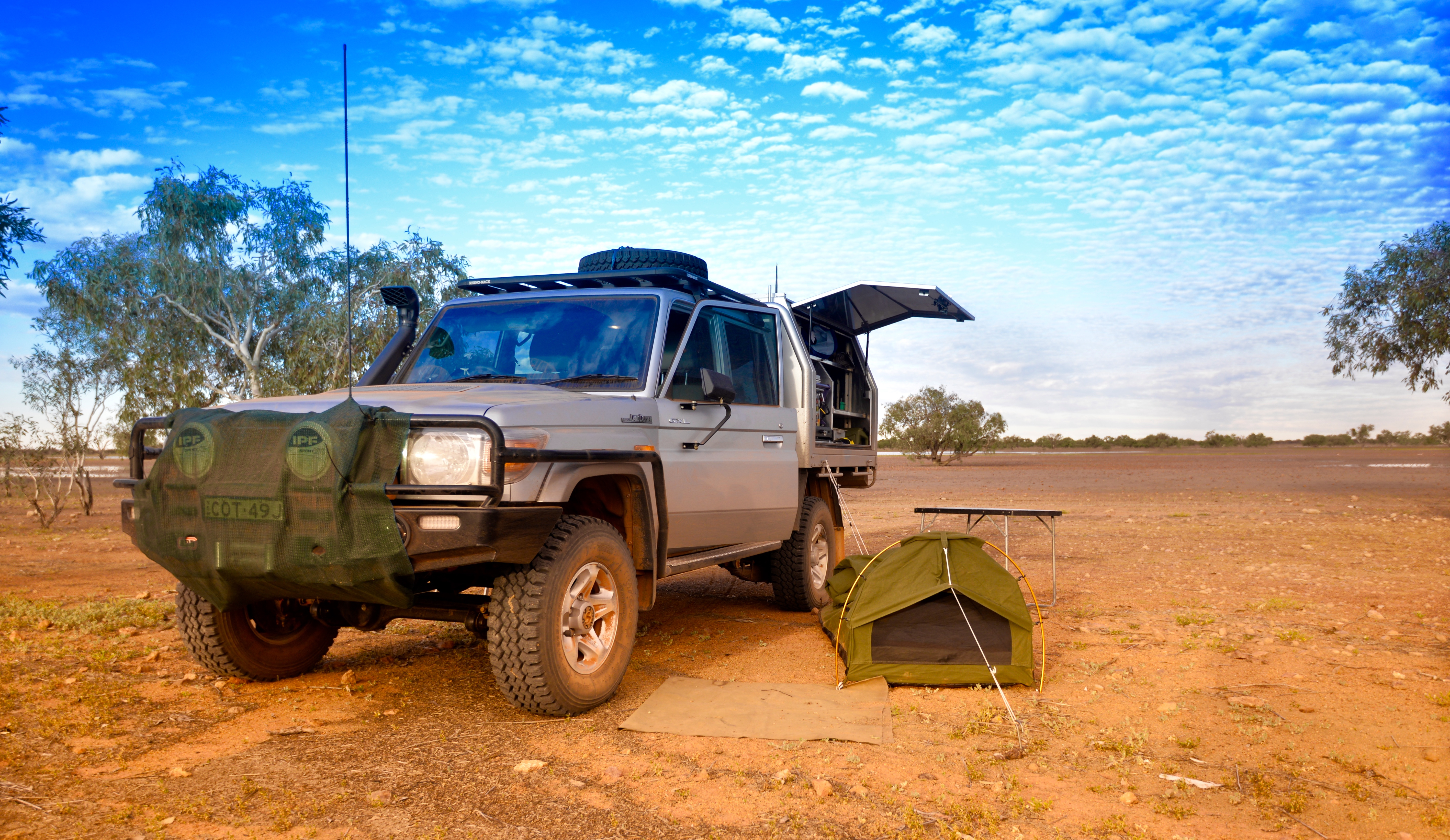
Mind you, “The Landy” our Toyota 79 Series Dual Cab is fitted with a VMS In-Dash GPS running Oziexplorer mapping software. Although, I find the VMS lacking in functionality as it only runs a “light” version of the full Oziexplorer program and the screen size challenges even those with 20/20 vision.
On an outback expedition to the Gibson and Little Sandy Deserts I was able to review a Panasonic Toughbook in action. A robust laptop, the Toughbook has its genesis in the US Military and could survive almost anything thrown at it, especially the bone-jarring corrugations found on many of our outback tracks.
Rest assured, this sort of toughness comes at a hefty price for a brand new unit, but on my return from the expedition I purchased a reconditioned unit from a Melbourne based dealer for a fraction of its new cost.
It can be turned into a “tablet” and I use it with a wireless keyboard and it has a solid-state hard-drive, which makes loading up extremely fast.
The challenge was where to locate the unit so it would be accessible to both driver and navigator in the front seat, but without comprising comfort and safety, especially if air-bags were activated.
I reviewed a variety of over-the-counter products, but concluded none were likely to survive the corrugations of our outback roads and a custom made mount was the only way to go.
I settled on working with the team at Industrial Evolution, a Sydney based company specialising in making computer mounts for police vehicles.
The owner, Brett Franzi, was pleased I made contact as he had not had access to the more recent batch of Toyota 76, 78, and 79 series vehicles and my request provided the opportunity for a design template to be made.
Why go with the in-dash mount?
It is centrally located and securely attached to the dashboard and whilst it does take up some real estate in the central dash location, the alternatives would have done so also.
Importantly, it meets ADR Standards and fitting is a straightforward process and is easily achieved by the most basic of handymen.
Mind you, the proof is always “in the pudding” and tests on all types of road surfaces covering in excess of 30,000 kilometres over the past couple of years has proven the Panasonic Toughbook, combined with the in-dash mount from Industrial Evolution, to be a great partnership…
A great solution that gets my vote, but hey, don’t leave home without a map and a basic compass – they have never been known to fail…!
The cost, well it will depend on what items you purchase, but don’t expect too much change out of $500.
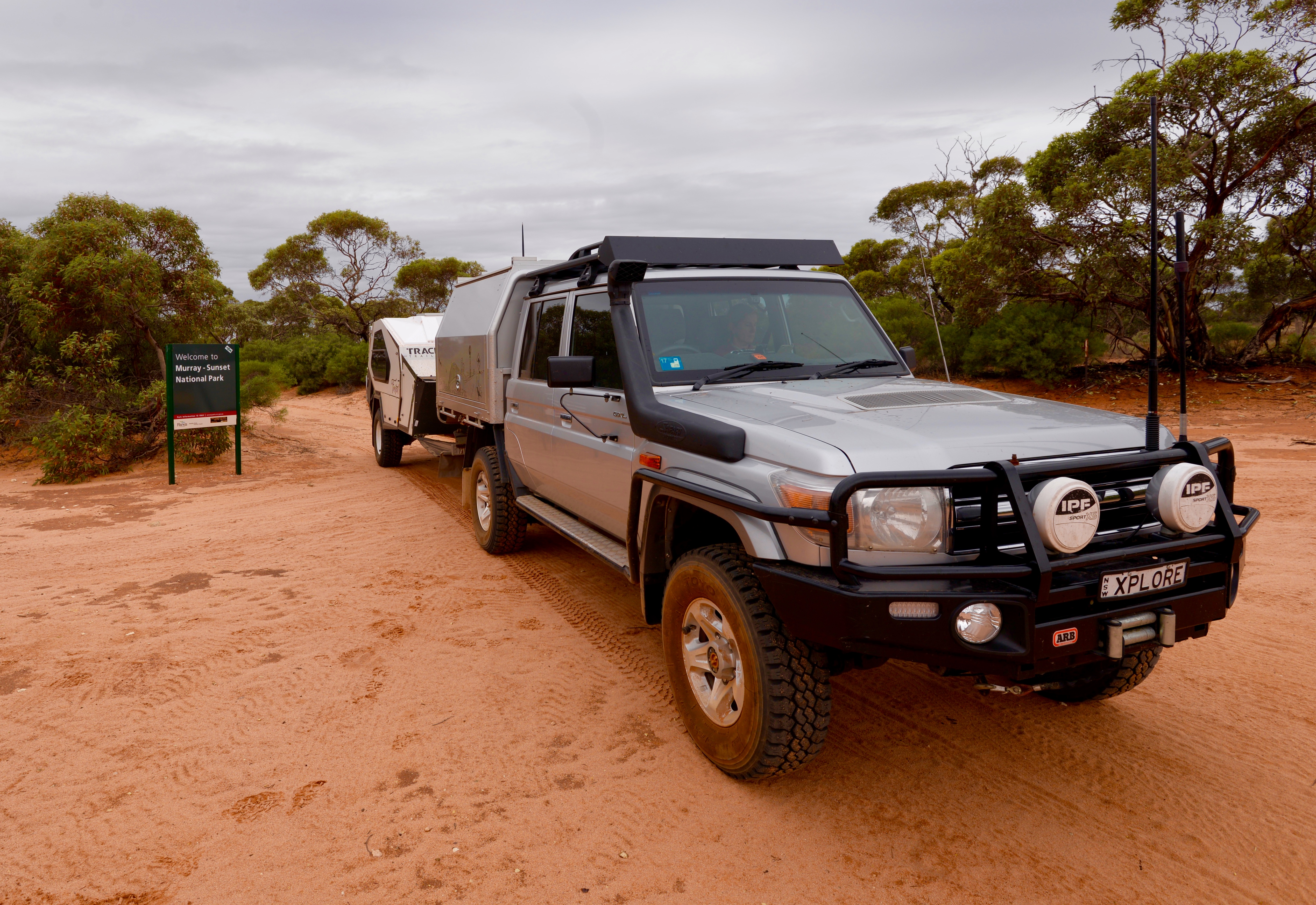
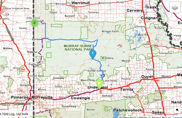
Situated in the far north-west of Victoria is a park that showcases the rugged and spectacularly beautiful Mallee landscape of low scrubland and sand dunes, the Murray-Sunset National Park.
Murray-Sunset gives you a feeling of being Out and About in Australia’s vast outback without the need for travelling the vast distances usually associated with visits to “the interior”…
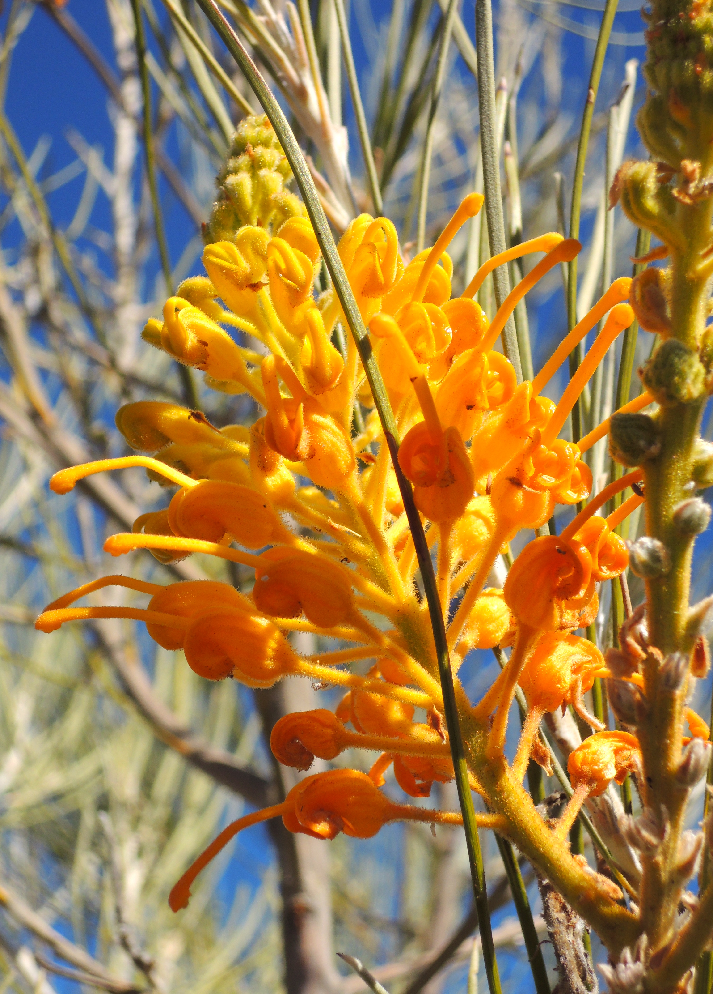
On a recent trip south to Kangaroo Island we took a couple of days to traverse parts of the park and view the Pink Lakes for which it is renown. Pigmentation caused by algae colours the lakes pink during the summer months and is quite spectacular to view later in the day.
Throughout the 1900s salt was commercially mined in the area with operations ceasing around 1975, but relics of this era can be viewed as you make your way around the lakes on the Pioneer Circuit.
Our starting point for travelling into the park was the small township of Linga where there is a well-signed and formed dirt road that takes you to the Pink Lakes. The Pioneer Track is a circuit that is suitable for two-wheel drive vehicles taking visitors on a tour around the lakes and can easily be accessed from the larger towns of Ouyen or Pinaroo for those wanting to do a day visit.
Being summer, we were cautious to ensure temperatures were not too high in the park before committing to travelling through it. Not that we are unaccustomed to extreme heat and humidity, after all, we grew up in Queensland and lived in tropical Papua New Guinea for a number of years. But at this time of the year the park sees far less visitors and despite being not too far from a number of towns it remains a remote area that should be respected.
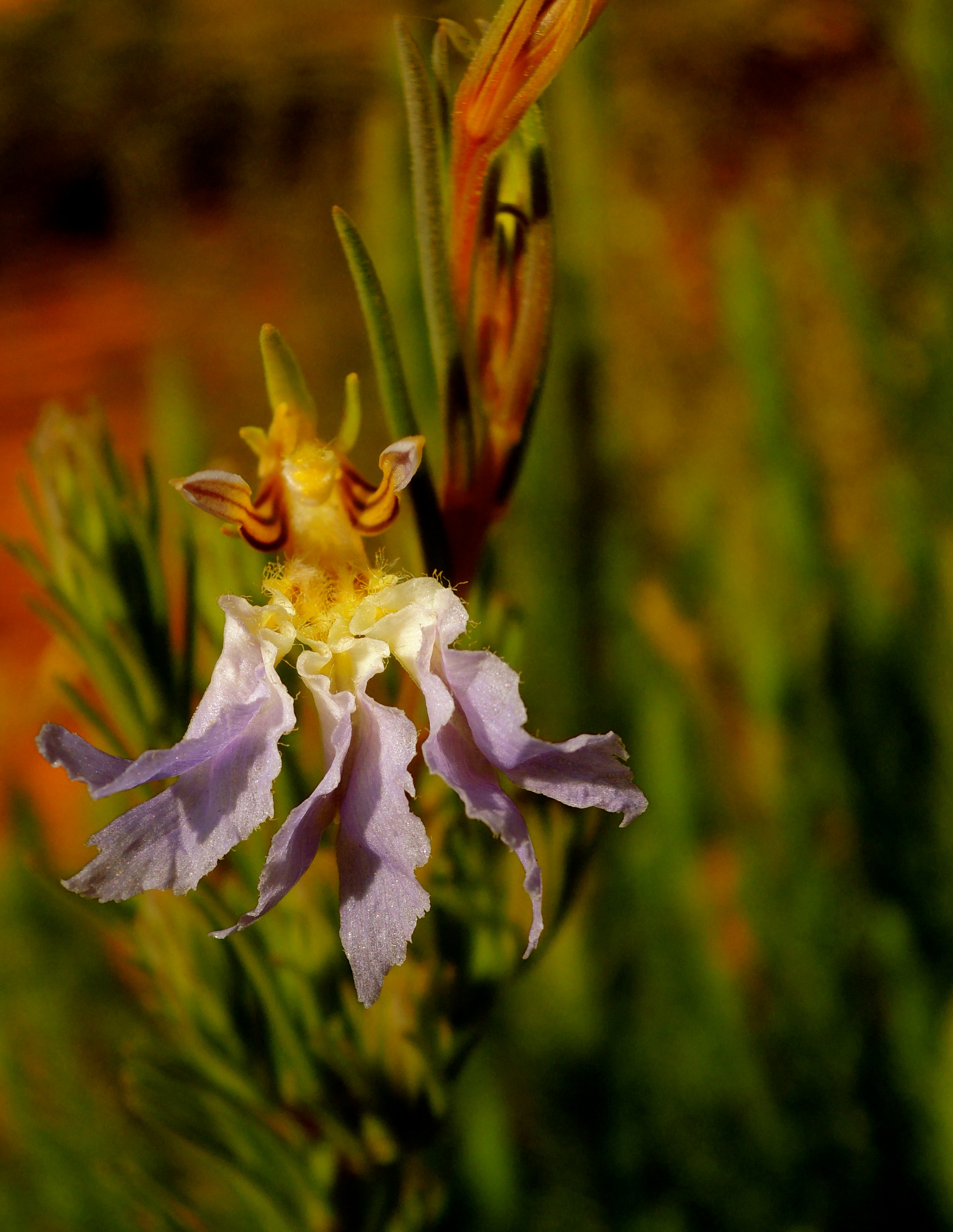
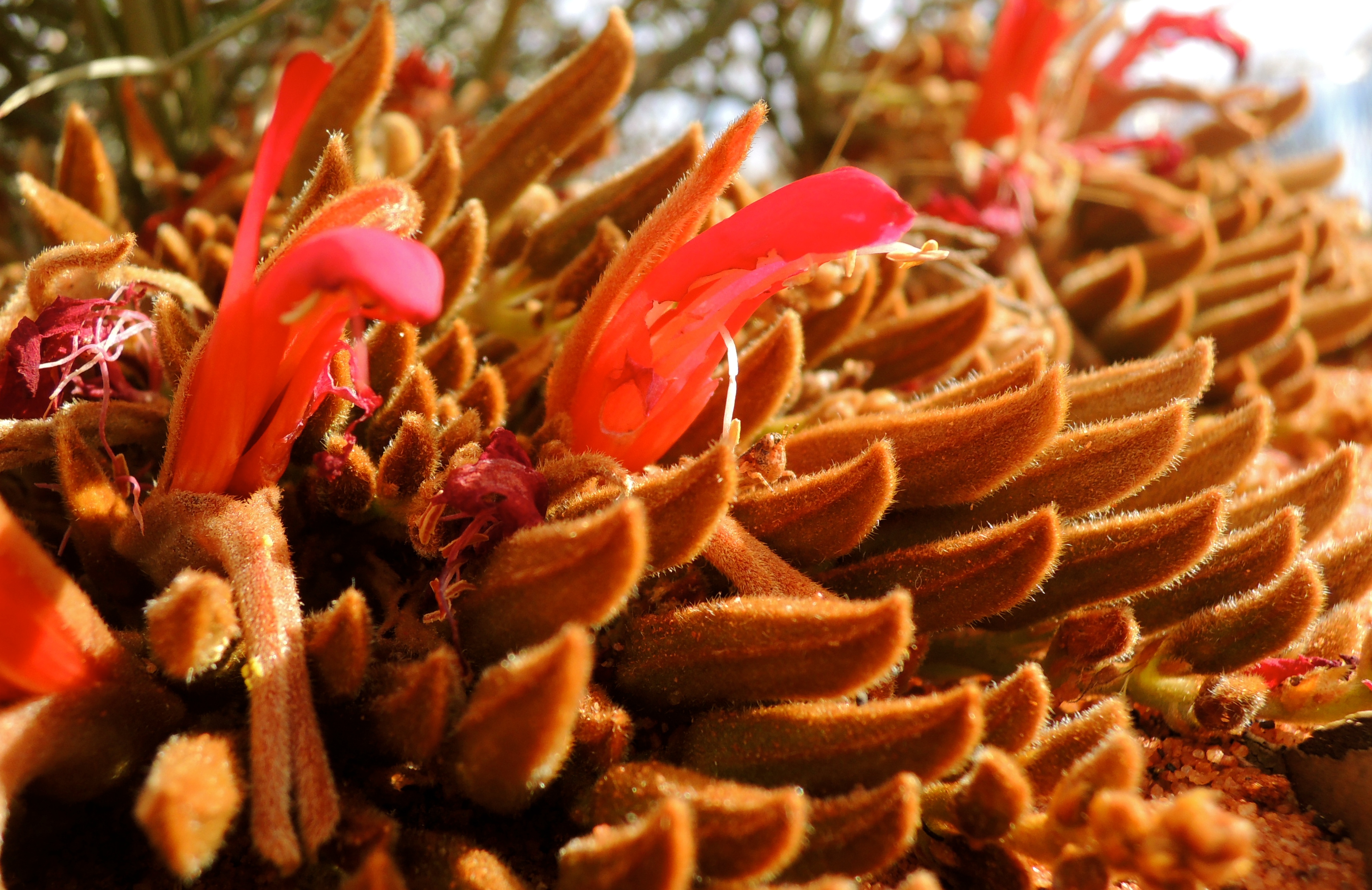
After a short drive from the highway we arrived at the Pink Lakes and Janet took the opportunity to photograph numerous plants and flowers at Lake Hardy before we moved on to Lake Crosby, a larger lake with camping sites available.
For those travelling the Mallee Highway this would be a good overnight spot to take a break, or alternatively, a good base to further explore the park over a number of days.
Murray-Sunset is a large area with a seemingly endless amount of tracks that you can explore, but for the most part, this will require a four-wheel drive vehicle due to the many sandy sections that are encountered.
And come well prepared with plenty of water and basic recovery gear as you may be on your own. We did not see anyone else in the park during our short visit.
With only a limited time to explore the park we headed north along the Underbool Track with an overnight camp at the Underbool campsite, before continuing north the following day to the intersection with the Pheeney ‘s Track and a drive towards the western boundary of the park.
There is a campsite not too far from the western border of the park on Pheeney’s Track, however we headed northwards along the North South Settlement Road and had our second night in the park at the Shearer’s Quarters campsite.
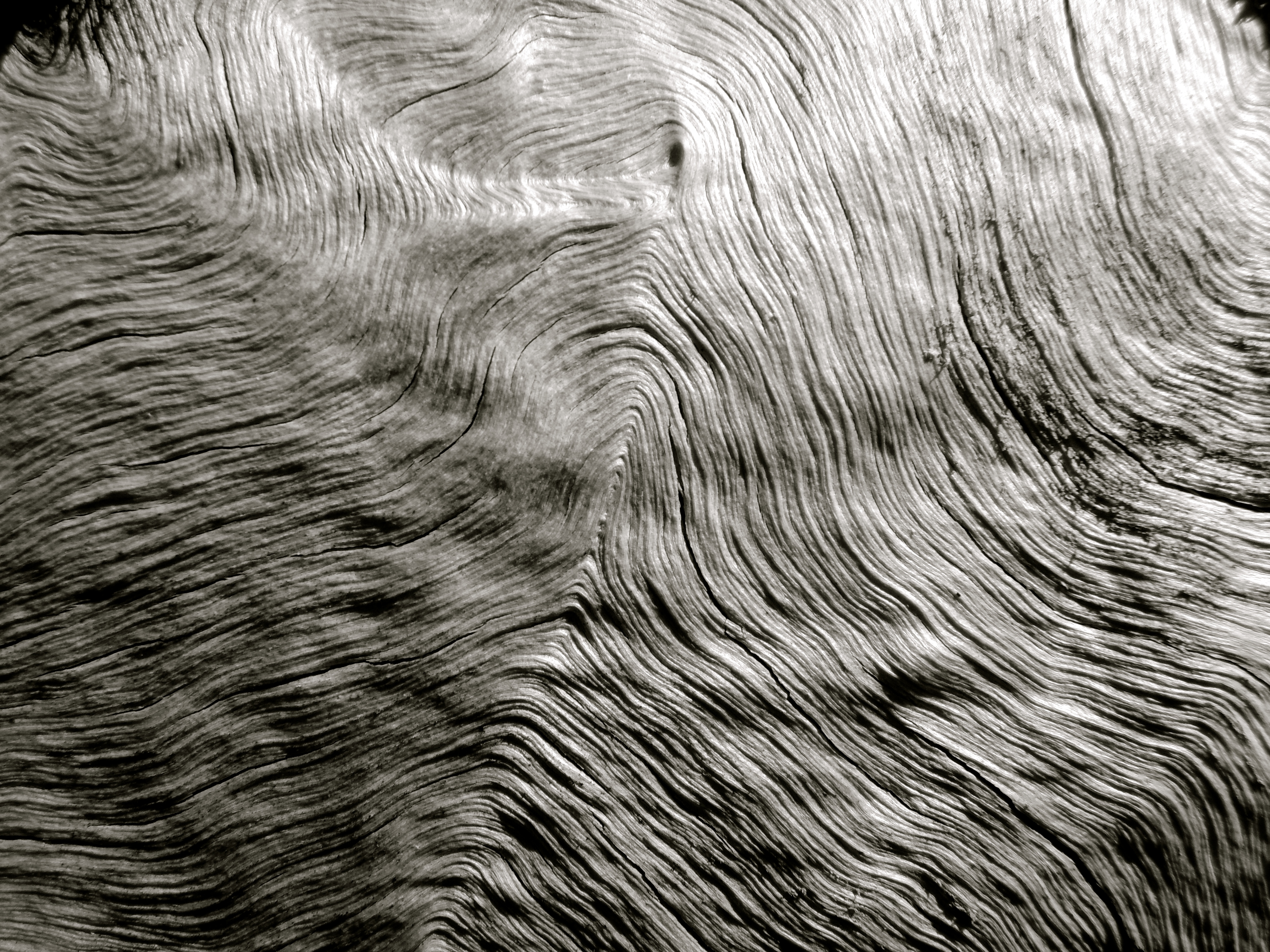
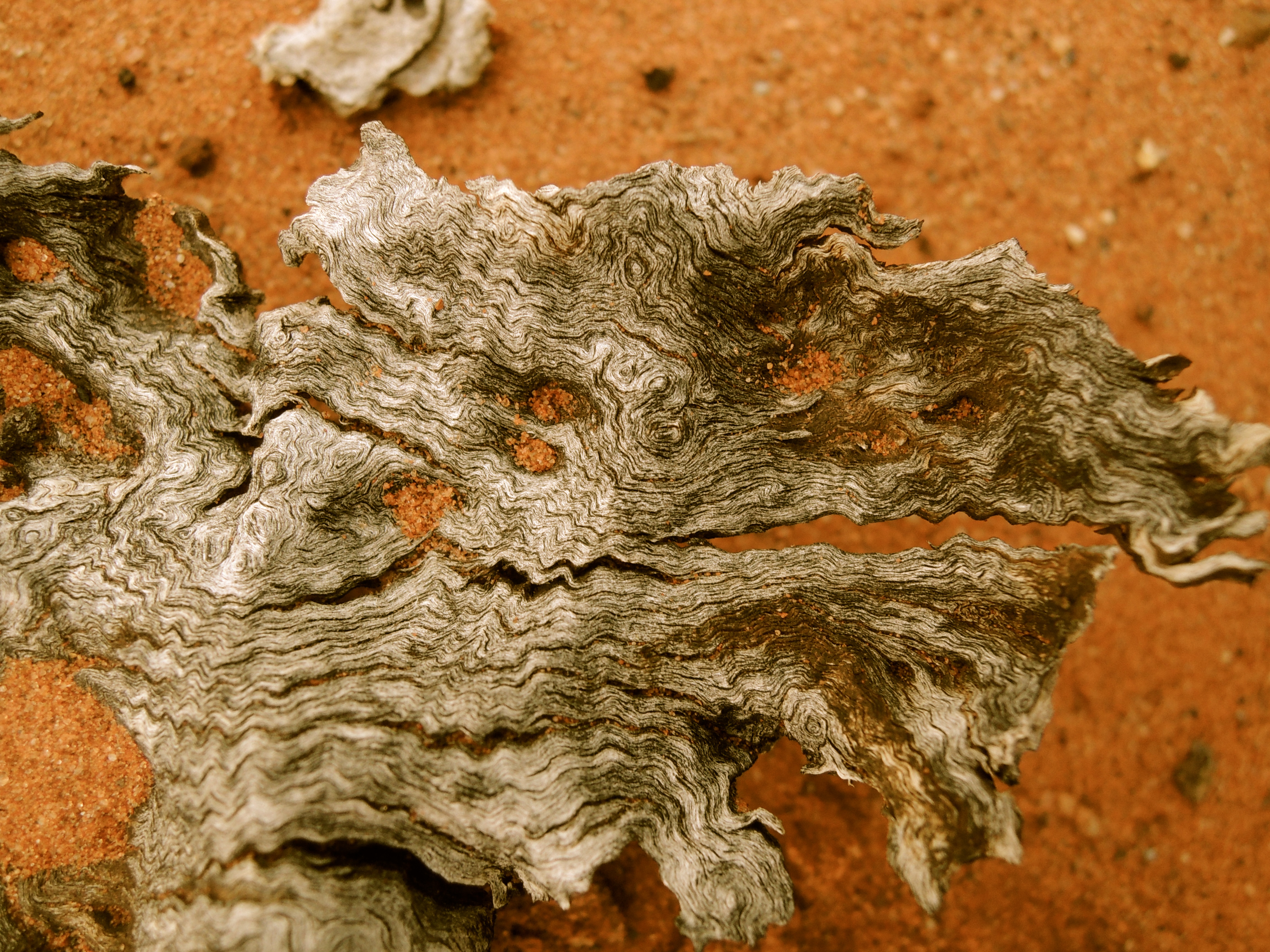
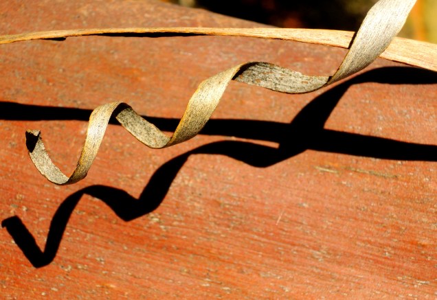
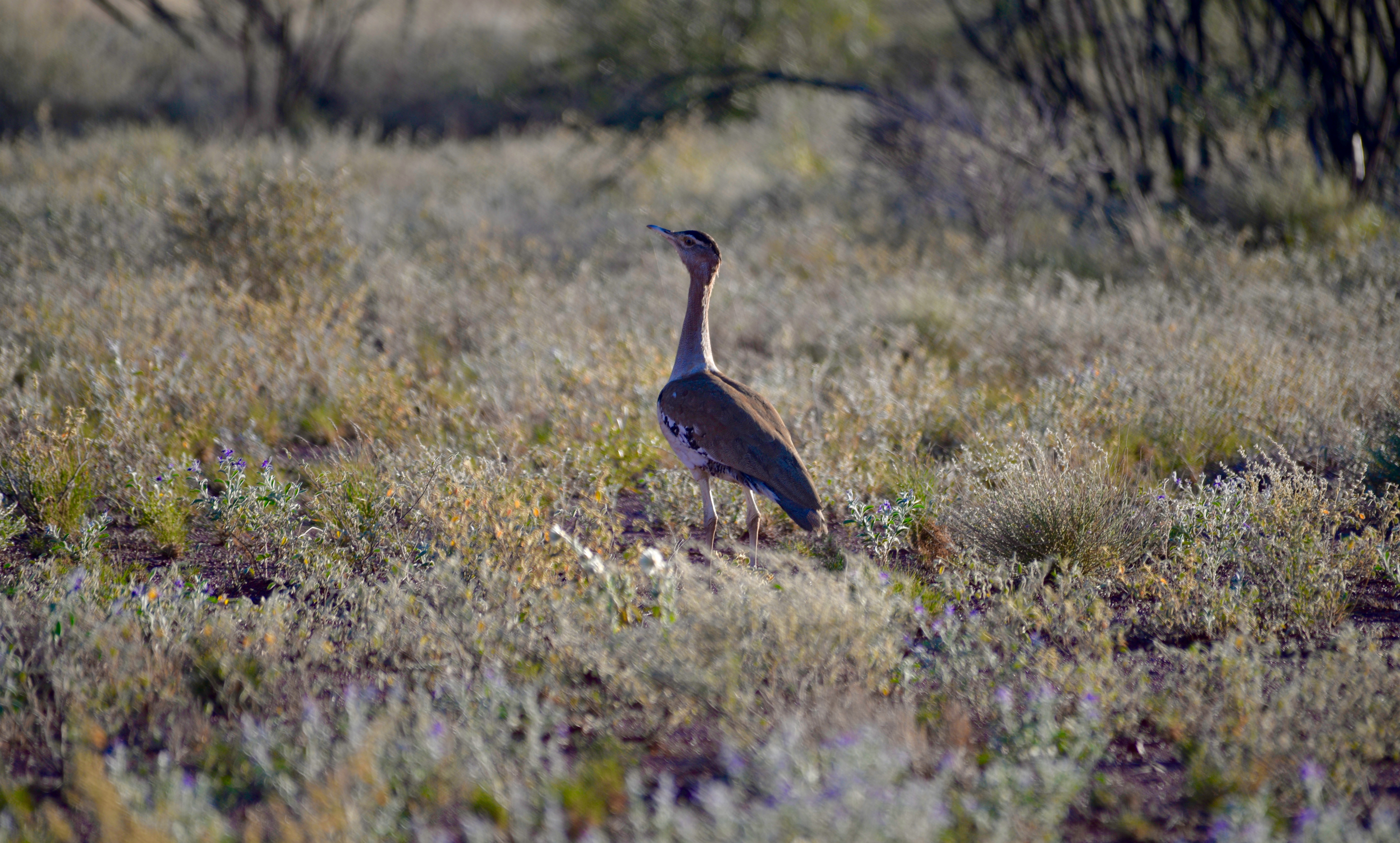
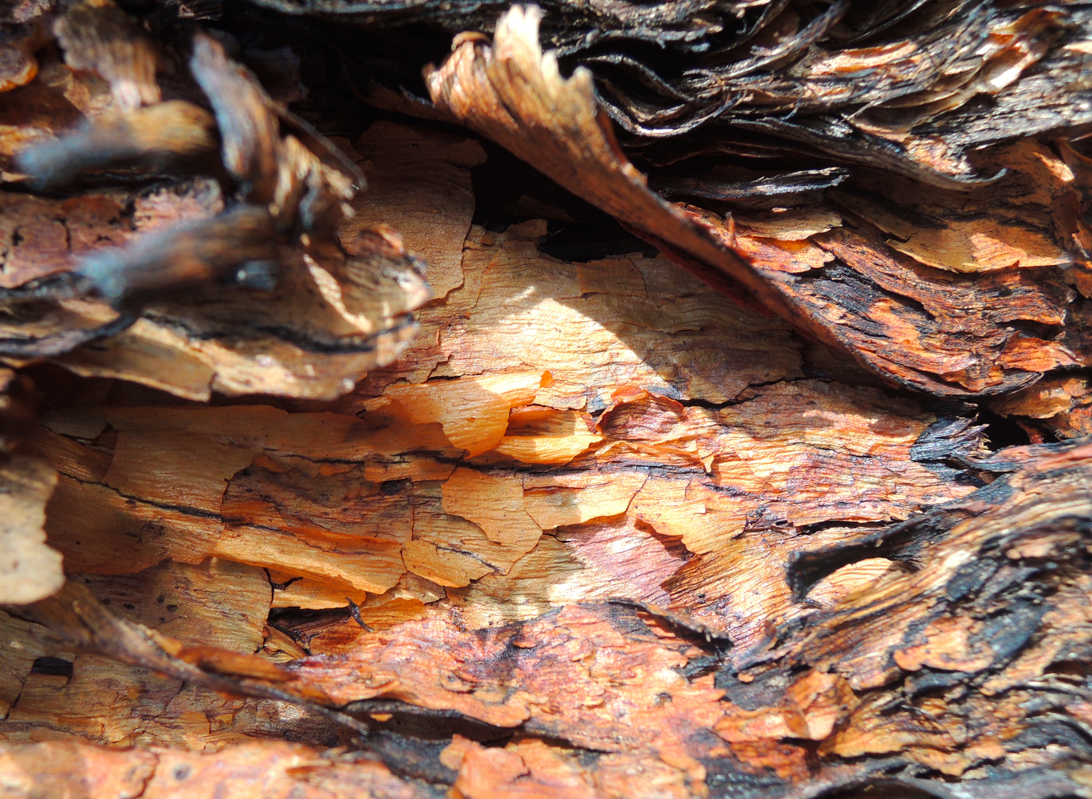
This is a campsite set amongst the trees not too far from the Shearer’s Quarters. And there is a walk that you can take through the scrub, but this is best done late in the day during the warmer months. And if you are lucky you’ll be rewarded with a glimpse of some of the wildlife and wonderful display of wildflowers. And not to forget, marvellous bark-art as we like to call the patterns found on the many types of trees one encounters when exploring…
After a pleasant overnight stay at this campsite, which we had to ourselves, we made our way out of the park at Taplan, a small town on the park’s western border, before making our way south to Cape Jervis, the stepping off point for our Kangaroo Island Adventure.
We had frequently looked at Murray-Sunset on our maps and had it penciled in our “places to see book”.
This short visit gave us a taste of what the park has to offer and provided an opportunity for us to give our new Track TVAN Firetaila test in the sand. We had no doubt it would perform as well as our older TVAN Canning that it replaced, and it did, flawlessly…
We have vowed to return in the cooler months, although we suspect that in the depths of winter Murray Sunset would be a very cold place, but with changing seasons comes new perspectives, a warm campfire and the opportunity to XPLORE…!
Photos: Baz – The Landy and Janet-Planet, Murray Sunset National Park, Australia.
The pub was in operation until the 1950s, but apart from the cellar there is little evidence of it these days. The cellar door was closed during the day, and opened at night to allow the cooler air in.


 Yerranderie has a history closely linked to the people of Burragorang Valley…
 Hey, we’re Out & About getting the smell of the Aussie Bush into our nostrils.


