Photo: Janet-Planet, in the Australian Bush

Photo: Janet-Planet, in the Australian Bush

Photo: Janet Planet – in the Australian bush!

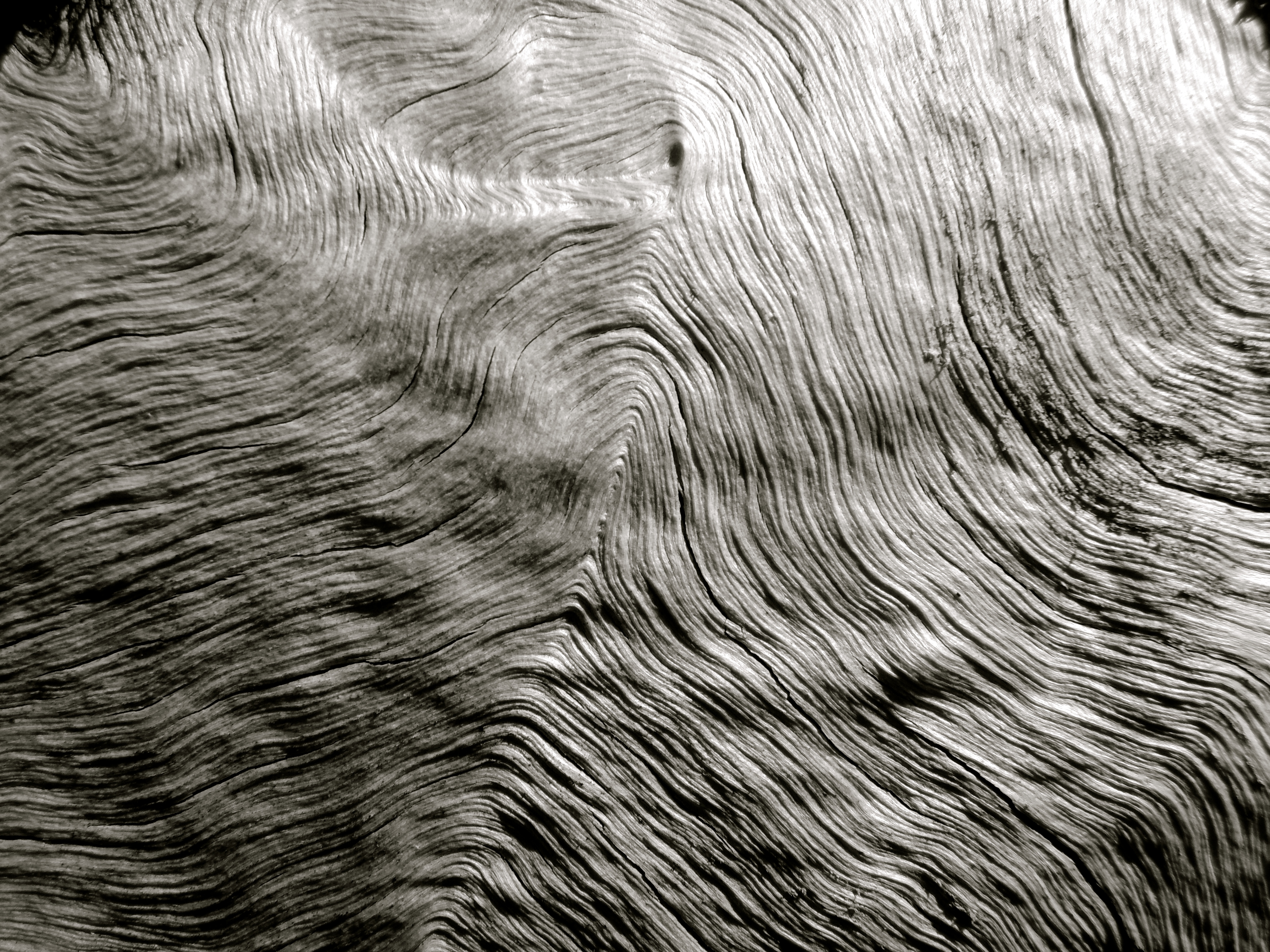
This is actually a close up of the bark on a tree!
Photo: Janet-Planet in the Australian Bush

Photo: Janet-Planet, in the Australian bush


Photo: Janet-Planet, in the Australian bush.

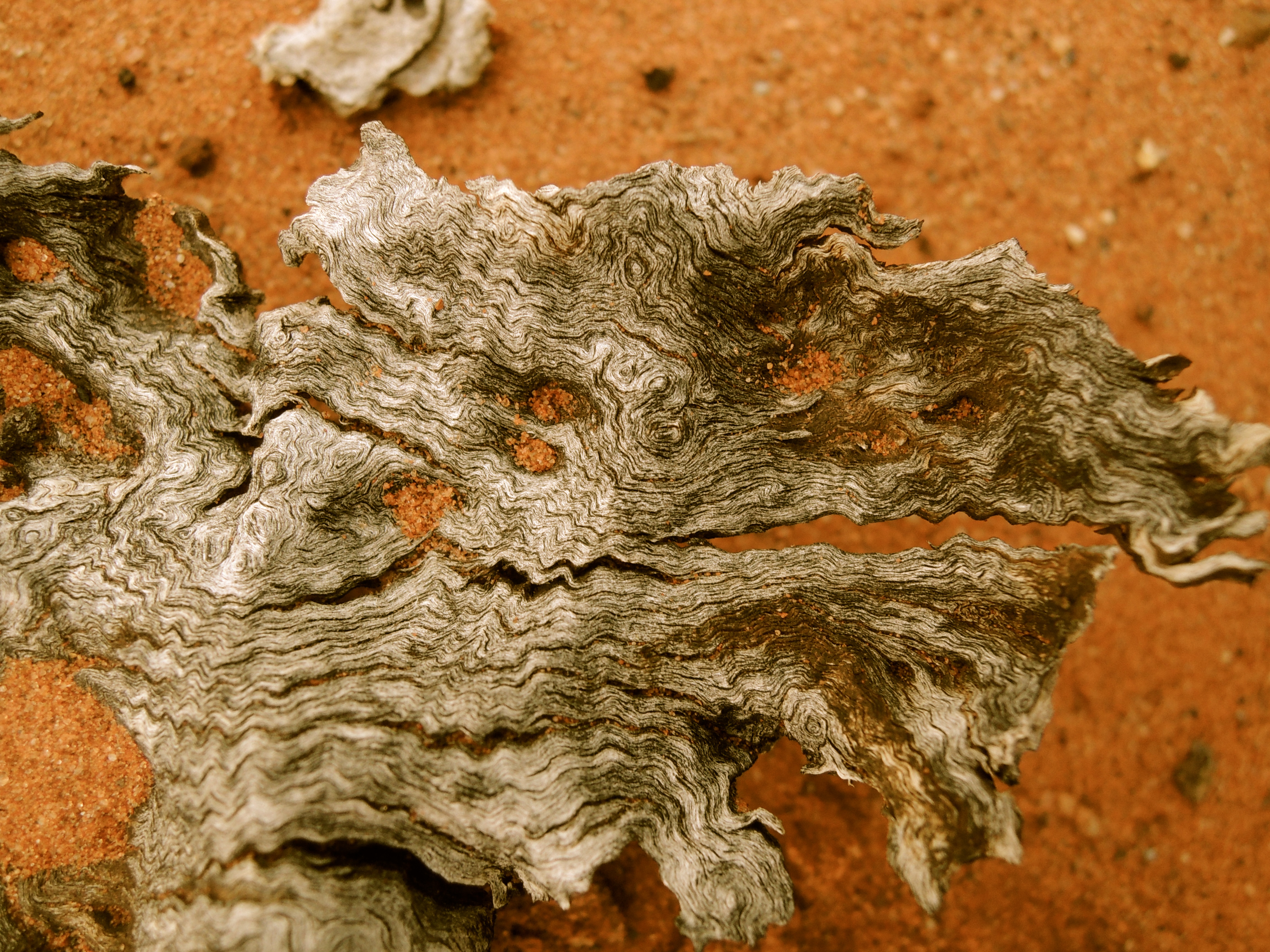
Photo: Janet-Planet, in the Australian Outback

Photo: Janet-Planet, in the Australian Outback

Photo: Baz – The Landy, in the Australian Bush…

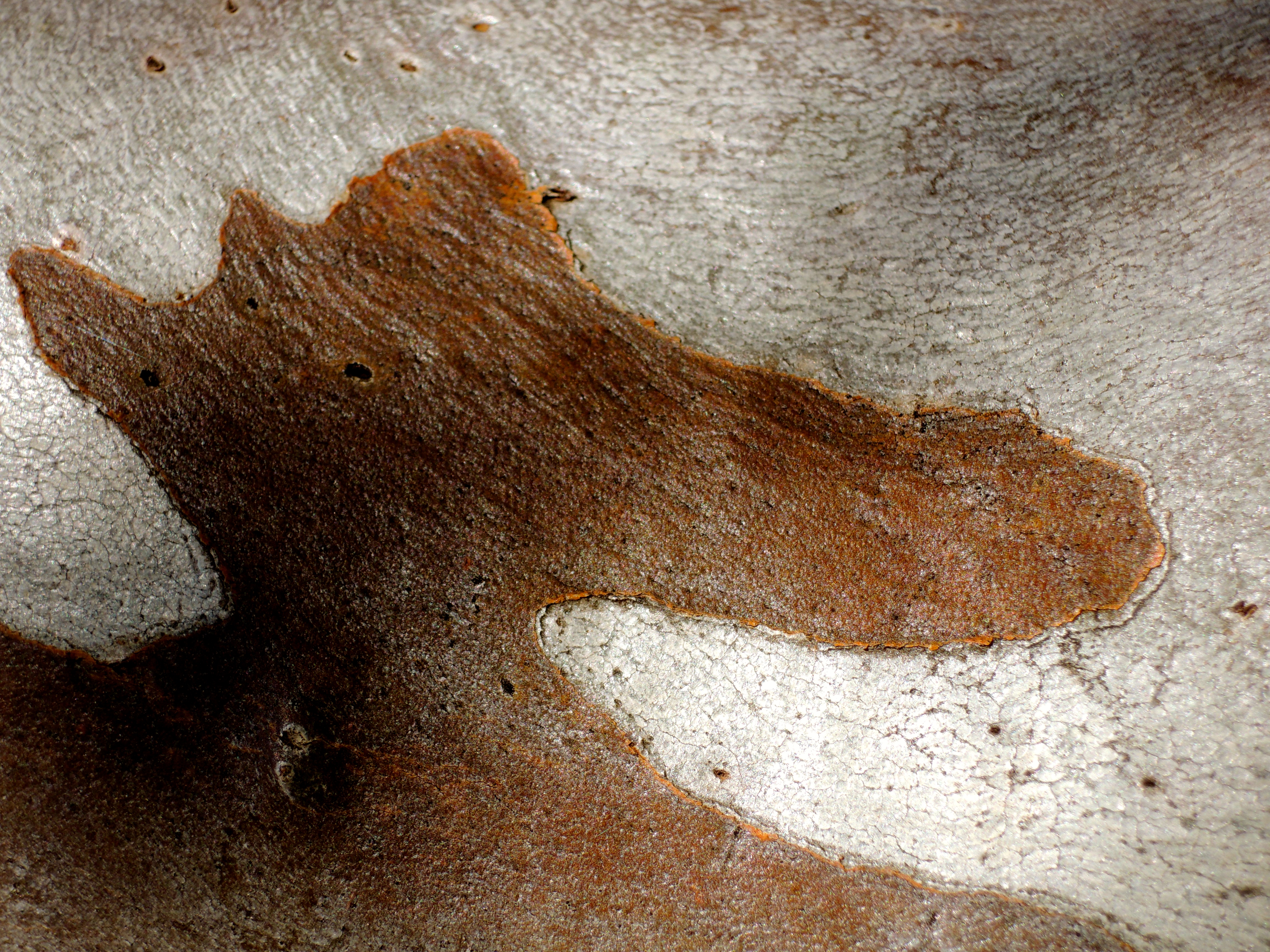
Photo: Janet-Planet, in the Australian Bush (and loving it..!)

Photo: Baz – The Landy, in the Australian Bush…(somewhere!)


Photo: Baz – The Landy, Trilby Station, Outback Australia

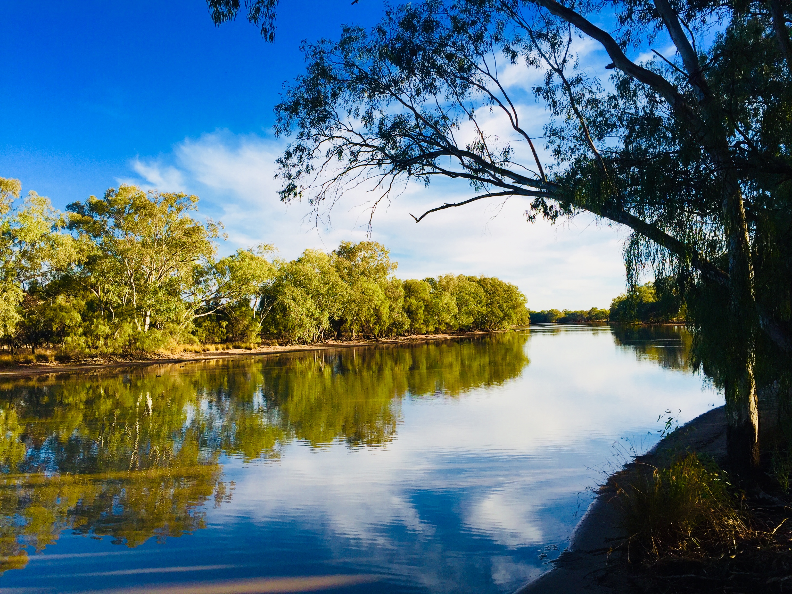
I’m camped by a favourite waterhole of ours along the Bogan River as I head towards Milparinka which is situated in the Corner Country in the far northwest of New South Wales…
Hey. three weeks in the outback, where a deep blue sky gently blends to the red earth on a faraway horizon, and the night sky is laden with stars – how good is that, hey…!
Photo: Baz – The Landy, on the Bogan River


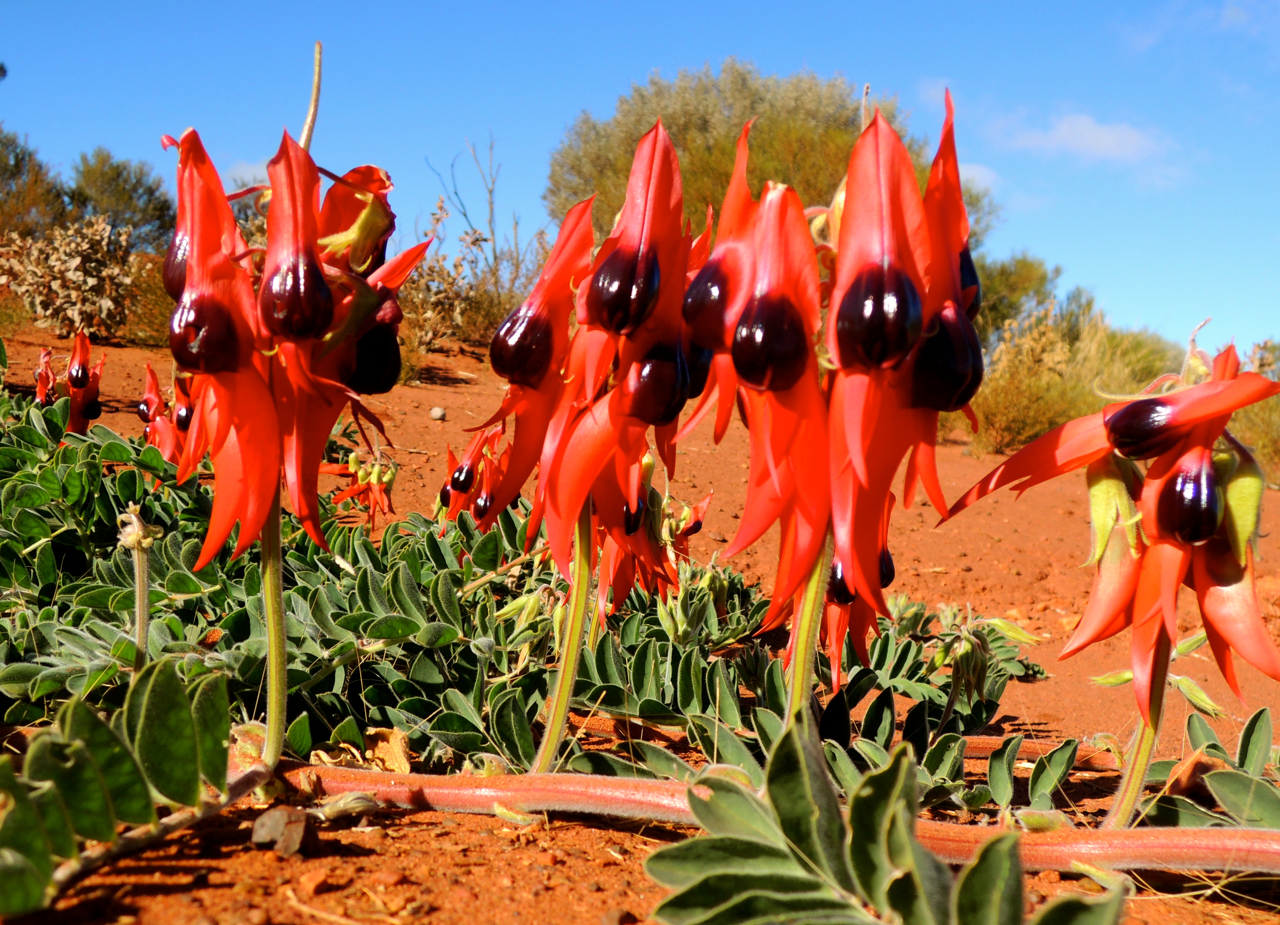
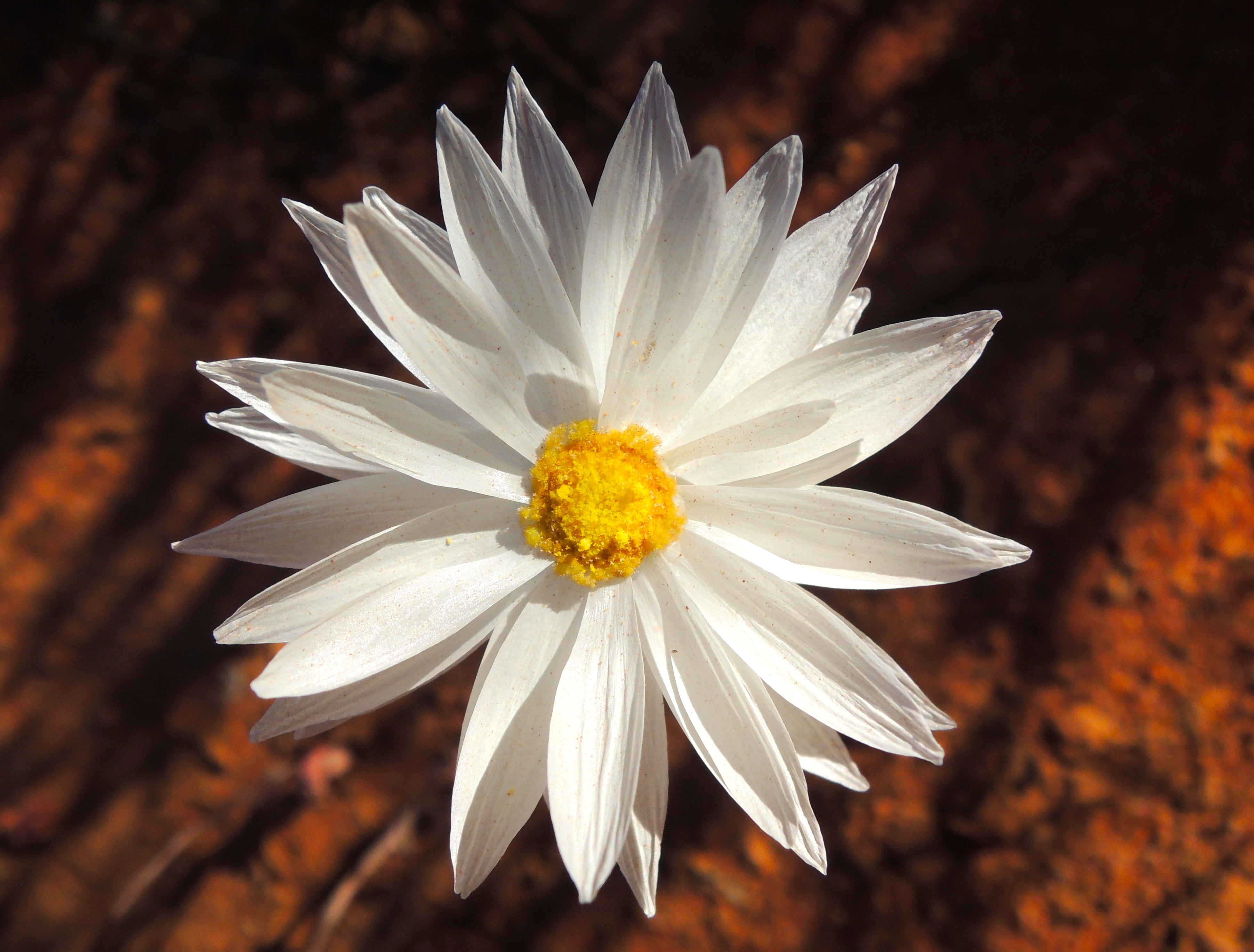
The Sturt Desert Pea, almost alien looking…!
Photo: Janet-Planet, Outback Australia

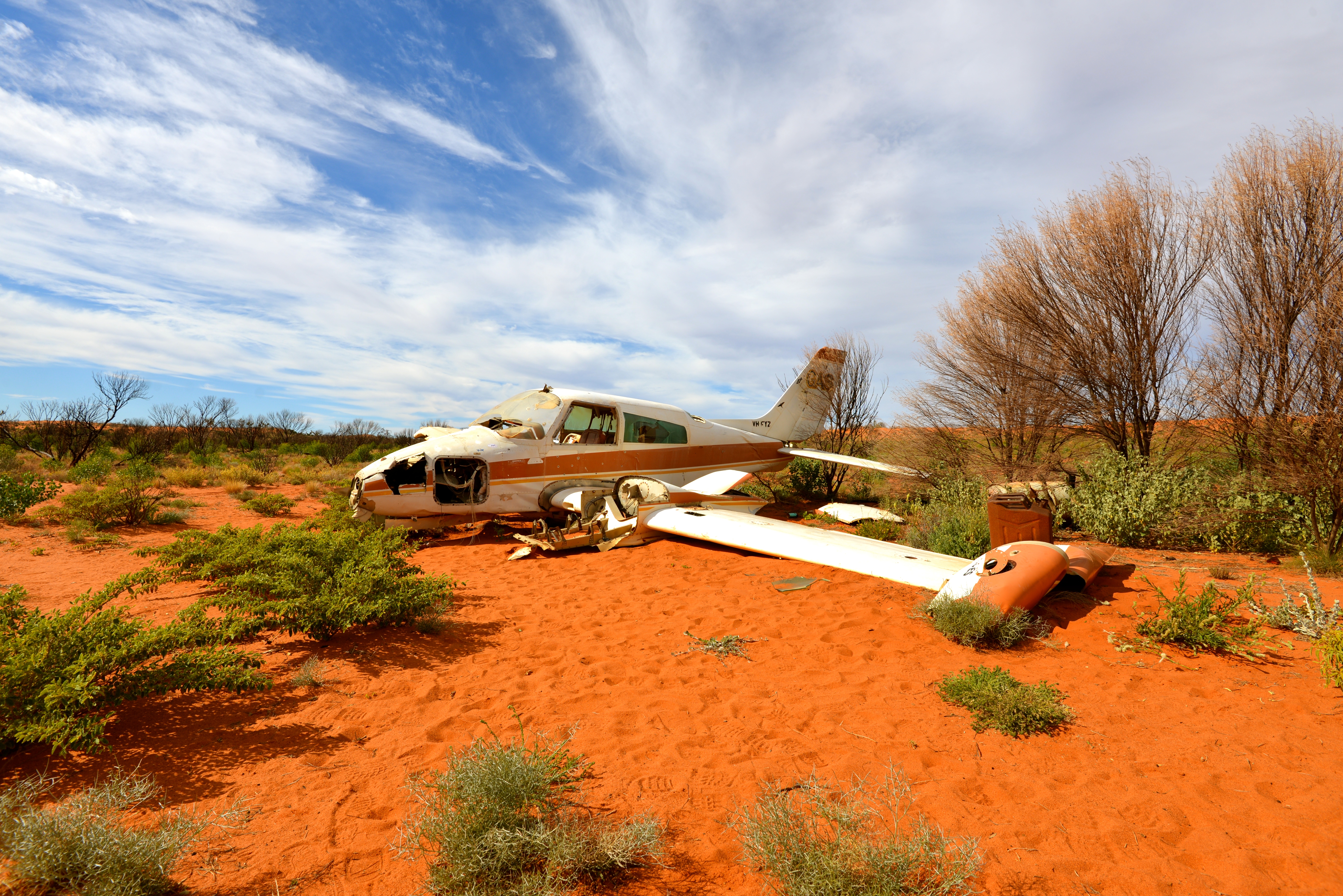
Photo: Baz – The Landy, Great Victoria Desert

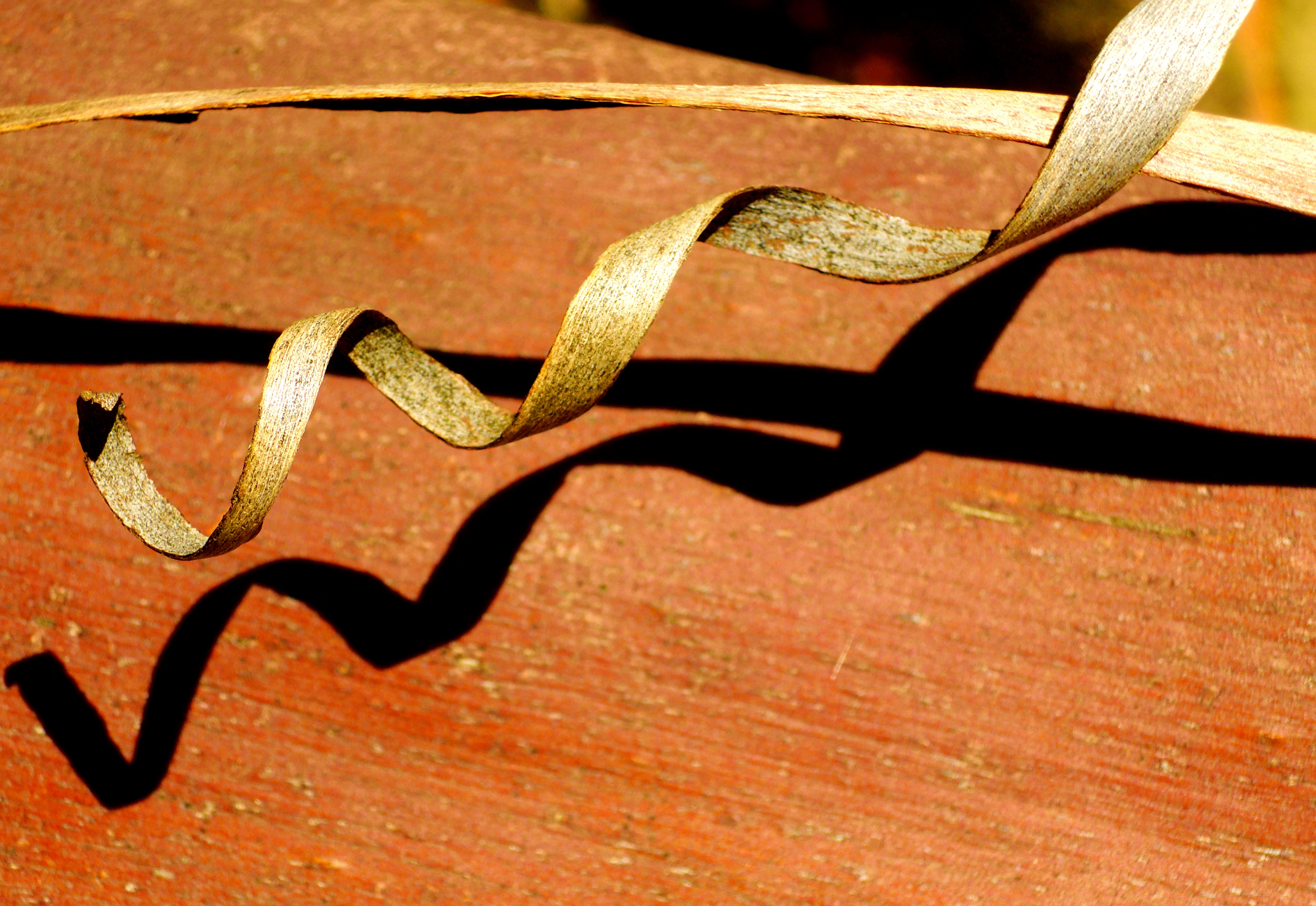
Photo: Janet-Planet, Outback Australia


Photo’s: Baz – The Landy, in the Australian Bush…


In late May I will be acting caretaker at the Milparinka historical precinct and museum.
Milparinka is a tiny community located in far north-western New South Wales, about 40-kilometres south of Tibooburra and 300-kilometres north of Broken Hill. It is the oldest proclaimed township in the Corner Country, and is situated on the banks of the Evelyn Creek, named by Charles Sturt during his 1845 Inland Expedition.
Hey, be sure to drop into the museum and say g’day, if you’re out that way…!
Oh, don’t worry, if you can’t make it I’ll be sure to be capturing some of our spectacular outback in photo’s…
Photos: Baz – The Landy, Corner Country, Outback Australia…


Photo: Baz – The Landy, Plenty Highway, Central Australia…


Photo’s: Baz – The Landy, Outback Australia


Photo: Baz – The Landy, the Peake Overland Telegraph Station, Oodnadatta Track, Outback Australia…


Photo: Baz – The Landy, Canning Stock Route, Outback Australia


Photo: Baz – The Landy, Point Hicks, Southern Australia…


Photo: Baz – The Landy, Outback Australia


Photo: Baz – The Landy, Gibson Desert, Outback Australia


Photo: Baz – The Landy, Outback Australia…


Photo’s: Baz – The Landy, Glasshouse Mountains, Australia


Photo’s: Baz – The Landy, Moreton Island, East Coast Australia…

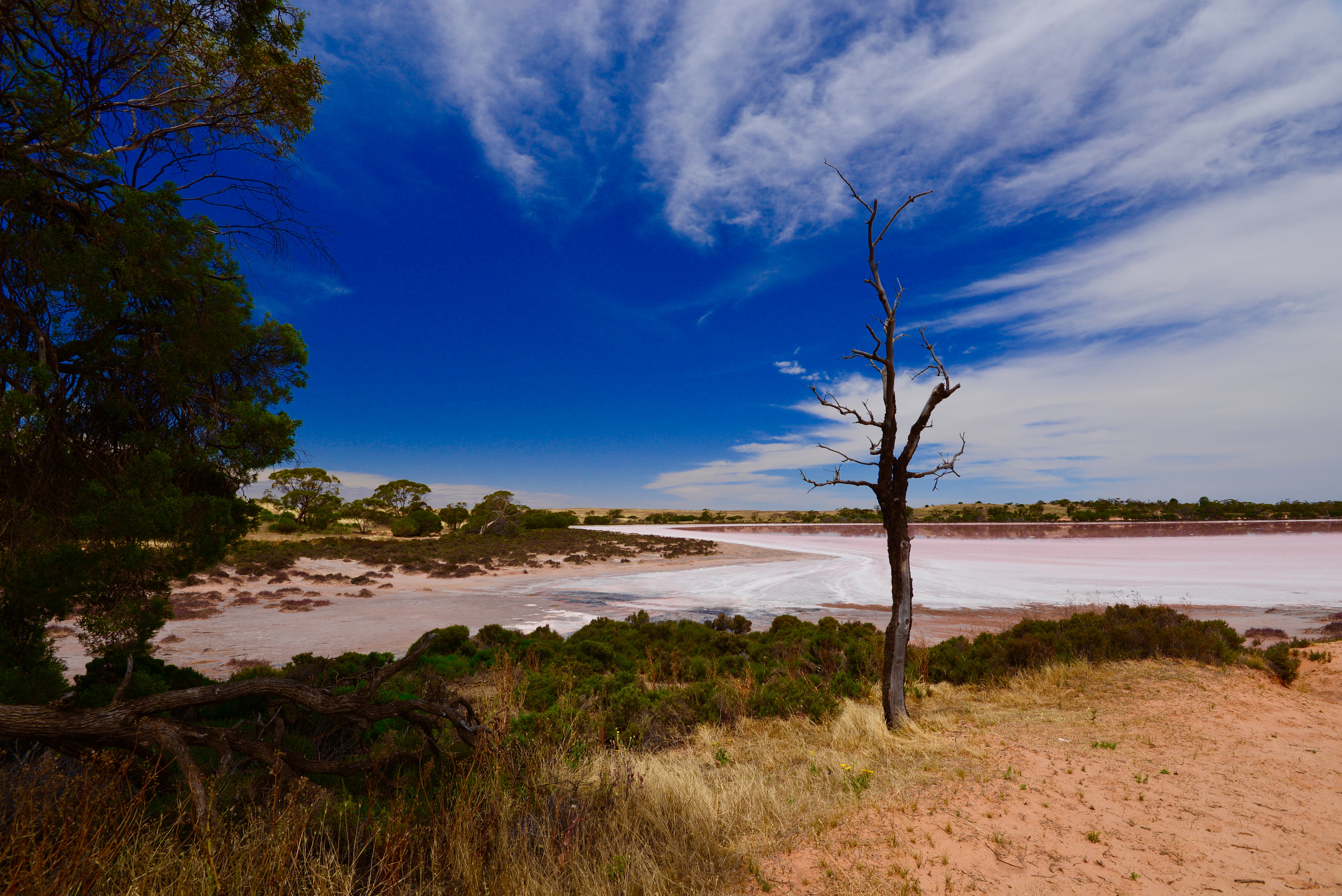
Photo: Baz – The Landy, Murray Sunset National Park, Australia…


Photo: Baz – The Landy, Gumhole Water Hole, Outback Australia


Photo: Baz – The Landy, Shallow Inlet, Wilson’s Promontory.


Photo: Baz, Wilson’s Promontory, Southern Australia…

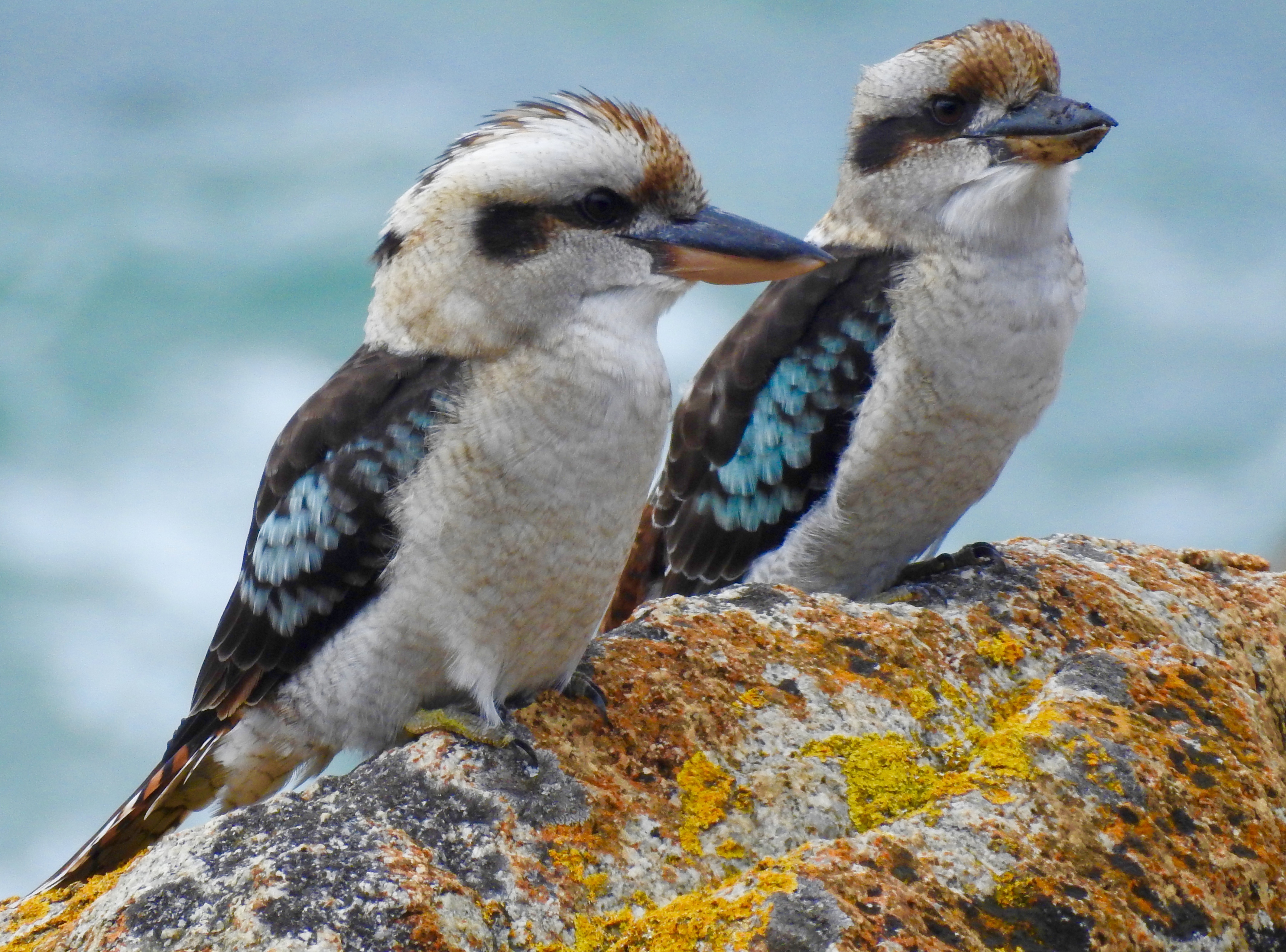
Photo: Baz – The Landy, Croajingolong National Park, Southern Australia


Photo’s: Baz – The Landy, Phillip Island, Southern Australia


I never tire of watching, observing, and photographing them…
Photograph: Baz – The Landy, Outback Australia

But don’t be put off by that fact, this is a fabulous place to spend a few days exploring what is a very special place to three Aboriginal tribal groups, the Paakantji / Barkindji, Ngyiampaa and Mutthi people.
These people have walked this land for close to 50,000 years.
Yes, 50,000 years…!
To put some context to that, they only started building the pyramids about 5,000 years ago, and Christian’s celebrated the arrival of Jesus Christ just over 2,000 years ago.
And in more contemporary history of Australia, Captain Cook landed at Botany Bay less than 250 years ago.
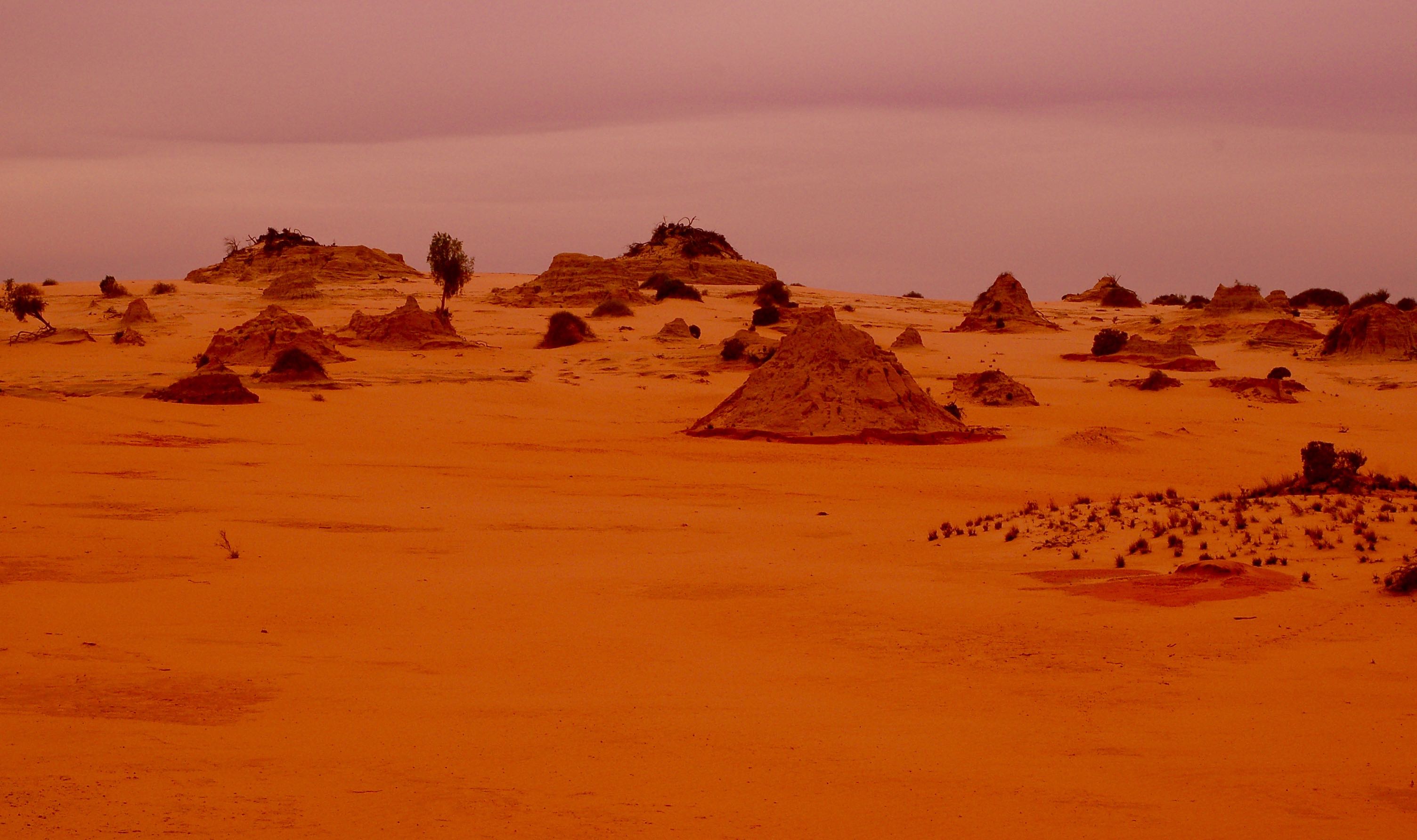
Life would have been substantially different when the waters were teaming with fish and the land abundant with food sources. And remarkably, evidence of this era has been enshrined in the “Mungo Lunette” and uncovered by the moving sand dunes in this windswept land.
A Lunette is a crescent-shaped sand dune similar in outline to the first quarter of the Moon. The Mungo Lunette is also known as the “Walls of China”.

I visited the region recently with the hope of photographing the “Super Red Blue Moon” that rose in the skies on 31 January, the prospect of capturing a photograph of a remarkable event over the Walls of China proving irresistible to me.
The Walls of China is where the remains of “Mungo Lady” an aboriginal women of some 18 years of age was discovered in the late 1960s. Her discovery and subsequent removal from her “spiritual home” by archaeologists’ was not without controversy, especially for the aboriginal people from this region.


Mungo Woman was eventually returned home to rest in country by her people and similarly, Mungo Man, whose remains were removed from his resting place has also made the journey home to country.
Scientists’ estimated that Mungo Man walked this land over 40,000 years ago.
It was against this cultural backdrop that I stood alone at the Mungo Lunette, a number of camera’s at hand to capture this remarkable lunar event.
But it wasn’t too be as cloud cover “eclipsed” my view of the moon as it rose over this ancient land.

Looking to the west, the sky was ablaze as a fiery sun cast its final rays into a darkening night sky…
I closed my eyes and let my mind drift and wondered if the spirits of those who had walked this land were sitting around the glow of this eternal fire, breathing life to this place of Haunting Beauty…
Photo’s: Baz – The Landy, Mungo National Park, Outback Australia


But hey, with time on my side what better way to wile away that time than being camped beside the mighty Murrumbidgee River at Gundagai reading poems and short stories by one of Australia’s greatest story tellers, Henry Lawson.
And of course, apart from the river the town is famous for the “Dog on the Tucker Box”…
Photos: Baz – The Landy, Gundagai…

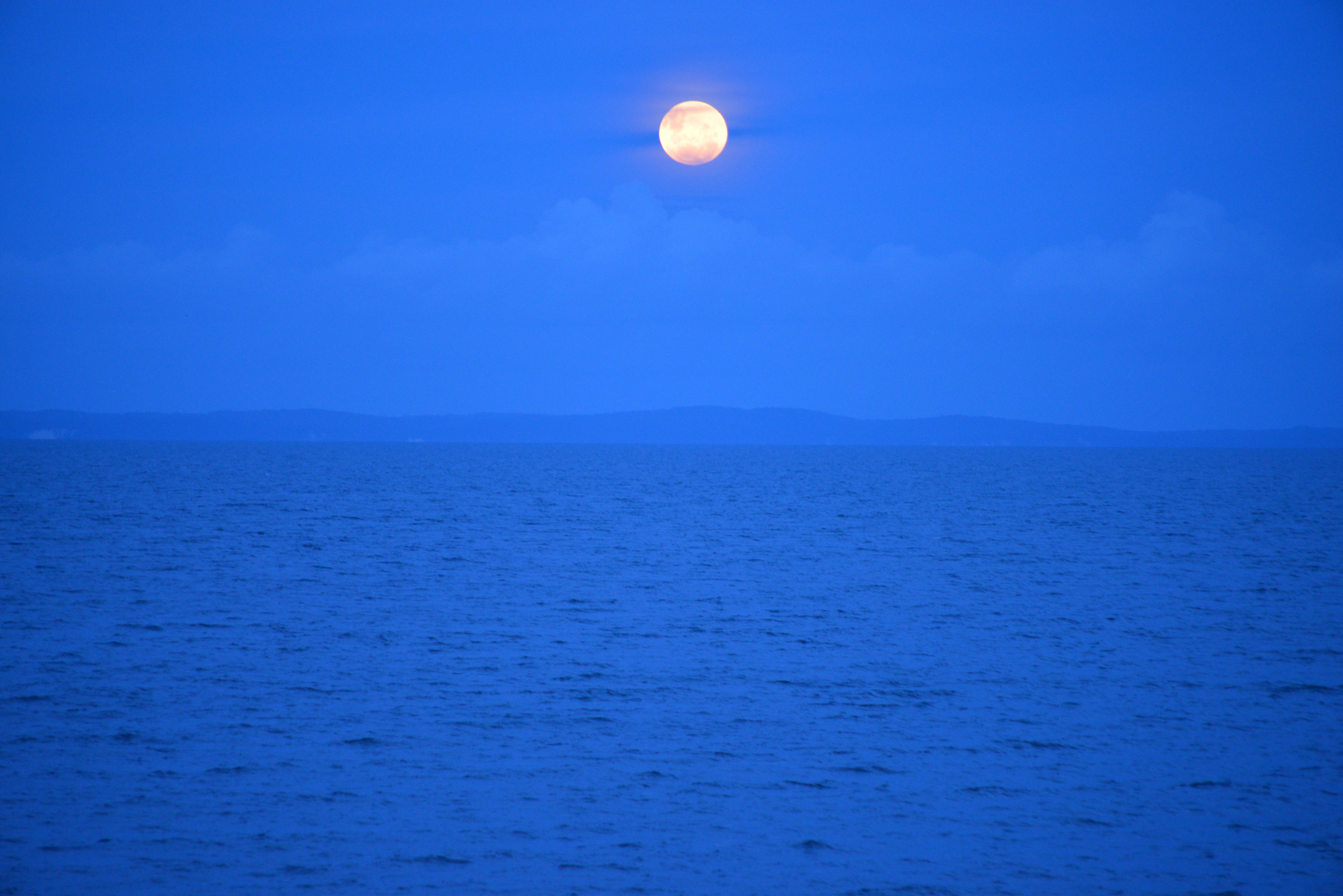
Apparently, a super moon occurs when the moon reaches its closest point to earth and appears much larger than normal (some 30% they say). The red part happens during a lunar eclipse, and the blue moon is when there are two full moons in a month.
Some experts suggest that it is unlikely to see all three events converge again this century, although I have seen conflicting reports on this with suggestions there will be another one in 2028 – but given it last occurred in 1866 I’ll try and observe this one and leave it to the experts to argue over the timing of the next one.
I was pondering where to view it from away from the glare of city lights and decided on heading to the World Heritage listed Mungo National Park, south east of Broken Hill.
It has been at least two decades since I last visited the area so I am looking forward to it, although with daytime temperatures getting up to around the 45C mark I doubt I will linger there for too long afterwards. But it is a spectacular area, so I’ll play that one by ear and see how the weather is…
The phenomena is due to start on 31 January around 10:30pm (AEDT) and end just after 2:00AM (AEDT) on 1 February…
Photo: Baz – The Landy, Moreton Bay, Queensland


Australian aboriginal people moved from water-hole to water-hole to survive in the harsh desert country relying on “dream-time stories” to guide them…
Stories told in song, carvings and engravings, and rock art.
For our early European explorers’ finding water was critical as they surveyed our vast sunburnt country. At times, it was a critical life and death situation and there are many tributes to these explorers’ dotted across Australia.
Two explorers, John and Alexander Forrest, both surveyors, travelled into the vast Western Australian desert region in 1874. One can only imagine what was in their thoughts as they stood atop Mt Allott looking back across the vast plains to Mt Worsnop in the distance…
Perhaps it was the need to find a water supply before thirst from the relentless heat of the desert claimed them.
Standing on Mt Allott I reflected on how you can only live in the moment you are in; the past is irrelevant and the future may never arrive – you can only survive one moment at a time…!
That’s a great way to live your life, one moment at a time. Hey, what do you reckon?
Photos: Baz, Outback Australia (somewhere…!)


Yes, it seems I’m a couple of weeks late, but hey, I’m working on leisure time these days…
Janet and I are gearing up for plenty of adventure travel into the Australian Bush and Outback this year and we’ve dusted the cameras’ off to photograph our magnificent country.
Photo’s: Baz – The Landy, Outback Australia.


Photo’s: Baz, Kangaroo Island, Southern Australia.


Photos: Baz – The Landy, Outback Australia


Janet and I think of this area as our ‘backyard’ and over many years we have walked and kayaked through this area, which is little more than 20-kilometres north of the Sydney CBD. And yet, this was a first time spotting for us of the powerful owl, which is Australia’s largest, in this location.
Although, it is a familiar bird for us as we have visitations from one into the local park opposite our home. In fact, I heard our resident owl calling just a few nights ago…
Following my sighting of the bird last week I made contact with Beth Mott, Project Officer for the Powerful Owl Project with Birdlife Australia who was excited to review the area and to glean if there is a pair that might be raising a young chick.
So today, Janet, myself and Beth set off along the track to see if we could find any further signs of inhabitation.
Janet and I were on a steep learning curve when it came to bird observation, but Beth, who holds a Degree in Conservation Biology, and who has undertaken a PhD study on ‘Animal Community Dynamics’, enthusiastically showed us many of the ‘telltale’ signs to look for.
Um, that includes bird vomit and droppings, you know, poo!
Beth’s enthusiasm was infectious and on our walk she went on to explain…
“We aim to locate Powerful Owl breeding pairs within urban Greater Sydney, which also includes Newcastle in the north to Kiama in the south and west to the Blue Mountains.
We also aim to identify the location of nesting trees and record breeding behaviour and success.
This information will help determine the critical roosting and breeding requirements of urban Powerful Owls. We are collecting data on diet and foraging habitat to gain a greater understanding of their urban ecology, as well as look at threats (causes of injury and mortality) within the urban landscape.”
We were surprised to learn that there is estimated to be only around 400 Powerful Owls in the Greater Sydney Region and around 5,000 in Australia, and that puts them only one notch above being an “endangered species”.
Powerful Owls have a slow; double-note ‘whoo-hoo’ call that is soft, but very strong and resonant, and which can be heard more than 1-kilometre away. And the most common time to hear them is when they “wake” to a new day, at least for them, around dusk…
So if you hear that sound, take the time to look around your ‘backyard’ you might just find a special visitor, and if you do observe one, be sure to let the good people at Birdlife Australia know…
Photos: Baz – The Landy, Ku-ring-gai Chase National Park, Bobbin Head.


Recently, I was contacted by a researcher from Germany who is doing a thesis on a bird that I grew up with in Northern Australia and one that will be familiar too many, the Zebra Finch, and they were keen to use this photograph in their paper.
It is a favourite photograph of mine that showcases this wonderful bird in all its splendour…!
Photo: Baz – The Landy, Outback Australia
ps: I had about one-second to get this shot away before they flittered away – the wonders of continuous shooting…!


Photo: Baz – The Landy, Blencoe Falls, Australia…

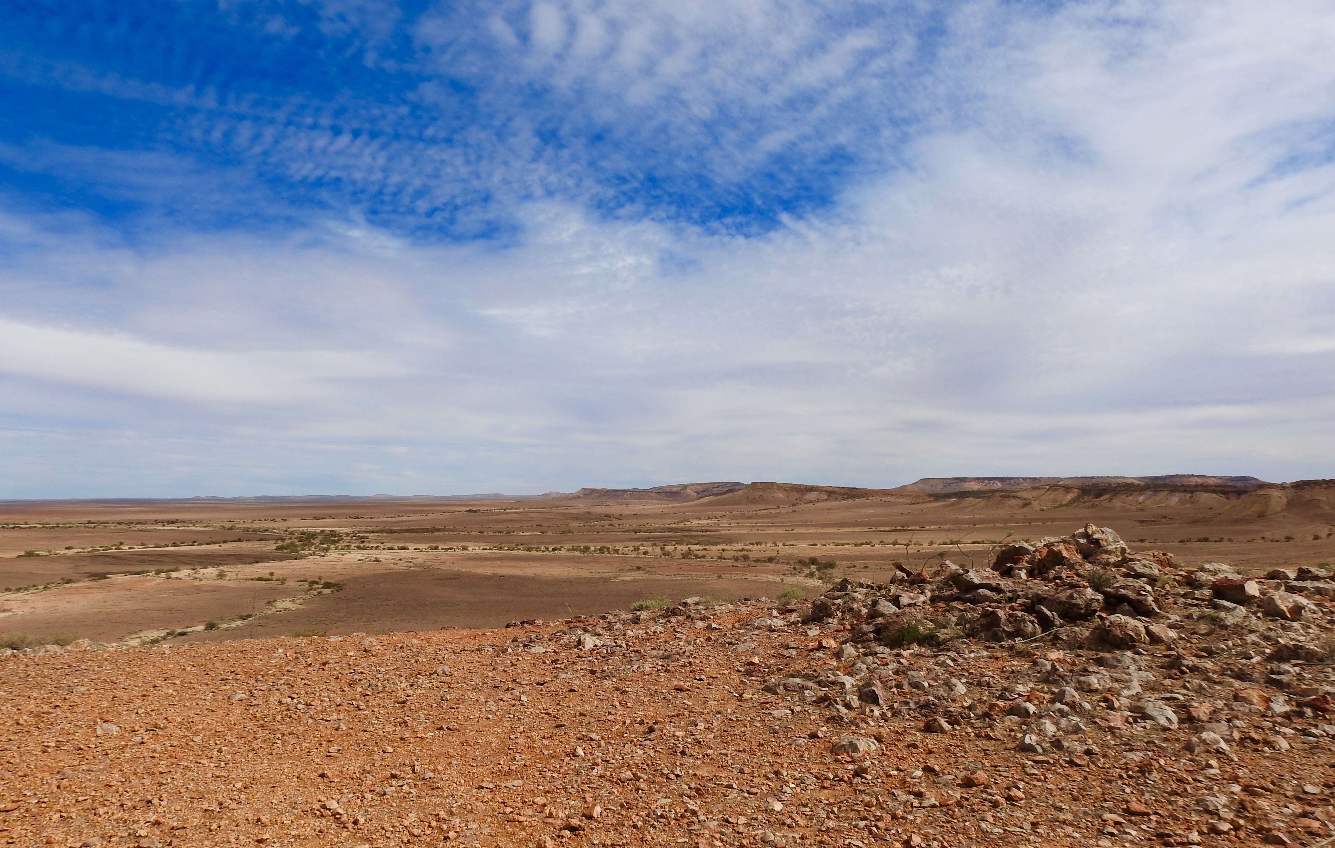
Photo: Baz – The Landy, “Jump up Country” North-West New South Wales, Australia


The attraction is the permanent water source of Lawn Hill Creek. During arid times, when other sites where abandoned, this area was like an oasis in the desert for aboriginal people, Australia’s first people, who gathered here to camp, fish, and hunt.
Janet, TomO, and I have explored this region previously, but it has drawn us back like a magnet on many occasions, and being in North Queensland I could not resist the lure of another visit, to walk through the country and swim in Lawn Hill Creek.
In the Dreamtime stories of the Waanyi people, “Boodjamulla” is a spiritual person, the creator of all animals.
In the words of the Waanyi people…
“He made all the animals in the Lawn Hill area, and all the billabongs such as the green swamp, and all the bush tucker. Boodjamulla’s dreamtime travels started in Waanyi country at Cabbage Tree Spring, up above Riversleigh, giving water to O’Shanassy Creek, Lawn Hill Creek, the Gregory River, Louie Creek and Lilydale Springs.
Waanyi believe that Boodjamulla created these rivers as healing waters – known in Waanyi language as Bougli Water”…
Perhaps for the Waanyi people, the “Bougli Waters” has a different interpretation, but I certainly found the cool spring fed water of Lawn Hill Creek soothing after a day of walking in the gorges and climbing the Constance Range.


As a base for this trip I stayed just outside of the national park at Adels Grove, a private campground that we first visited in the early 1990s. Not much has changed over the years, and that is a good thing.
Adels Grove was declared a ’Miner’s Homestead Perpetual Lease’ in 1920, being within the Burketown Mineral Field at that time.
According to the history provided by the current owners, Adels Grove lease was purchased by Albert De Lestang, a French botanist, who experimented with the growing of tropical trees and fruits and had in excess of 1,000 trees and sold the fruit to supplement his income.

Tragically, in the early 1950s the ‘Grove’ and buildings were accidently burnt down. By this time Albert was in his seventies and after loosing everything, including all of his written records, he succumbed to depression and died age 75 at Charters Towers in 1959.
‘The Grove’ has certainly provided shade and comfort from the heat of the winter sun during my stay, with temperatures reaching up to 36 degrees throughout the day and around 15 degrees at night…
Apart from the rugged and rocky outcrops surrounding the gorge, the country has a prolific amount of wildlife. This includes the Johnstone’s crocodile or Freshie as it is usually known, turtles, the olive python, a large variety of birds, and a favourite of ours, the Gilbert Dragon, or Ta-Ta lizard due to the peculiar little wave it gives with its front legs before scampering away.


I managed to photograph some of the wildlife on my walks and at other times, simply sat back and enjoyed the calls of the birds flittering through the trees, and of the birds of prey soaring overhead.
And yes, I did swim with the Freshwater Crocs. Unlike their Saltwater cousins, the Freshie’s are generally timid and will leave you alone, if you stay out of their way…!
Boodjamulla National Park, truly an Oasis in the Desert in Australia’s Gulf Savannah.
Photos: Baz – The Landy, in the Gulf Savannah, Northern Australia…


Baz – The Landy, Leichhardt Lagoon, Gulf Country, Australia…


Photo’s: Baz – The Landy, Gulf Country, Northern Australia


And hey, take my word for it…!
I worked in Malanda in the late 1970s and lived in this very pub.
Today, I had my first meal in the Malanda Hotel in almost 40-years and I am pleased it is still owned by the same people, the English family, and it is as grand as I always remember it. And how good is that silky-oak timber.
Um, yeah, a touch of reminiscing going on here…!
But hey, the past is what makes up the mosaic of whom we are today, right…!
Cheers, Baz – The Landy, in Far North Queensland…

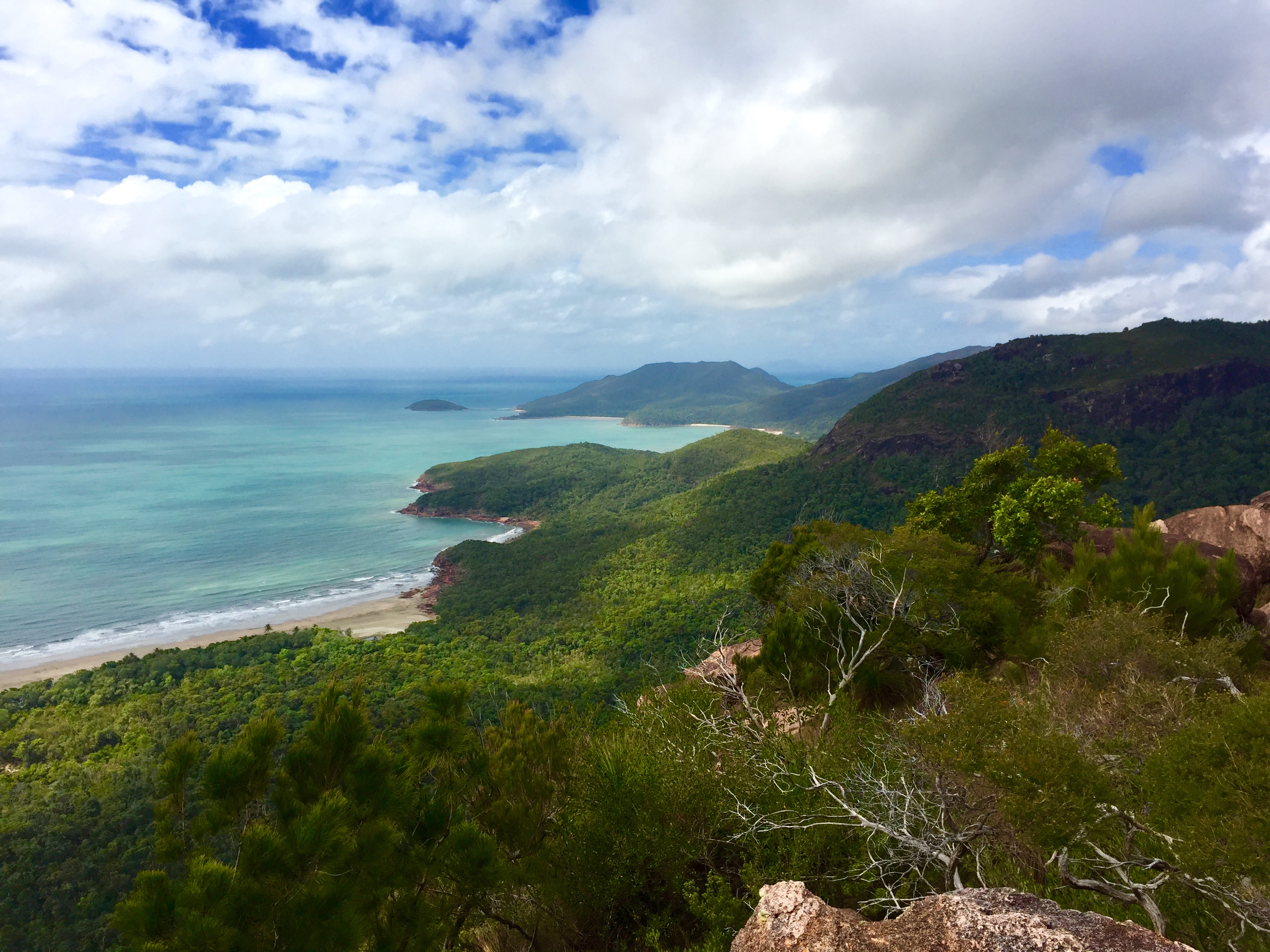
Wonderfully mysterious is perhaps an odd way to describe Hinchinbrook, but as a kid growing up in the region I always remember thinking of it in this way as we stopped at the local ‘pie cart’ on the foreshore. A delightful feature of Cardwell that I am pleased to say is still the case today.

Across the water, the island’s tall peaks stand proudly, densely covered in tropical rainforest and often shrouded in cloud, giving it a mysterious look. A somewhat enticing look that always excited me as a place made of a ‘boy’s own adventure’ and I daydreamed of what I would find as I devoured my pie. And if I was lucky, another.
They say it is never too late and as I stood on the Cardwell Esplanade this week, eating a pie from the pie-man, I looked out across the Hinchinbrook Passage to that mysterious island with the eyes of a young boy. Excited no less than I was all those years ago I contemplated the walk along the Thorsborne Trail on the eastern seaboard of the island that I was about to embark on.


Would I find my boy’s own adventure?
Whilst I am a frequent hiker in the bush and mountains it has been a while since I last strapped on my hiking pack and my fitness levels were showing it, especially after just spending a month in Scotland and England enjoying cream teas and the odd one, or too many, pints of bitter, despite it being warm. Both the beer and the weather!
It is fair to say the waist strap was slightly more extended than usual, but a few days hiking would go some way to sorting that out…
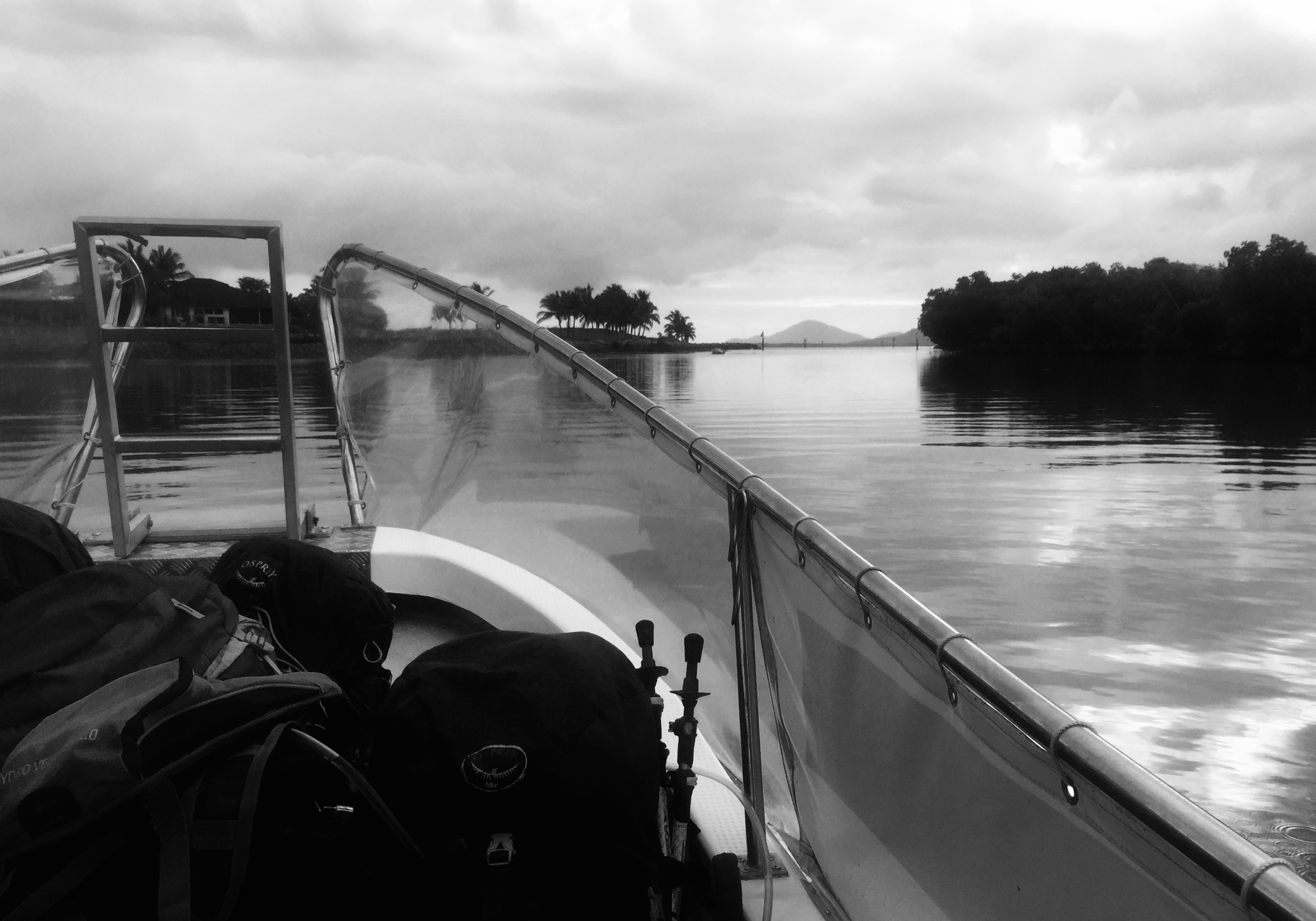
Eagerly, I boarded a small boat that would ferry myself and some other hikers to the island. And under overcast skies we headed towards our drop-off point at Ramsay Bay, situated on the northern part of the island, but not quite at the tip.
We were hopeful of seeing a dugong, sea calf as they are frequently described as we made our way across the shallow passage. Over the past couple of years they have been returning to the area in growing numbers as their natural habitat and food source recovers following the devastating destruction Cyclone Yasi caused in 2011.
Unfortunately, we would not be so lucky to make a sighting on this day.
It is a pleasant boat ride and the skipper, Dean, was keen to point out many of the different landmarks and islands in the area, but before long I was strapping on my pack and walking south on this fantastic adventure.
A comfortable hiking time is four-days and three nights, with camps set at distances sufficient to challenge, but with plenty of time to enjoy the scenery.
My first day was spent hiking from Ramsay Bay, through Nina Bay and an overnight camp at Little Ramsay Bay, which is nestled in the rainforest just behind the beach next to a small lagoon. Before passing Nina Bay I climbed to the top of Nina Peak, a must-do for any visitor to the island. Sitting at the top you get a great sense of the magnitude of the island and a better glimpse of those mountaintops shrouded in cloud and mist.


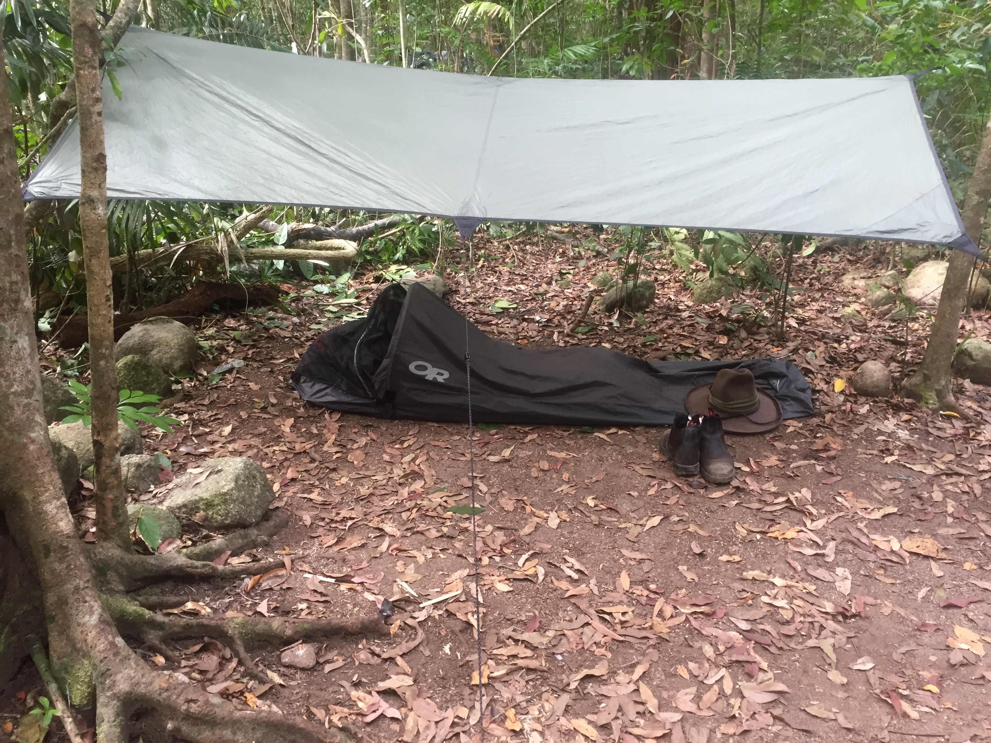
For this hike I decided to travel light and used a simple bivvy bag and lightweight tarp to shelter from the elements, especially the sandflies that inhabit the island. Whilst a small insect it shows no discrimination in its choice of victim.
The ‘Hinchinbrook Hilton’ as I called my sleeping arrangements served me well and did the job perfectly.
I also kept meals simple, as I usually do on these types of hikes, dining on a ration of French onion soup and beef jerky, supplemented with dried apricots and mango, and a favourite hiking delicacy of mine, smoked hickory almonds.
There was little risk of me starving and besides I had built up a decent layer of body fat after a few months of inactivity, much like a bear about to go into hibernation!
Water was generally accessible throughout the hike and whilst carrying water-purifying tablets I didn’t feel the need to use them all the time, but assessed it depending where I was getting the water. And hey, it is nice to get some fresh, unadulterated drinking water from streams whose origins are in the mountains.


And of course, speaking of water it is sensible to keep in mind that this is crocodile country and they are known to inhabit the island, something I was extremely conscious of as I heard the water lapping onto the beach not far from the ‘Hinchinbrook Hilton’ on my second night at Zoe Bay.
Departure from my first night’s camp on day two was delayed slightly as the National Parks Rangers’ had closed the track between Little Ramsay Bay and Zoe Bay the previous day due a ‘cool burn’ they were conducting of undergrowth nearby to the walking track. I was aware of this in the week leading up to the hike and after they did a quick reconnaissance of the area they reopened the track mid-morning as planned.
The burn had little impact on the walk from Little Ramsay Bay to Zoe Bay.
Leaving Little Ramsay I had to do some rock hopping around the southern end of the beach leading to another beach around the headland before heading into the bush. The track takes you through a number of vegetation types, including dry open forest, rainforest and mangrove swamps and many creek crossings. At times of heavy rain the swamplands and creek crossings would become more challenging.
Continuing south towards Zoe Bay my path took me through a number of palm swamps in tall rainforest between North Zoe Creek and Fan Palm Creek, an area I was able to view earlier on one of the many headlands that I had ascended.

Eventually I found myself on the sands at Zoe Beach and I made way towards the camp situated near the mouth of South Zoe Creek. And let me say, the creek looked inviting, but there were plenty of ‘croc’ warning signs to indicate swimming here would be a mugs game. Mind you, it was only a short walk up the creek to Zoe Falls, where I enjoyed a refreshing couple of hours swimming in the pristine waters…
I shared the night here with a number of other hiker’s enjoying a meal and the camaraderie that is forged from a common interest. And a feature of these campsites is the metal boxes provided for food storage. The island has a large population of native rats and they are known to chew through your backpack to get to your food supply!
The smoke haze from the burn-off provided a spectacular sunset that evening and an equally spectacular sunrise the next morning. And whilst the ‘Hinchinbrook Hilton’ was serving me well, its size provides an incentive to get up and stretch the body early enough to witness sunrise, the start of another day in paradise…!


My third day of hiking started with a heart-pumping climb up behind Zoe Falls and on to some granite slabs above the falls where you get spectacular views of Zoe Bay. And a note to self, next time fill the water containers at the top of the falls rather than at the bottom!
After crossing numerous creeks on the ascent towards the trail’s highest point, which is 260 metres, I was rewarded with great views of the Palm Island Group of islands to the south. I have always marvelled at this island group sparkling in the Coral Sea.
Traversing a variety of terrain I eventually descended to Diamantina Creek where I sat back amongst the trees and listened to the calls of the many species of birds present on the island.
Crossing this creek needs to be done with care as the rocks and boulders can be slippery when wet, and if the water is high and running you would be wise to wait until it subsides. But with the water low I was across and only a short walk to my last camp on the island at Mulligan Falls.
I wasted little time in setting up the ‘Hinchinbrook Hilton’ in this rainforest setting before making a beeline for the refreshing waters of the falls. This is a beautiful spot to relax and with an early arrival at camp I made the most of it.


There is a restricted area above the falls where you are not permitted to enter due to the slippery nature of the boulders and rock pavements and deaths and serious injuries have occurred here. So it is wise to heed the advice.
But as I relaxed against a rock perfectly molded to the shape of my back I dozed in the warmth as my body tingled from the crystal clear water that washed away the sweat and grime of the day’s hike. The only thing missing was a ‘Margarita’ to refresh the soul…!
And a word of warning, if there is one thing you don’t want to forget when visiting Hinchinbrook Island is some form of insect repellant, especially when camping in the midst of the rainforest. This was no more apparent than at Mulligan Falls.
The dawn was welcoming and whilst my sleep was restful when it came, at other times it was punctuated by the sounds of a ‘million mozzies’ serenading me and all wanting a piece of my flesh.
Such is life in the food chain, I guess…
The pick-up point for my boat ride back to Cardwell was at George Point and was timed to coincide with low tide to assist with the crossing of Mulligan Creek.
Situated on the southern tip of the island George Point overlooks the port of Lucinda and the extremely long jetty that transports sugar grown locally to cargo vessels.
Much of the morning’s walk was along the beach at Mulligan Bay and it was with just a touch of trepidation that I crossed Mulligan Creek where it opened to the sea. And not before I walked upstream for a 100 metres, or so, to see if there were any telltale crocodile slide marks on the banks…

Fortunately for me the only ‘crocs’ present where the ones I was wearing on my feet. Not long after I crossed the creek I found myself humming the tune ‘Never Smile at a Crocodile’ which made me laugh at myself. Amusement can be very simple, all that is needed is a good sense of imagination, hey!
Before long I was sitting on the sand at George Point reflecting on my ‘boy’s own adventure’ through the eyes of an adult…
…And rest assured it was with no less enthusiasm and excitement than a young boy looking over to the ‘Mysterious Island’…
Baz – The Landy, Hinchinbrook Island, Far North Queensland.

