


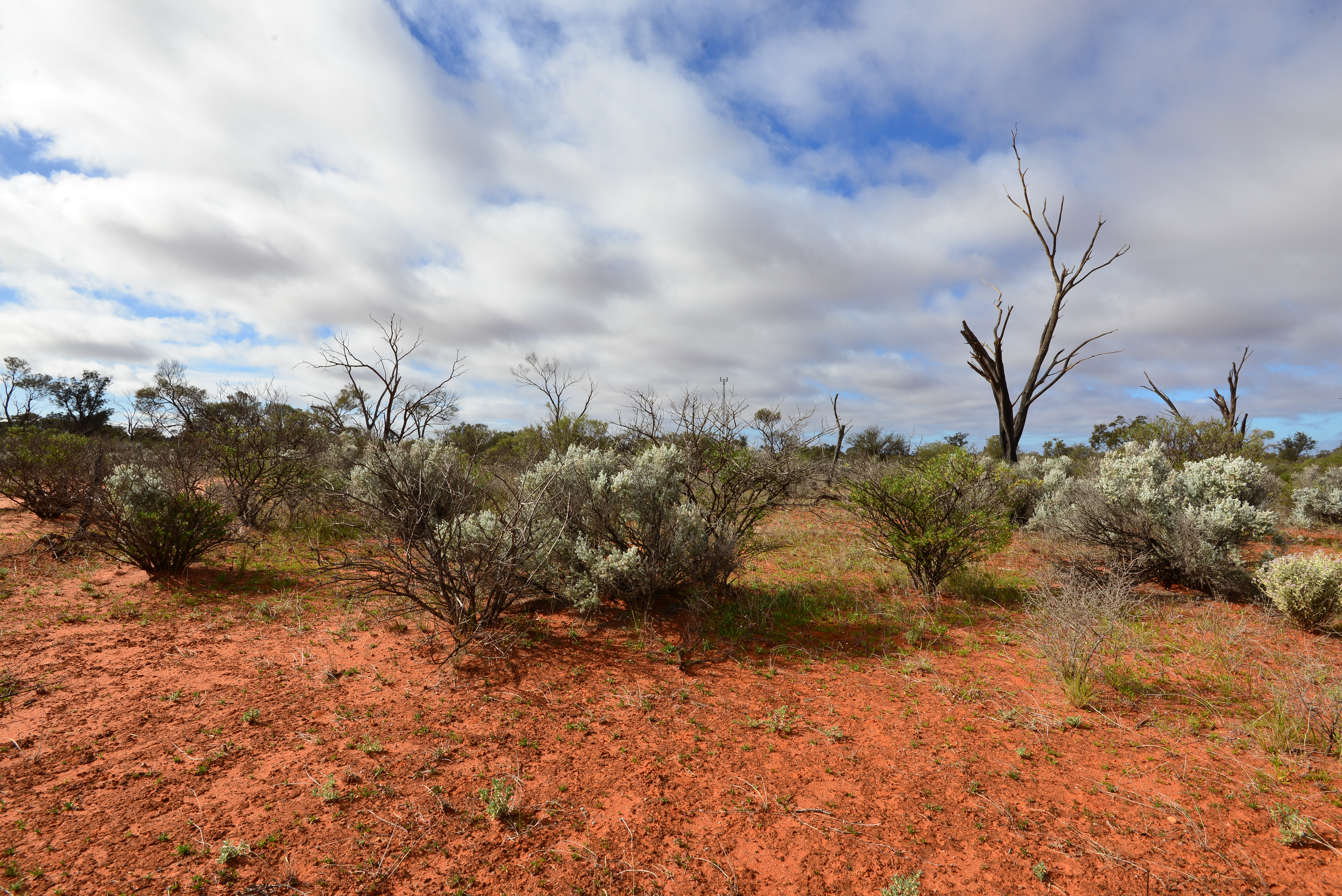
Lobed-leaf Hop Bush, Maralinga Atomic Bomb Site, Australia…
Photos: Janet-Planet
Lobed-leaf Hop Bush, Maralinga Atomic Bomb Site, Australia…
Photos: Janet-Planet


In 1956 the British Government built an atomic bomb testing site in the South Australian outback with assistance from the Australian Government of the day…
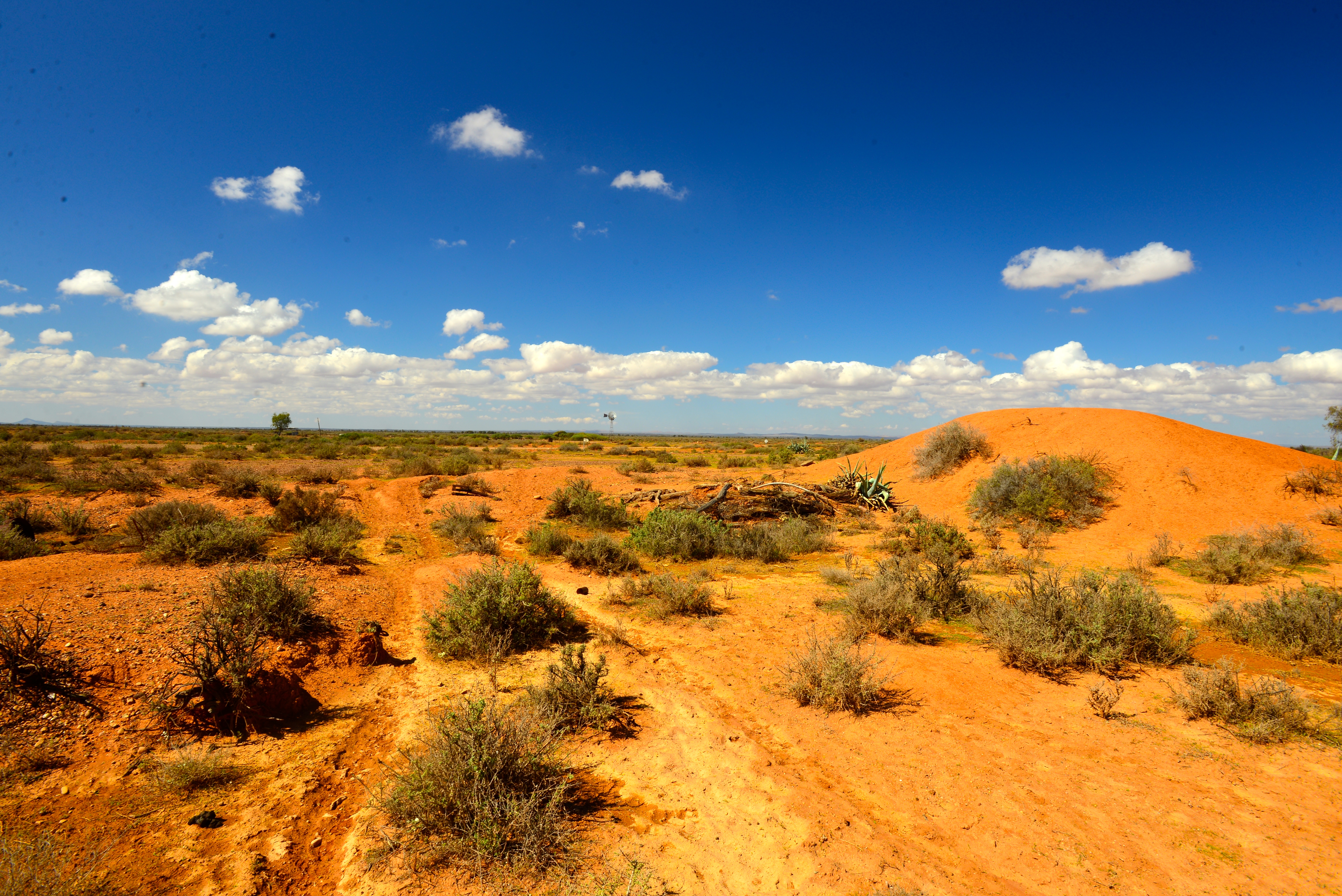
We discovered these beautiful flowers growing at “ground zero”… Don’t they demonstrate the tenacity of nature by defiantly shining through in spite of the brutal treatment this wonderful landscape was subjected to?
You can read more about the area in our blog titled “An Atomic Blast (In the Outback)”.
Photos: Janet Planet – Maralinga, South Australia

 A highlight of our recent trip into the Western Deserts, which took us across The Great Victoria and Gibson Deserts in the Australian Outback, was a visit to Maralinga Village.
Many Australian’s will remember Maralinga as being at the centre of the British Atomic testing program conducted in Australia during the 1950’s, such is life in the colonies, although perhaps it is only in more recent history that much of what transpired at Maralinga has been fully understood by the general public.
You might even recall the alternative Australian rock band, Midnight Oil, wrote a song about it, but perhaps that depends on either your age or maybe your taste in music…
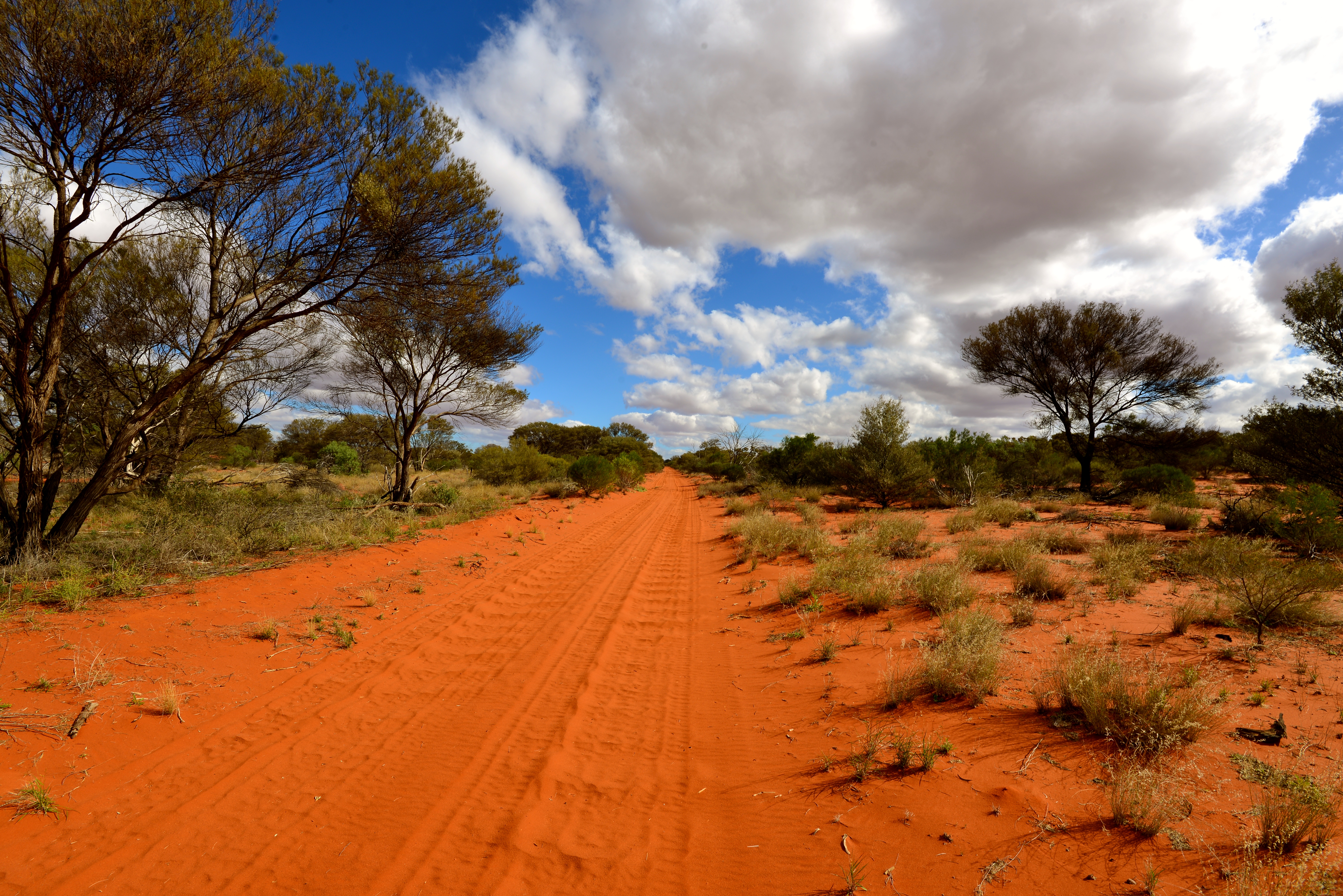
We had not previously travelled the Anne Beadell Highway, the track that traverses The Great Victoria Desert, but were informed that the far eastern section from Coober Pedy, the usual starting point, to Emu Junction had some of the worst road corrugations one could ever find, and the crossing experience from a scenery perspective would not be diminished by avoiding this section.
And I should clarify that the term highway is used in a very loose sense. It is little more than an extremely remote sandy track that winds its way across a large part of Australia and not the place for a leisurely Sunday afternoon drive.
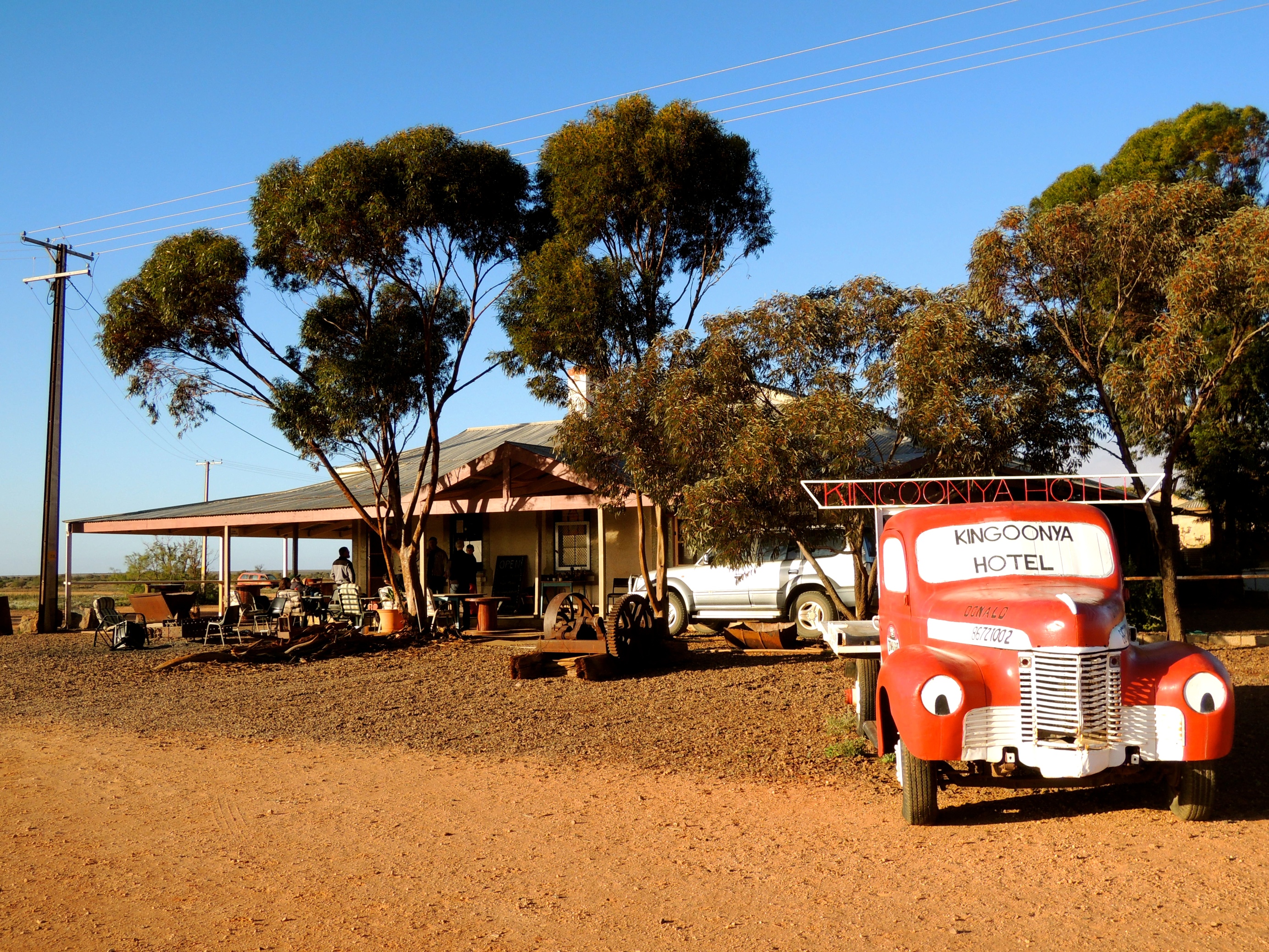
With this in mind and a strong desire to visit the very place where the bombs were detonated we headed to Maralinga. Passing by the small community and pub at Kingoonya we made our way west on another access road avoiding some of those bad corrugations, at least for a short time!
Kingoonya is typical of the very places we like to visit as usually the small populations are overrun by interesting characters! Kingoonya was no exception and we’ll be sure to spend more time there on future travel in the region…
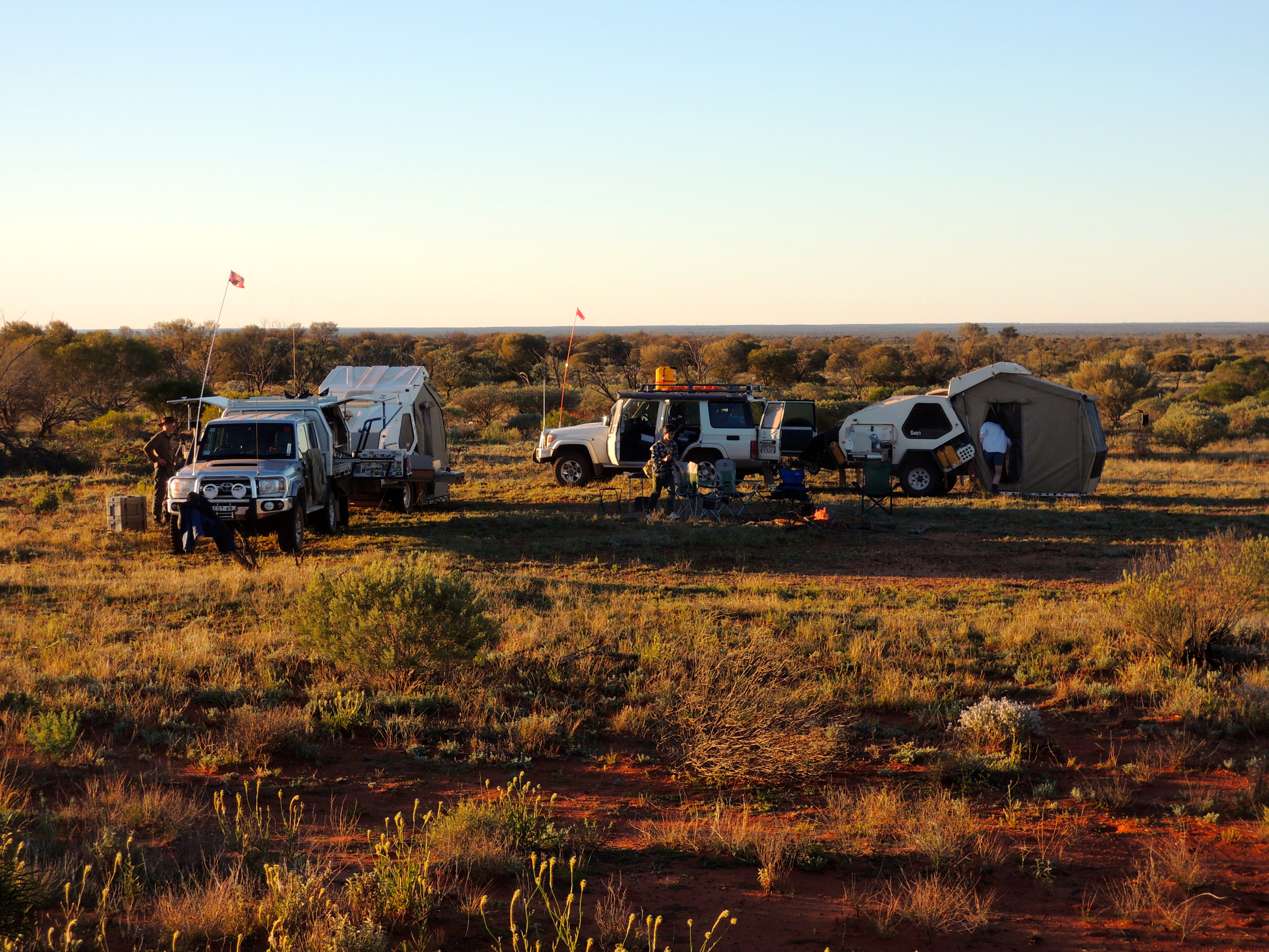
Robin Matthews, the care-taker of the now moth-balled Maralinga Village gave us a great welcome, meeting us at the locked gate that gives access before settling us into a camping spot nearby to a “donga” we could shower in.
It is worth a walk around the small village and even a climb to the top of the water tower for a commanding view of the immediate facility and beyond. Mind you, it might be worth noting that if you want the commanding view gained by climbing a steel ladder to the top, do it sooner rather than later, as the Occupational Health and Safety team masquerading as the “fun police” might put a stop to that eventually.
Being a family of climbers and mountaineers, we relished the chance!
Robin has a strong connection to the area and the Maralinga Tjarutja (jar-u-ja) people and was able to relate in a sensitive way the impact the testing has had on the traditional landowners, many of whom live in the nearby community of Oak Valley.
Our tour of the forward area included visits to many of the actual testing sites referred to as “ground zero” and Robin was able to tell us much about how the tests were completed, and even where people stood to observe the tests. For all intended purposes these people were “human guinea pigs” drawn from the ranks of the military. Volunteers was the way it was described…


A visit to the air strip showed just how big this facility was and the focal point where service personnel were flown in and out of the area from England under a cloak of secrecy. The strip, measuring approximately two-and-a-half kilometres in length, was the distance the “human guinea pigs” stood from ground zero in one of the tests.
Some of these people, many of whom were from England survived to live a long life, others died within a couple of years. But it is reported that health impacts have secreted its way into their offspring with devastating results.
Similarly, it has had health impacts for the Tjarutja people who now mostly avoid the area due to superstition. As Robin explained, for the traditional owners it would be like living in a cemetery.
We spent a great day with Robin and towards its end we headed north along the Emu Road to a bush camp before continuing our journey to Emu Junction and across the Anne Beadell Highway to Laverton in Western Australia.
A visit to an Atomic Bomb test site might not be everyone’s cup of tea or ideal holiday destination, and you are unlikely to leave with a healthy glow that a holiday in the islands might provide, but it enabled us to better understand a part of Australia’s more recent history and involvement in the nuclear arms race. And this was enhanced by a character you’d be happy to call a mate, Robin Matthews.
If you are travelling that way and have a curiosity of Australia’s involvement in the “nuclear arms race” or perhaps just to draw some dots to the work that one of Australia’s more experienced contemporary bushman, Len Beadell, undertook in this region by building many of the roads, be sure to give Robin a call, I am confident you’ll enjoy the experience.

Maralinga was developed as the permanent proving ground site and was the location of all trials conducted in Australia and yes, we will stand on the actual site where the Atom Bombs were detonated!
The area also holds significance for Janet as her aunt worked for the Australian Weapons Research Establishment and spent time at Woomera in her role as a scientist.
The expedition will take us across some of Australia’s remotest country, covering arid desert lands to gorges flowing with life giving water.
The primary aim of our expedition is to visit the “bomb tracks” that were made by the legendary Australian Surveyor, Len Beadell and his team during the 1950s and 1960s in preparation for the nuclear testing program.
The Anne Beadell Highway, the first of Len’s tracks that we will travel covers a distance of 1,350 kilometres and traverses the Great Victoria Desert, from Coober Pedy in South Australia to Laverton in Western Australia.
And it is anything but a highway.
At best, it is little more than two-wheel tracks passing through arid desert and scrub country and punctuated by many sand dunes.

On reaching Laverton we will travel along the Great Central Road to the aboriginal community of Warakurna before heading along the Sandy Blight Junction Track. This will be a highlight of our western deserts trip and is another track built by Len. Completed in 1960 the track takes its name from the eye disease that affects many of Australia’s indigenous population and now referred to as Trachoma.
Len contracted the ailment and is most likely the reason the track took this name.
After a brief stop in the West MacDonnell Ranges, we will travel to Alice Springs and bid farewell to Janet and TomO before heading eastwards across the Plenty Highway and eventually down through the channel country to the well-known outback town of Birdsville.

Our departure from Birdsville will mark our arrival into the Corner Country which is situated in the north-east corner of South Australia and extending to the north-west of New South Wales.
And after four weeks of travel on corrugated roads perhaps the bitumen will be a welcome relief as we pass through the central west of New South Wales making our way home to Sydney!
So who said it is all work and no play?
And don’t worry, I’ll let you know before we go, and you’ll be able to track our progress across this remote and arid wilderness…
Strewth, Australia, you just got to love the place, hey?

